Fulfilling our mission to protect and restore the Morro Bay estuary for people and animals requires a lot of hard work in the field. Read on to see what our staff and volunteers have been up to during the month of November.
For some people, the big November negative tides provide a great opportunity for going tide pooling or to surf a low tide break. For the Estuary Program, these low tides are the start of our busy fall and winter eelgrass monitoring season.
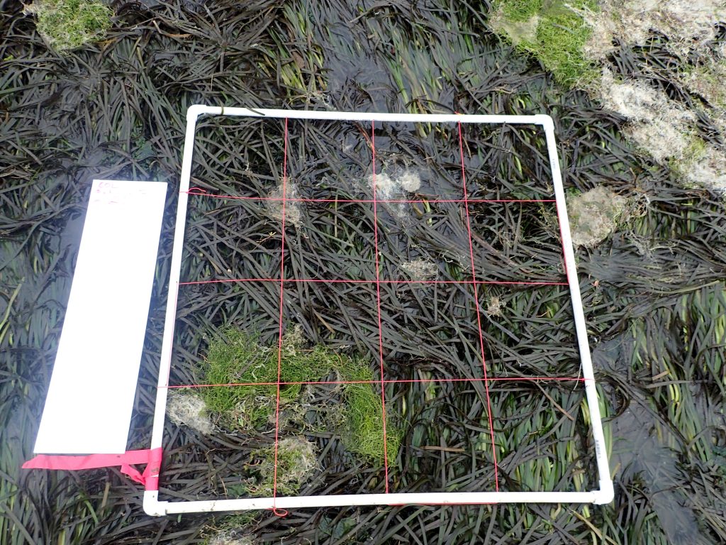
Eelgrass Bed Condition Monitoring
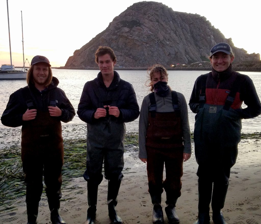
This is our third year of conducting an eelgrass survey called Bed Condition Monitoring. We do this in partnership with Cal Poly. The survey takes place at the four most significant eelgrass beds throughout Morro Bay.
The goal of the monitoring is to determine how healthy the eelgrass beds are by assessing their condition through density, patchiness, and observational data. Check out this blog post from last year to learn more about the data we collect during these surveys.
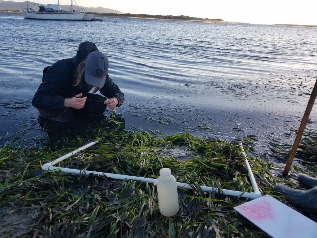
Eelgrass Bed Condition Monitoring Steps
1. The first step is to look at the different species of algae and invertebrates in the quadrat.
2. Next, we count the total number of eelgrass shoots a subset of the quadrat.
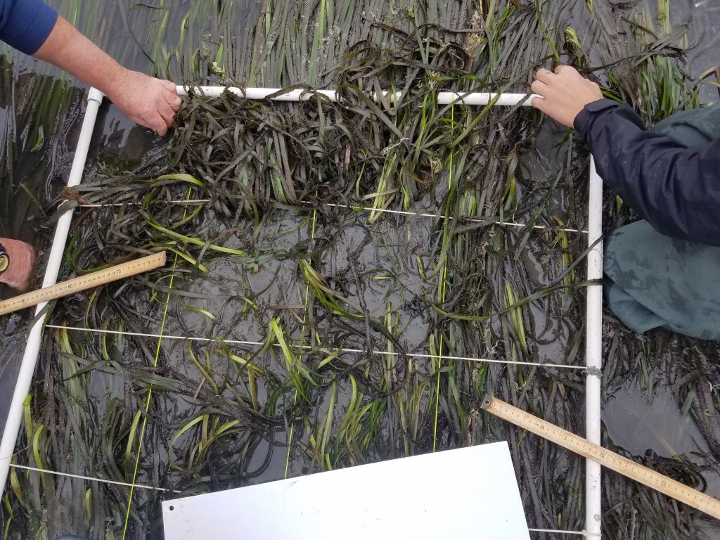
3. Next, we measure the length of the eelgrass shoots and take photos for future analysis.
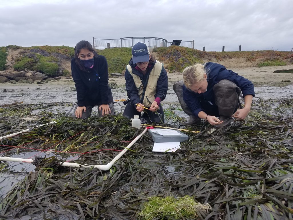
4. Finally, we look at the epiphytes (plants growing on the eelgrass) and epifauna (animals living on the eelgrass).
A huge thank you to our student volunteers from Cal Poly and UC Santa Barbara, as well as our 2017 Monitoring Volunteer of the Year, Mike Lindley!
Eelgrass Seed Deployments
We also put out more eelgrass seeds in the back bay near Cuesta Inlet.
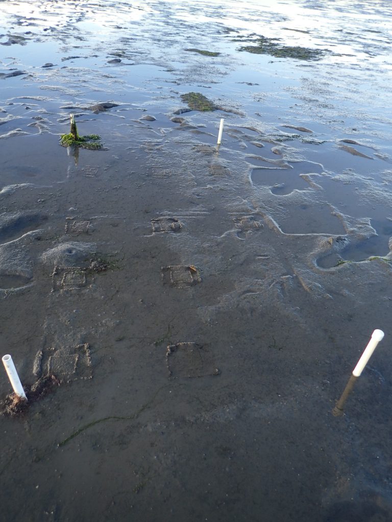
The seed bags are placed inside PVC markers so that we can come back to the exact same location and track how many germinate.
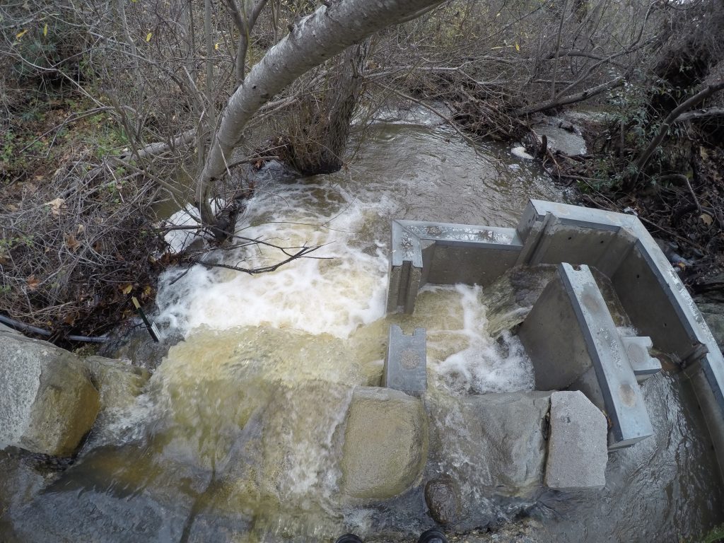
Pressure Transducer Survey
The Estuary Program has installed seven pressure transducers (PTDs) throughout the Morro Bay watershed. These pieces of equipment continuously monitor the water levels in the creeks. Check out this blog post for more about how they work.
In order to protect the long term data set at each site where we have PTDs, staff went out and took a series of measurements on the elevation of this equipment relative to a permanent marker nearby, called a benchmark.
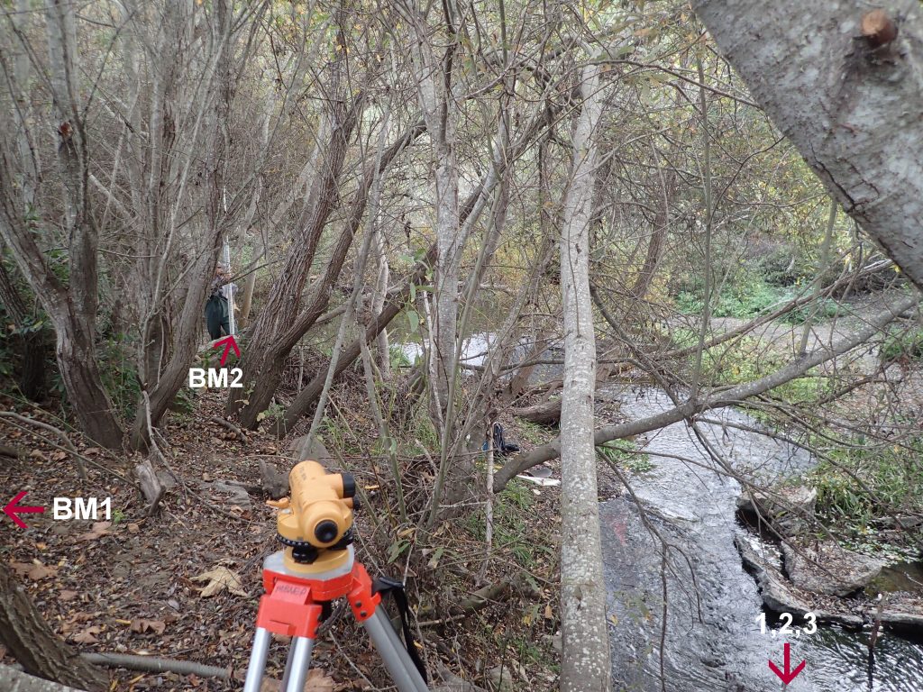
If any of these PTD units are moved or swept away by large storm events, then the data we collected in this survey will allow us to reinstall them at exactly the same elevation they were placed before, allowing us to maintain a highly valuable, continuous data set.