Are important natural areas being protected, enhanced, and restored?
Yes, more than 5,400 acres have been protected and thirty-eight projects have been completed to improve natural areas and water quality.
The Estuary Program works with many partners to protect, restore, and enhance habitat in the Morro Bay estuary and the lands that surround it. These efforts support open space, healthy habitats, clean water, and resilient lands for people and for wildlife.
Morro Bay Watershed Habitat Protected, Enhanced, and Restored
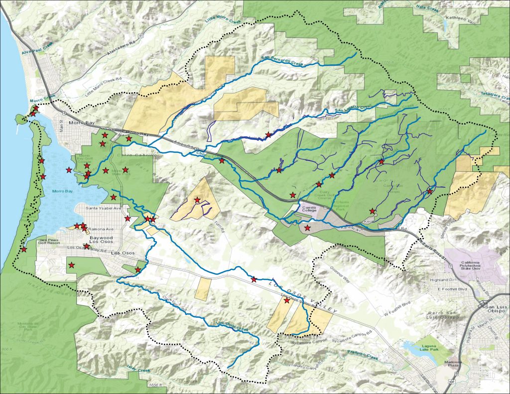
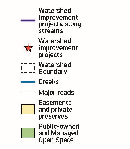
The above map shows the lands that are conserved and protected through public ownership, easements, and private preserves. The map also illustrates the locations of projects such as floodplain restoration, invasive plant removal, and stormwater management infrastructure.
Training the Next Generation of Land Stewards
The Morro Bay estuary and watershed host a wide variety of habitats that require active management to protect and restore. Grasslands within the watershed are dominated by invasive species like brome grasses, thistles, and mustard that threaten native plant biodiversity and increase wildfire risk. Livestock grazing is an effective tool to reduce invasive species cover and fire fuel loads while improving native species habitat. Grazing can also improve soil health by adding organic matter via manure.
The Estuary Program recently provided funding for water infrastructure to help establish Cuesta College’s Ranch Education Program on their 75-acre grassland property. This new program supports workforce development for sustainable ranch management practices and improves grassland habitat through livestock grazing. Each semester, around thirty students are trained in hands-on agricultural skills, including sustainable grazing practices and methods to maintain and monitor ranch lands. Measurements of soil and vegetation occur before and after grazing to track weed management success and soil health improvements.
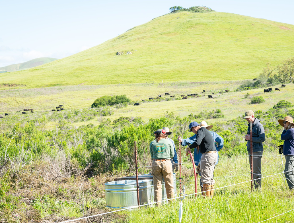
Photo courtesy of Shelly Ingram.
Currently the site has two active pastures grazed by cattle on loan from the Cal Poly Animal Science Department to target grass species preferred by cows. The program will incorporate three additional pastures for goats and sheep in the future to target grasses, woody plants, and forbs (broad-leaved, non-woody plants). As the landscape changes with grazing, the pasture size and type of grazers will be adjusted based on habitat needs
Studying the Past to Create a Better Future
Understanding landscape conditions before Euro-American development provides valuable information for management and restoration efforts in our watershed. The Estuary Program has embarked on a three-year historical ecology study that involves collecting archival data such as photos, maps, and journals, compiling the information, and synthesizing it to create maps of historical habitat conditions. This effort documents information like the paths that waterways originally took, the types of plants and animals present, and Indigenous land management practices.
The project creates a habitat map of conditions in the late 18th through mid-19th centuries and a report describing landscape processes and ecological functions. Rather than attempting to recreate the past, the ultimate goal is to use this knowledge to inform sustainable land management and restoration.
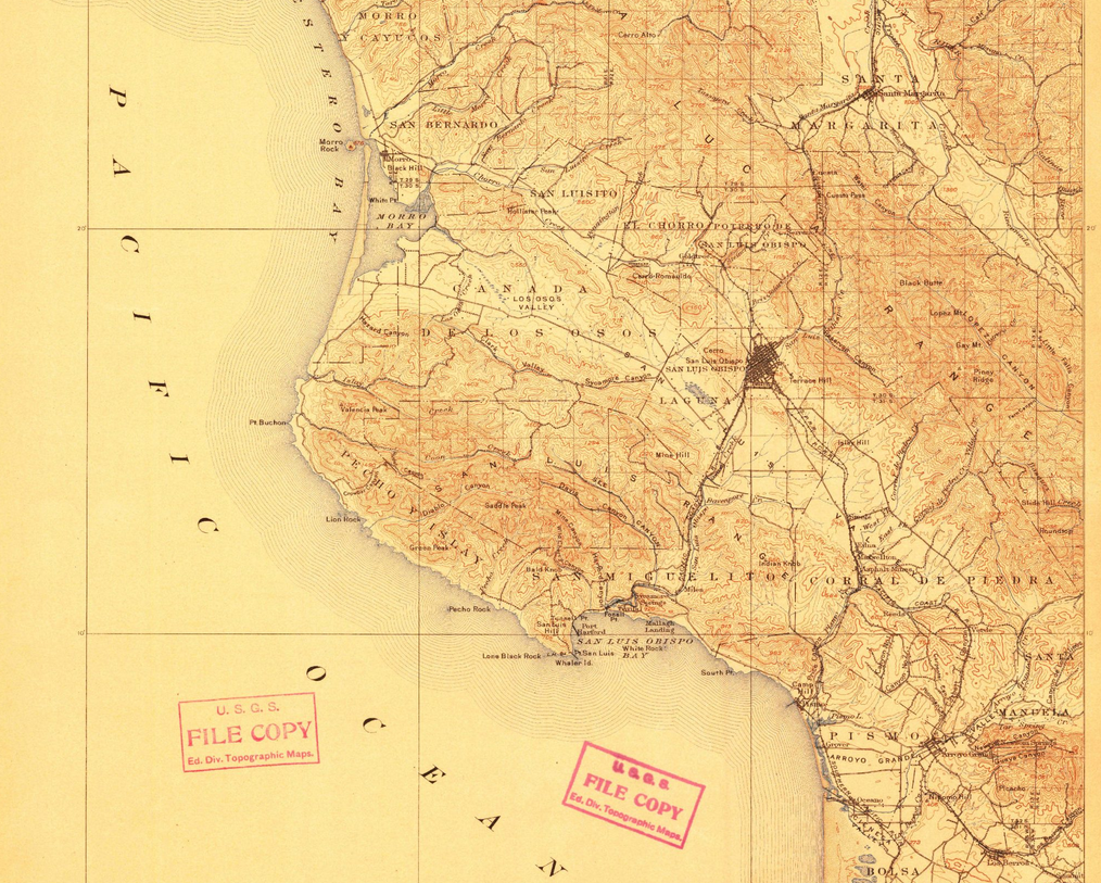
This USGS topographic map from 1900 shows the bay entrance when Morro Rock was an island, prior to construction of the causeway that connected it to the shoreline. This is an example of the type of material gathered to understand historical conditions in the Morro Bay area.
For more information on our restoration and conservation work, scan the QR code below.