Are the bays and creeks impacted by accelerated sedimentation?
Yes. Large storms events can loosen sediments in creeks and degrade habitat for sensitive species. In the estuary, sea level rise could outpace marsh elevation increases, resulting in large shifts in habitat.
The movement of sediment (loose soil) is a naturally occurring process. Sedimentation can have both beneficial and harmful outcomes for habitat health in the watershed and estuary.
Although the Morro Bay estuary is experiencing an increase of sediment deposit from upstream, it is also experiencing rising water levels from sea level rise. If both sedimentation and sea level rise continue as predicted, the rising waters will outpace sedimentation, leading to shift in habitat from salt marsh to mudflats.
The Estuary Program works with partners to manage erosion and track rising water levels that threaten the health of the creeks and estuary.
Monitoring Elevation Change in the Morro Bay Salt Marsh
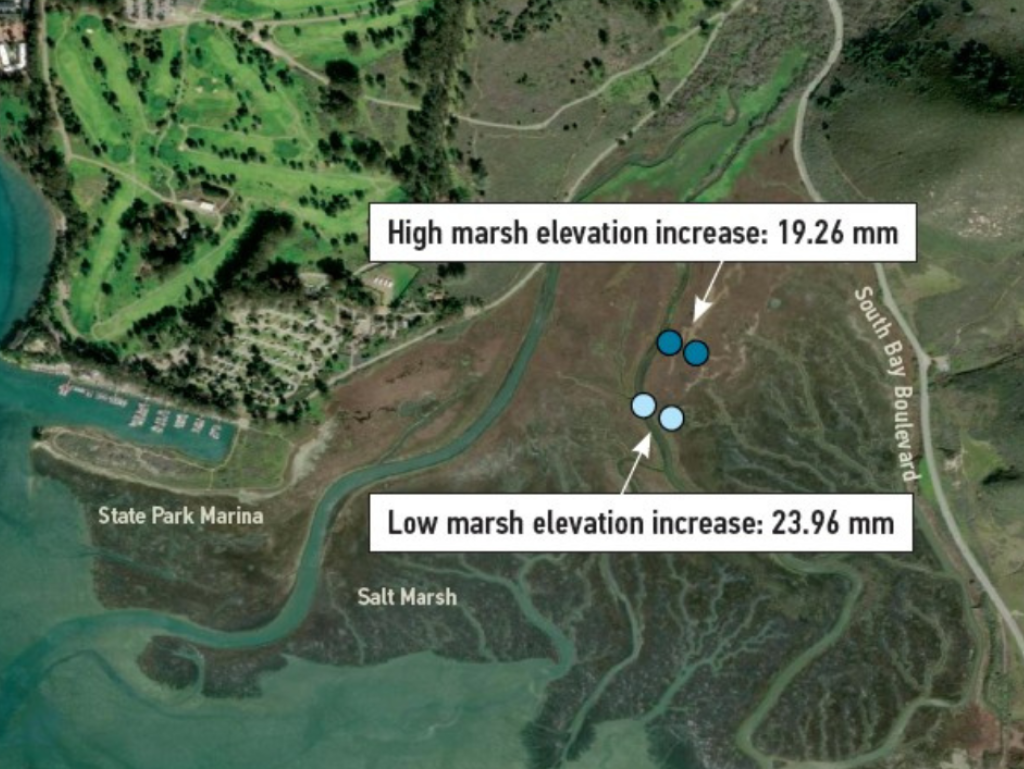
Sediments from creeks flow downstream and settle in the salt marsh. The U.S. Geological Survey (USGS) monitors change in sediment deposition in four sites in Morro Bay. This map shows the increase in marsh elevation at each site from 2013 to 2025. Historical data indicates annual increases averaging 1.59 mm in the high marsh and 1.98 mm in the low marsh, enough to keep pace with the current rates of sea level rise. But if the rates of rising waters increase as they are projected to do, areas like Morro Bay’s marsh habitat will flood more often and could eventually transition to mudflats or open water. The Estuary Program is working with USGS to develop adaptation strategies to reduce habitat loss and coastal flood risks.
Weathering the Storms: Chorro Creek Ecological Reserve
Over the past twenty years, the Estuary Program has conducted restoration and monitoring projects at the Chorro Creek Ecological Reserve. The goals of this project are to reduce sediment flowing to the estuary, support water quality for fish and other wildlife, and help recharge groundwater. During large storms in 2021 and 2022, the site operated as designed by trapping sediment and slowing the flow of water to reduce flooding.
Some major challenges to this project came during the winter storms of 2023, when the area received nine inches of rain in the first three weeks of January. Water levels on Chorro Creek reached nearly 23 feet on January 9, the highest level recorded at this site since monitoring began in 1979.
Monitoring data shows that, between 2021 and 2024, the main creek channel eroded by 2-3 feet, while the floodplain area gained about 1-2 feet of sediment. The creek also left the historic main channel and moved through the floodplain area via two side channels. This aligns with the design of the restoration project, encouraging water to move over flat open areas rather than rushing through a channelized creek. The movement of water through the floodplain slows water, reducing erosion and encouraging deposition of sediments in the creek rather than in the estuary.
Post-storm assessments of the site indicate that changes to channels in some restored areas could potentially impede the passage of fish through the creek. The site will require adaptive management to address areas of erosion, improve site stability, and ensure effective sediment trapping and habitat quality.
Tracking Changes in Our Creeks
To better understand creek health, we are interested in how streams change over time. One of the tools we use is cross sectional profiling, which involves surveying the shape of a creek channel. The cross-sectional profiles are permanent sites marked by metal “benchmarks” placed on opposite banks of the creek. These benchmarks allow us to return to the same locations to measure the shape and depth of the stream.
Students from Cal Poly supported our most recent cross-sectional profile monitoring effort, pictured here on Chorro Creek. The work involves using basic surveying equipment like an auto level and tripod to measure slope.
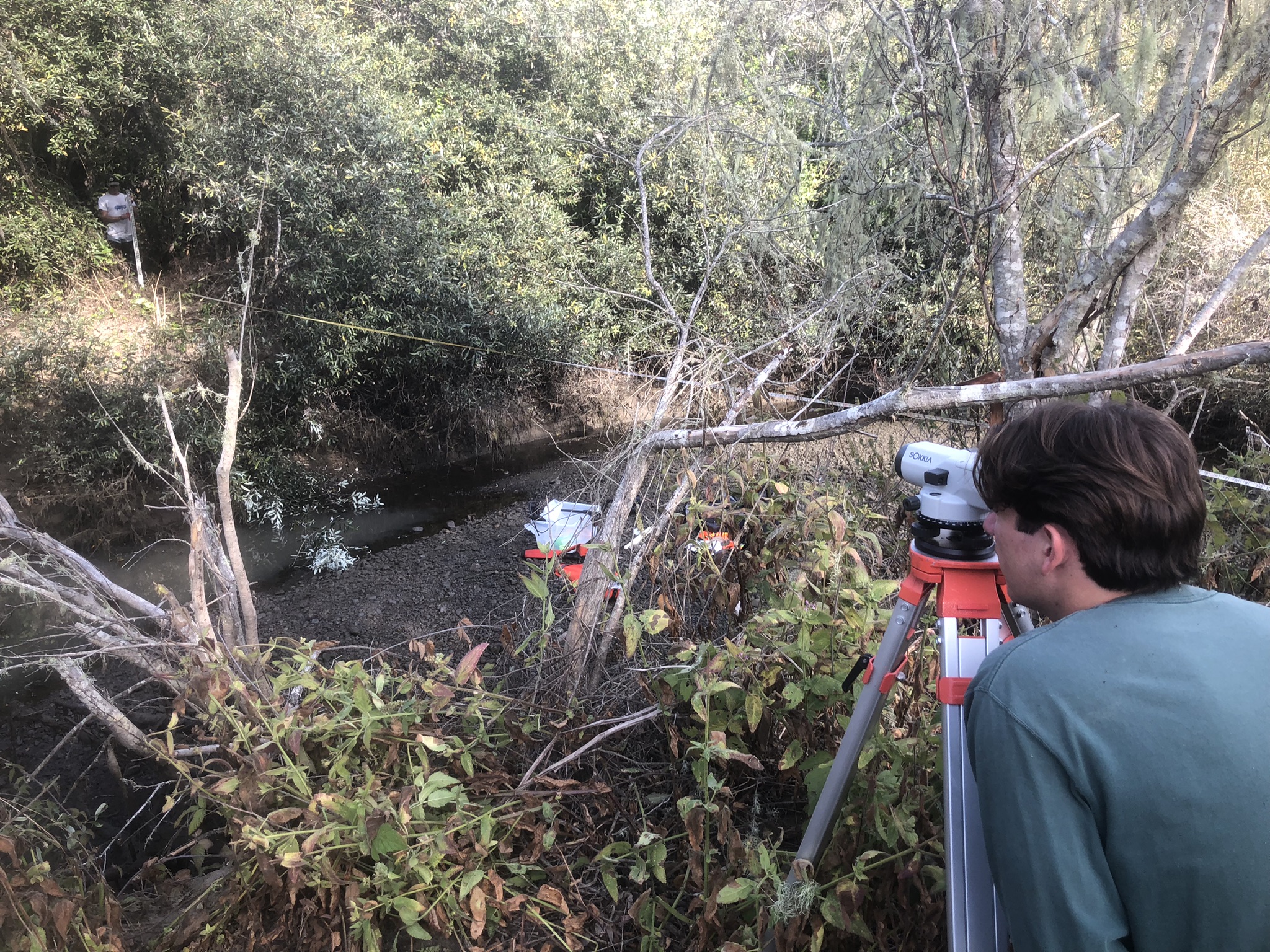
In 2023, the Estuary Program surveyed ten historic cross section sites, which had been established in the 1990s and early 2000s by the EPA’s National Monitoring Program, the Coastal San Luis Resource Conservation District, and UC Berkeley. The survey results indicated a wide range of conditions, with some sites showing evidence of aggradation (where sediment builds up and raises the creek’s elevation) and others showing signs of erosion (where the channel becomes wider or deeper over time).
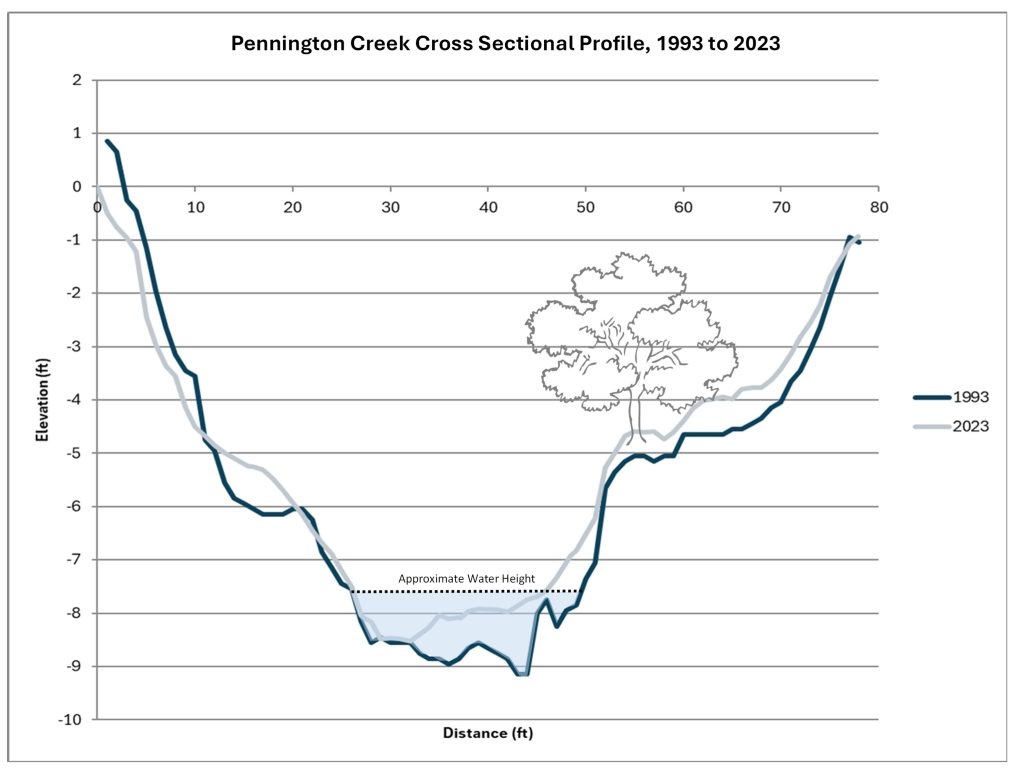
Although conditions throughout the watershed were variable, one long-term monitoring site on Pennington Creek stood out as more stable than others in the watershed. Between 1993 and 2023, the shape of the channel changed only slightly, with some sediment built up near the center and outer edges of the creek. This long-term stability indicates that the channel is in a healthy state that could provide more consistent habitats for the aquatic plants and animals that rely on them.
For more information on our sedimentation research, scan the QR code below.