Header photo courtesy of Sarah Kidd.
This blog was written by the Lower Columbia Estuary Partnership in Portland, Oregon. The program belongs to the National Estuary Program. This blog is part of a series to introduce our community to the work of other National Estuary Programs throughout the country.
Spanning 146 river miles and connecting the states of Washington and Oregon, the lower Columbia River stretches from Bonneville Dam to the Pacific Ocean. It passes through major cities, such as Vancouver, Washington and Portland, Oregon, and small towns, flows through wildlife refuges, and supports a thriving shipping industry with several ports.
The Columbia is the fourth largest river by volume in the United States and the largest by volume that flows from the Americas into the Pacific Ocean.
The river is also home to more than 2.7 million people, many of whom rely on it for jobs, fishing, recreation, and a deep cultural connection.
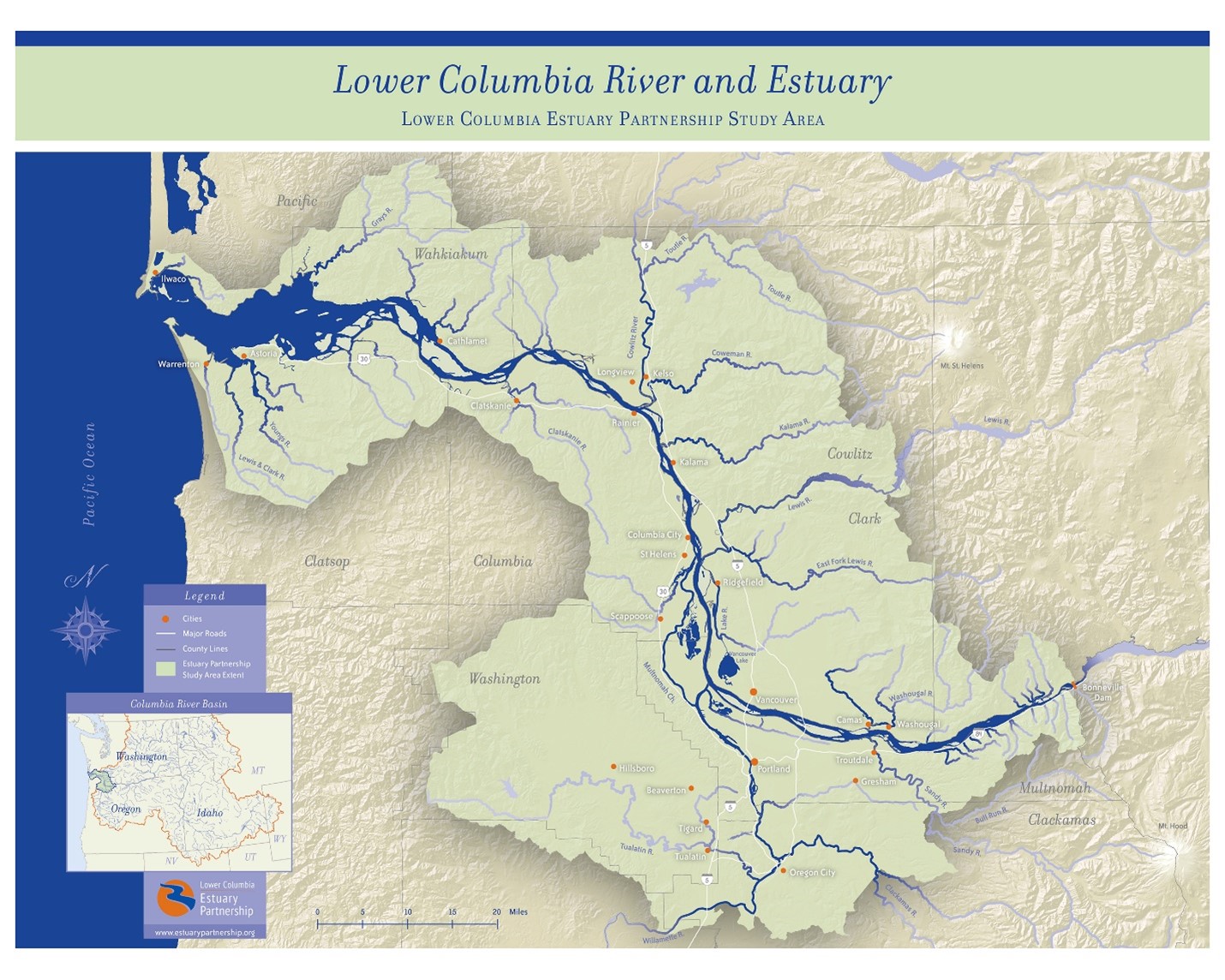
Numerous Tribes have called the Columbia River home for millennia. These Tribal Nations have stewarded these lands and waters since time immemorial, and were nourished by the historical abundance of salmon, lamprey, wapato, camas, berries, and other First Foods. Tribes continue to be the most deeply invested in Columbia River restoration.
Challenges for the Lower Columbia River
Local people recognized that the lower Columbia River was impaired from decades of development, agriculture, transportation, and industrial uses, in addition to impacts from dams on the river’s flows. By the 1990s, more than 50% of the historic floodplain had been converted to agriculture, urban, and other uses, a variety of contaminants were found in fish and sediment, and toxic hotspots dotted the lower river.
Historically, the Columbia River Basin was one of the largest producers of salmon in the world, with up to 16 million salmon migrating upriver annually. Sadly, salmon are now at a small fraction of their historic numbers, and thirteen species of our salmon and steelhead are endangered or threatened.
This is a tragic loss to Columbia River Tribes, to the livelihood of those in the fishing industry, and to the culture of our entire region. Columbia River Chinook salmon are also the favored diet of endangered Southern Resident Killer Whales that reside around the Puget Sound, and whose population in recent years has shrunk to 75 individuals.
Introducing the Lower Columbia Estuary Partnership
In 1990, the governors of Oregon and Washington brought together a group to study the degradation of the lower river, and the river was nominated to be a National Estuary Program. In 1995, the Lower Columbia Estuary Partnership was created as a 501(c)(3) nonprofit.
Our mission is to restore and care for the waters and ecosystems of the lower Columbia River for current and future generations of fish, wildlife, and people. We work closely with many partners to accomplish our work including Federal, state, local, and Tribal governments; agencies; private landowners; nonprofits; and other groups.
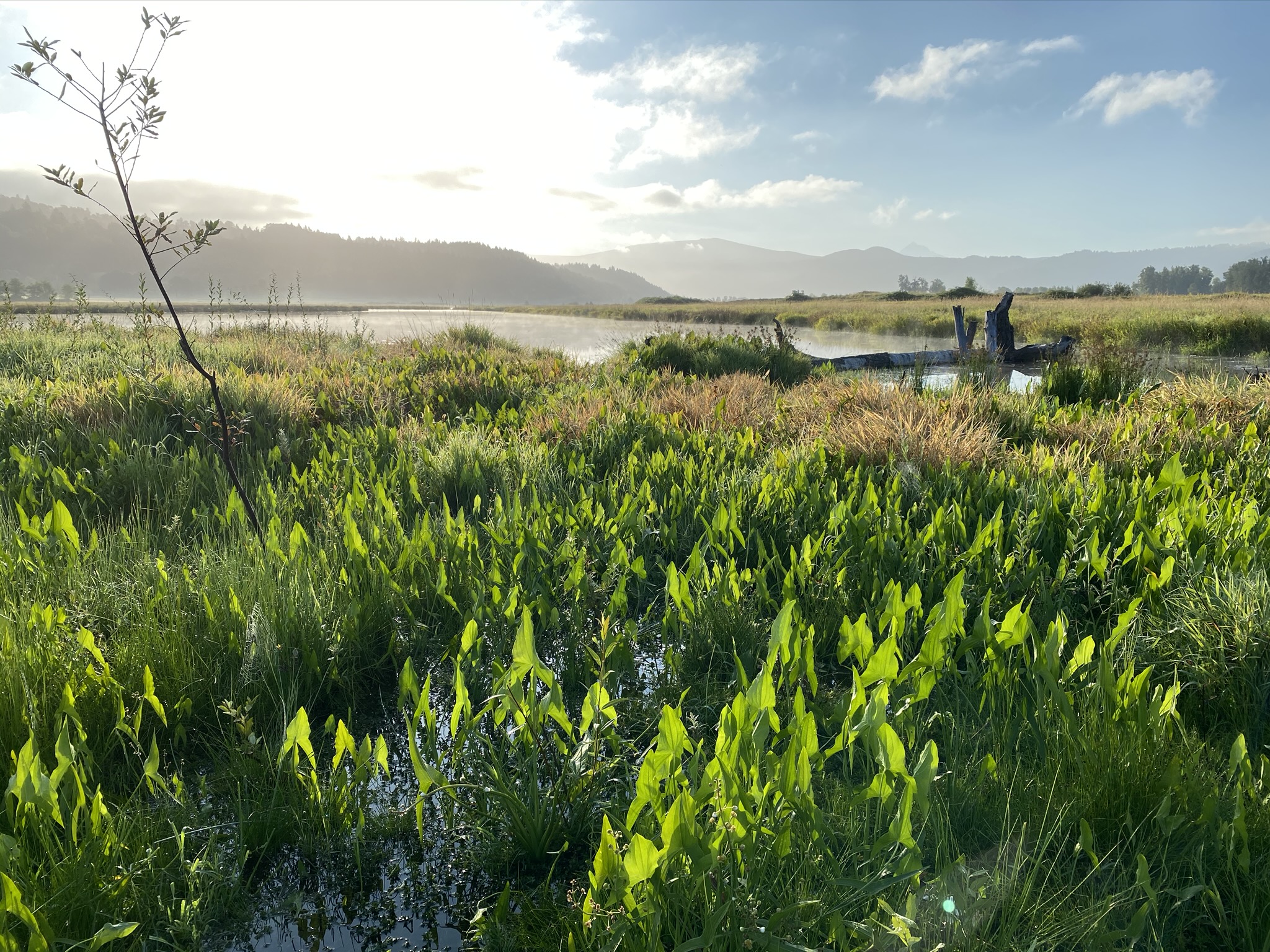
Restoring Habitat
We restore habitat, reconnect floodplains, and restore natural river flows to benefit salmon, lamprey, and other native animals and plants.
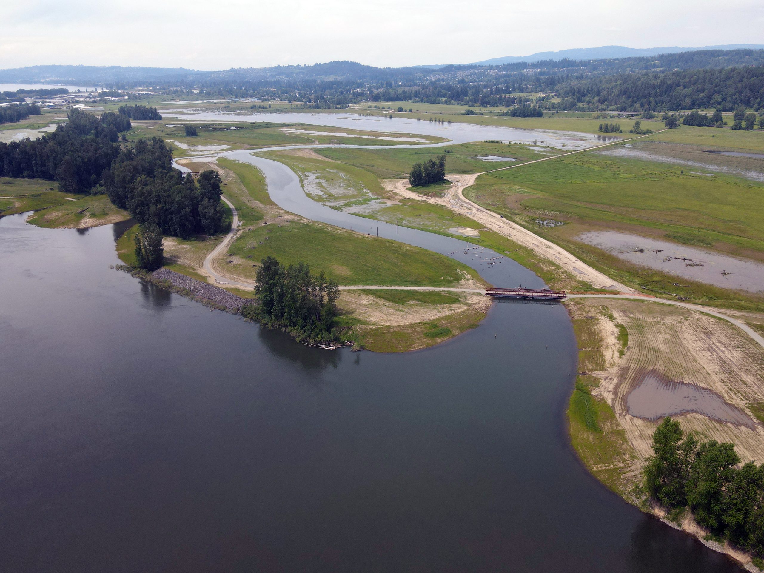
In 2022, we completed our largest habitat project ever along the lower Columbia River at Steigerwald Lake National Wildlife Refuge, where crews removed more than two miles of levee and reconnected 965 acres of floodplain to the Columbia River, while also reducing flood risk to the nearby port, city infrastructure, and private homes.
Monitoring the Waters and Wildlife
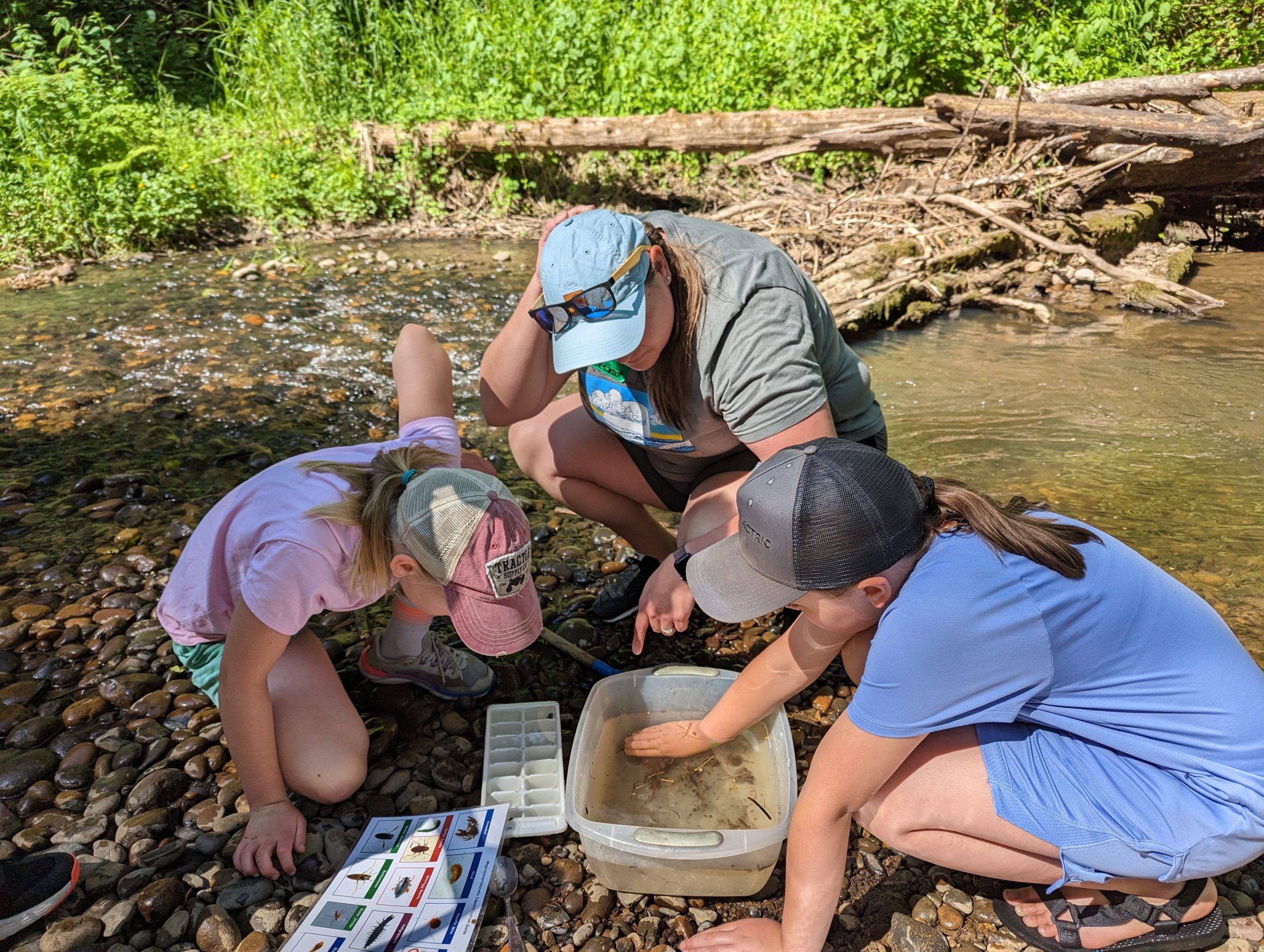
For more than 25 years, our team of scientists has conducted extensive research on the lower Columbia River wetlands, habitats, and estuary. All our research and data are accessible for free on our website.
We have an ongoing monitoring program that tracks conditions at relatively undisturbed tidal wetlands as well as restored sites. We have many other ongoing research projects to track water quality, aid in fish migration, study climate change impacts and adaptation, and tackle other issues facing our river.
Polluted stormwater runoff is the biggest threat to urban water quality and is toxic to aquatic life. The Lower Columbia Estuary Partnership works with schools, businesses, and cities to design and construct projects that infiltrate polluted runoff and keep toxins out of our rivers and streams. Often these projects also add other benefits, like adding shade and greenspace or an outdoor classroom area for a schoolyard.
Engaging with the Community
The Lower Columbia Estuary Partnership knows that people who have a relationship with the river will do more to protect it. We engage members of the community with their river in several ways.
Environmental Education
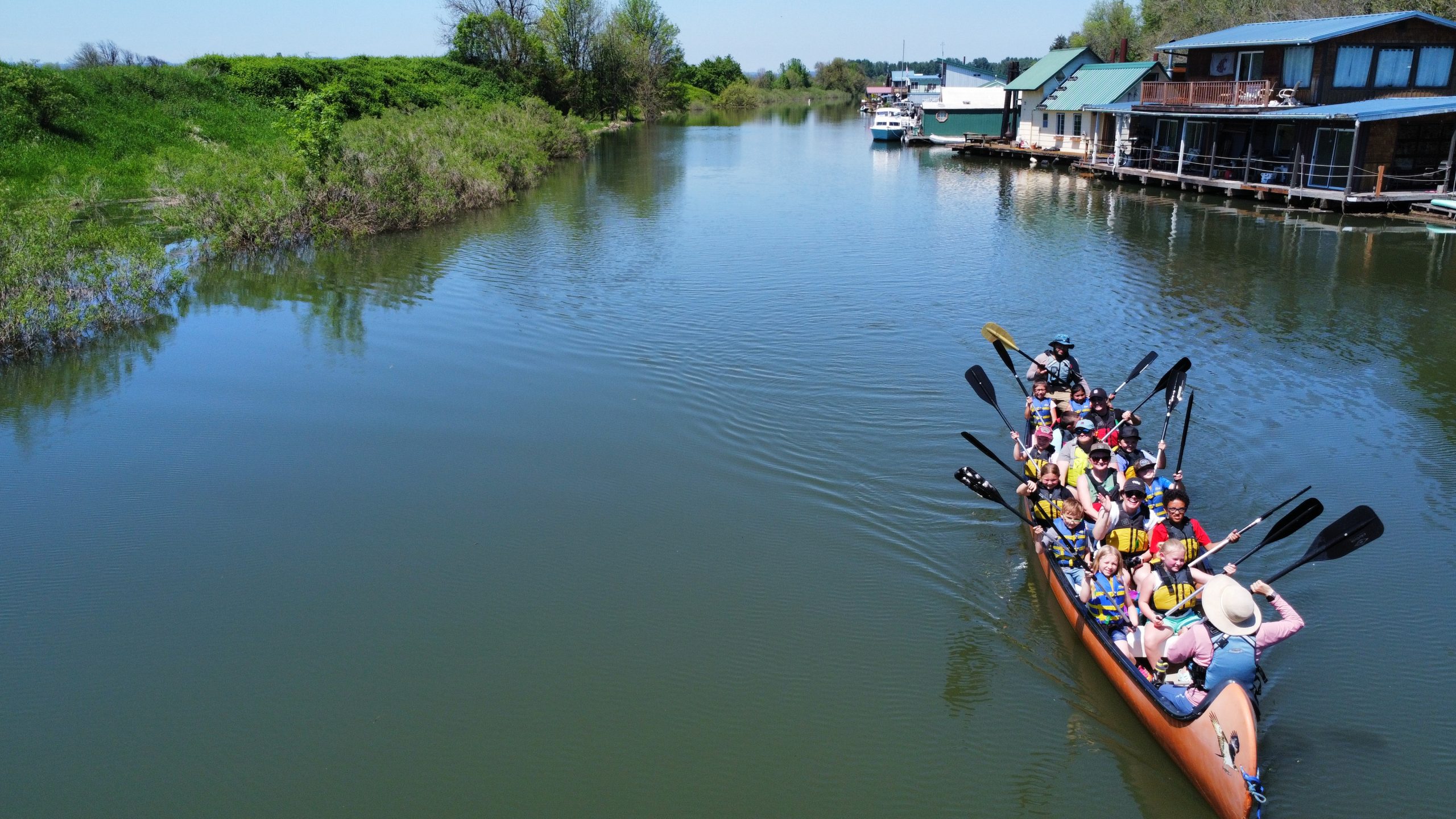
Our team of professional Environmental Educators works with schools and teachers throughout our region to deliver hands-on science lessons in the classroom and outdoors to introduce students to watersheds, local plants and birds, and other ecology topics. Field trips take students to a local natural area and can include planting trees to enhance habitat, monitoring water quality, and paddling on the water in our twelve-passenger Big Canoes. Last school year we reached nearly 3,000 students.
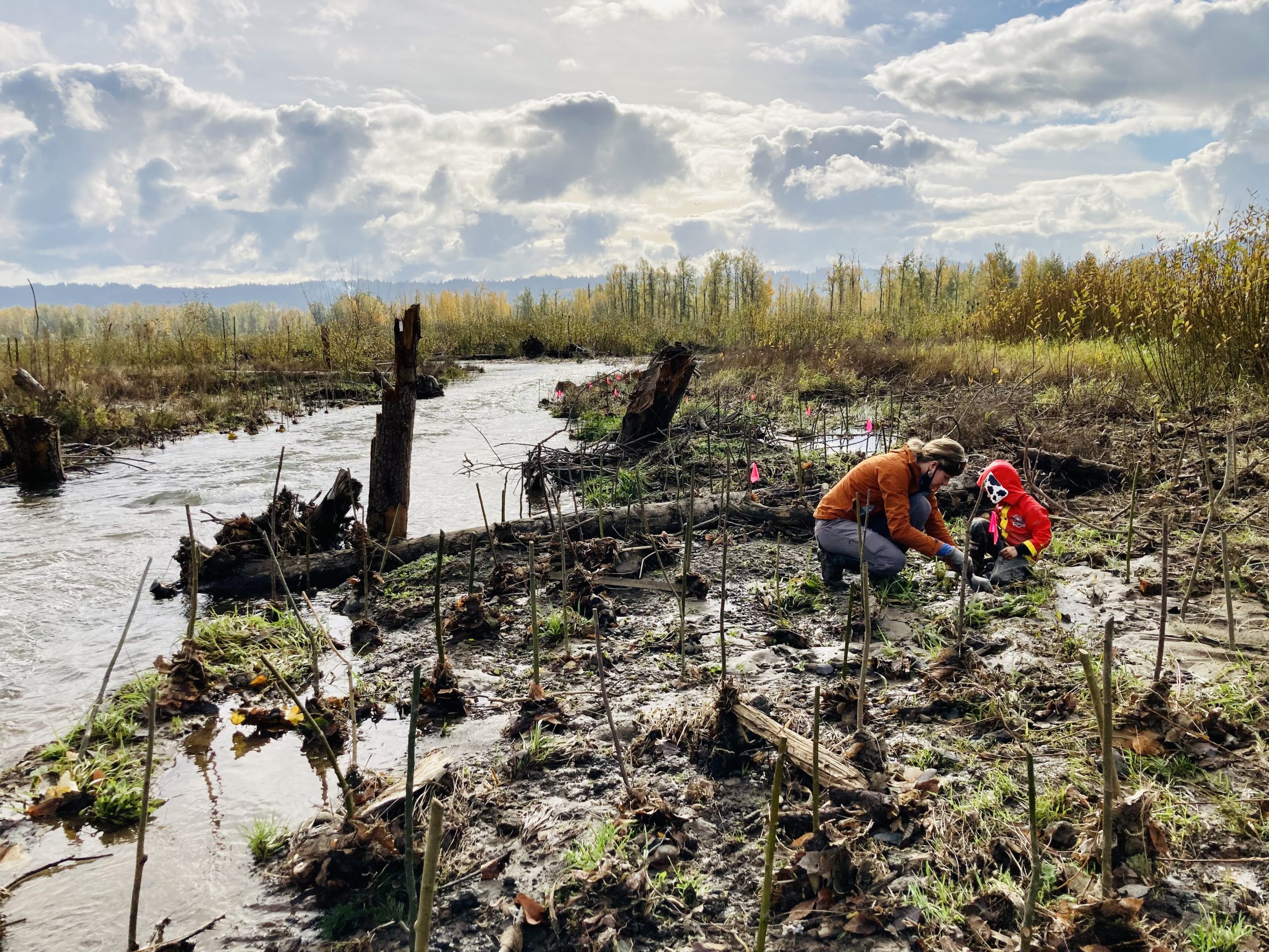
Volunteer Events
Volunteers lend a critical hand in enhancing streamside habitat at several stewardship sites along tributaries throughout our region. Volunteers plant native trees and shrubs, and mulch and weed to ensure young plants have the best chance of reaching maturity.
Big Canoe Paddles
Being out on the water is a truly unique experience that builds appreciation for and connection to our rivers. The Lower Columbia Estuary Partnership owns two, twelve-passenger canoes to get students and community members out on the water, many for their first time.
Every year we partner with community organizations to take their members out on fun educational paddles. Most of these groups serve children, BIPOC or culturally-specific communities, low-income groups, and others who traditionally lack access to the river and recreation on the water.
Learn more and sign up for our newsletter at www.estuarypartnership.org.
Help us protect and restore the Morro Bay estuary!
- Donate to the Estuary Program today and support our work in the field, the lab, and beyond.
The Estuary Program is a 501(c)3 nonprofit. We depend on funding from grants and generous donors to continue our work. - Support us by purchasing estuary-themed gear from ESTERO. This locally owned and operated company donates 20% of proceeds from its Estuary clothing line and 100% of Estuary decal proceeds to the Estuary Program. Thank you, ESTERO!
- Purchase items from the Estuary Program’s store on Zazzle. Zazzle prints and ships your items, and the Estuary Program receives 10% of the proceeds.
- Subscribe to our seasonal newsletter: Between the Tides!
- We want to hear from you! Please take a few minutes to fill out this short survey about what type of events you’d like to see from the Estuary Program. We appreciate your input!