The Estuary Program works to share research and monitoring results on the bay and creeks to increase understanding of the health of this special place. Every three years, we create a report called the State of the Bay and host and attend a variety of county-wide events during the spring to share the results. Continue reading for a sneak peek of some highlights, as well as information about upcoming events.
What is the State of the Bay report?
This report is published by the Estuary Program every three years. We gather the most recent research and monitoring results from our own efforts as well as partners to develop a 28-page hard copy report. We also compile an online webpage version where we have space to include additional information. The State of the Bay report is organized as a series of common questions, such as “Is Morro Bay safe for swimming?” and “Does Morro Bay support healthy eelgrass beds?”
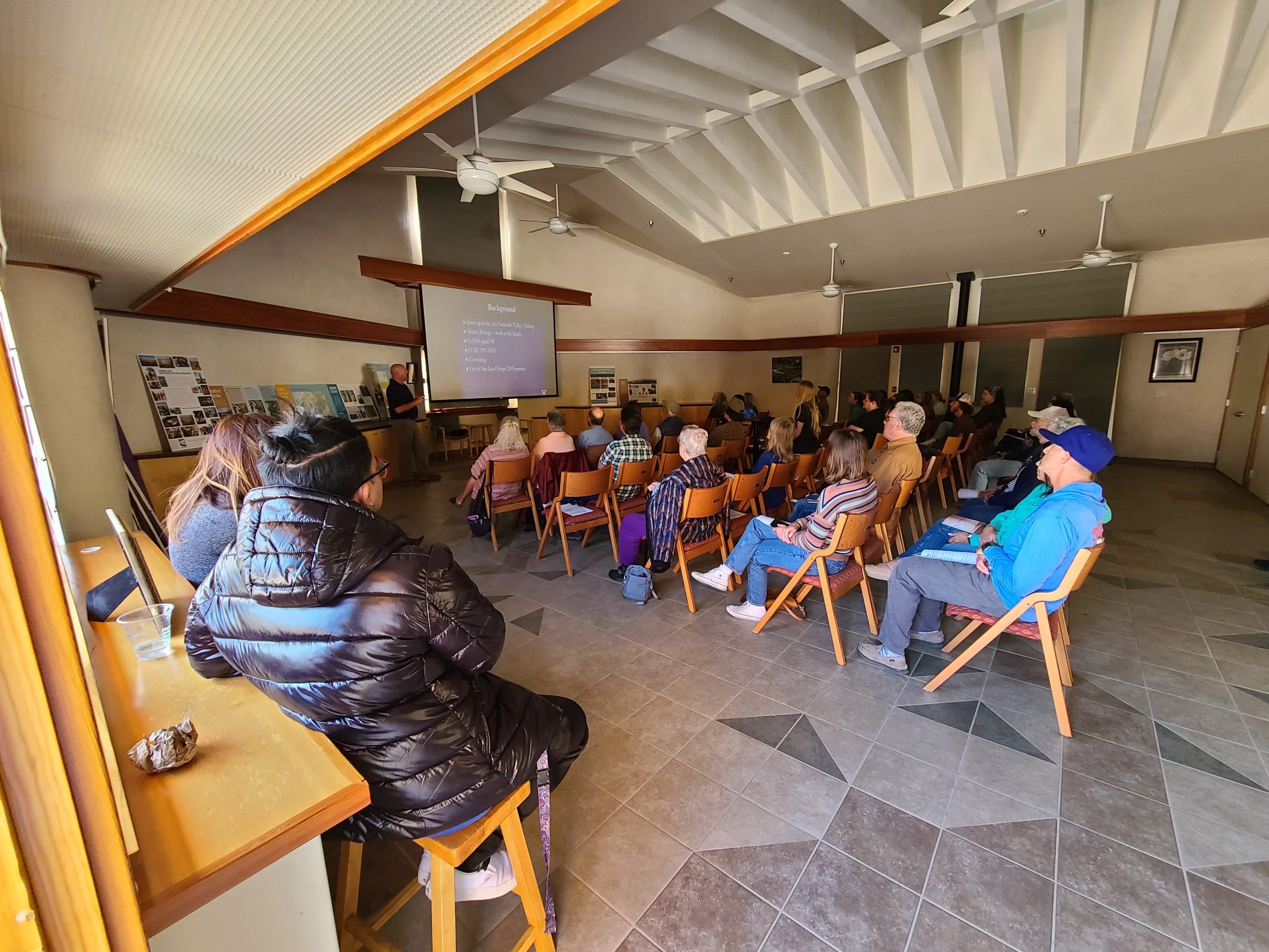
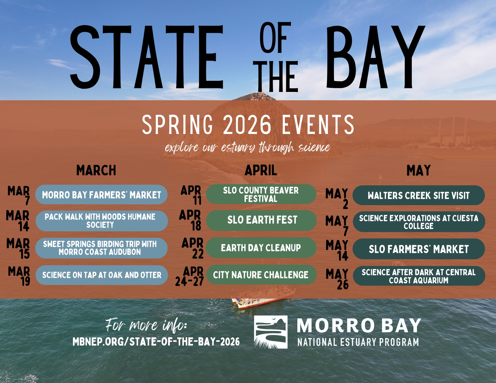
In addition to publishing and distributing the report, the Estuary Program hosts and attends a variety of outreach events throughout the spring. These events help to increase public engagement with and understanding of the Morro Bay estuary and watershed. This year, we are hosting or attending over a dozen events between March and May. See below for more information on these events and how to get involved.
Report Highlights
Throughout the next several months, we will be releasing blogs with more detailed highlights from the report. In the meantime, here is a sneak peek of some of the report topics.
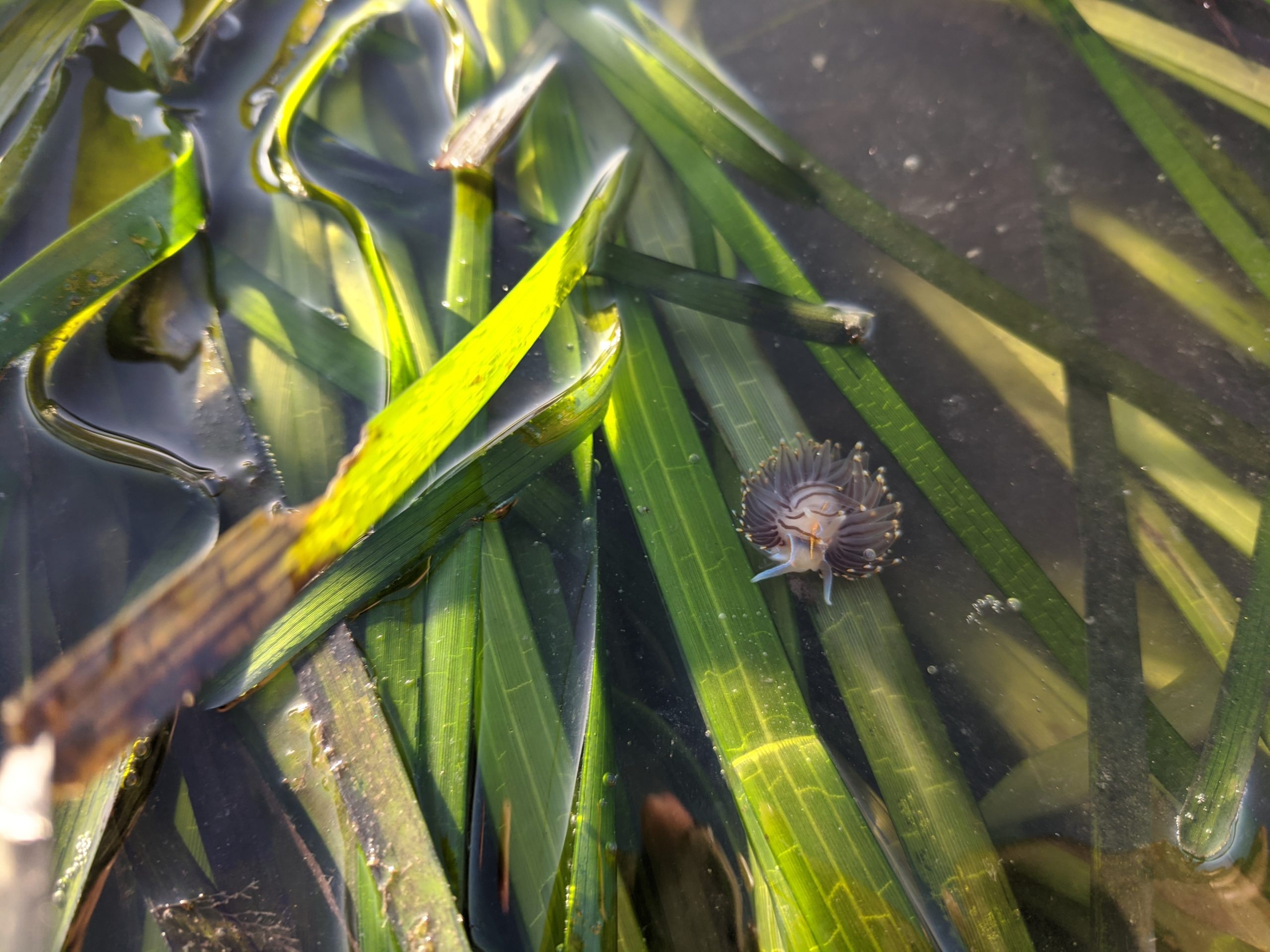
Eelgrass
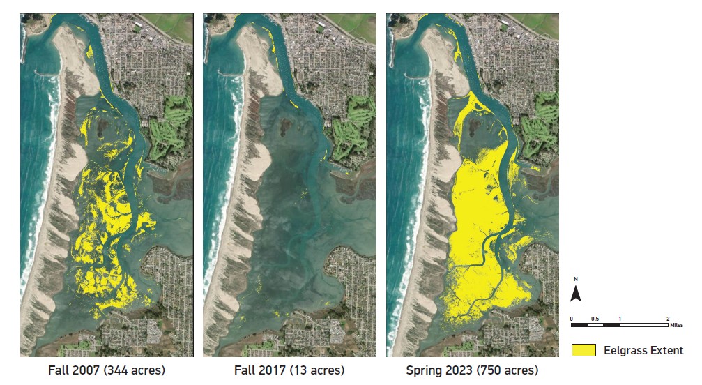
Eelgrass is a flowering plant that is an important foundation species for marine ecosystems worldwide, including here in Morro Bay. Unfortunately, eelgrass populations have declined by 30-50% worldwide in the last few decades. In the Morro Bay estuary, eelgrass declined from 344 acres to 13 acres between 2007 and 2017. More recently we’ve seen a resurgence in eelgrass, with 500 acres mapped in 2021 and 750 acres mapped in 2023.
The rapid eelgrass decline made clear the near for expanded research and monitoring of this important habitat type. To aid eelgrass mapping efforts, researchers at Cal Poly and Stanford University used machine learning to automate the process of developing eelgrass acreage maps using drone imagery. The new process vastly reduces the hands-on time required for map creation.
Habitat Protection
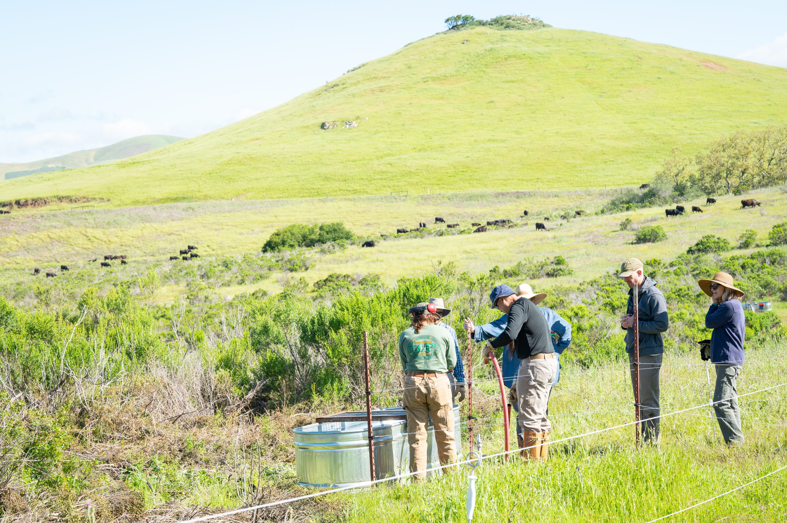
The Estuary Program has worked to protect and restore habitat since we were established in 1995, and the last three years have been no exception. Recently we partnered with Cuesta College to provide grazing infrastructure for their Ranch Education Program. Livestock grazing can be an effective tool to reduce invasive species cover, improve native species habitat, and improve soil health.
The Estuary Program has also launched several long-term projects to better understand local habitats. Our historical ecology study gives us a clearer idea of habitat conditions in our watershed during the late 18th through mid-19th centuries. This information can help inform future sustainable land management and restoration practices.
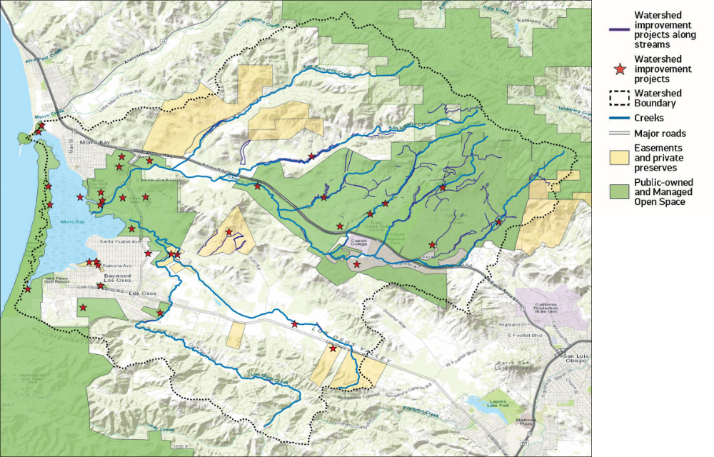
The report also highlights our thirty years of protection and restoration efforts with a map illustrating the more than 5,400 acres that have been protected and the thirty-eight projects that have been completed to improve natural areas and water quality.
How to Learn More
You can find the State of the Bay 2026 report and additional online content at www.mbnep.org/state-of-the-bay-2026. Keep an eye on our blog and social media pages (Instagram/Facebook) over the next several months for more detailed posts and information about the report.
You can also find us at a variety of events throughout SLO County between March and May including a Science on Tap in March, clean-up events in April, and a Science Explorations science talk event in May. Join us to pick up a copy of the report or to talk to staff about projects and research going on in our watershed. The report is available in our Nature Center which is upstairs in the Marina Square Building at 601 Embarcadero in Morro Bay.
Help us protect and restore the Morro Bay estuary!
- Donate to the Estuary Program today and support our work in the field, the lab, and beyond.
The Estuary Program is a 501(c)3 nonprofit. We depend on funding from grants and generous donors to continue our work. - Support us by purchasing estuary-themed gear from ESTERO. This locally owned and operated company donates 20% of proceeds from its Estuary clothing line and 100% of Estuary decal proceeds to the Estuary Program. Thank you, ESTERO!
- Purchase items from the Estuary Program’s store on Zazzle. Zazzle prints and ships your items, and the Estuary Program receives 10% of the proceeds.
- Subscribe to our seasonal newsletter: Between the Tides!
- We want to hear from you! Please take a few minutes to fill out this short survey about what type of events you’d like to see from the Estuary Program. We appreciate your input!