One of the goals of the Estuary Program is to monitor the bay and the lands that surround it to better understand conditions and how they are changing over time. As part of this effort, the Estuary Program conducts spring bioassessment surveys. This data allows us to assess the health of our creeks and determine if they support sensitive aquatic life.
What is bioassessment?
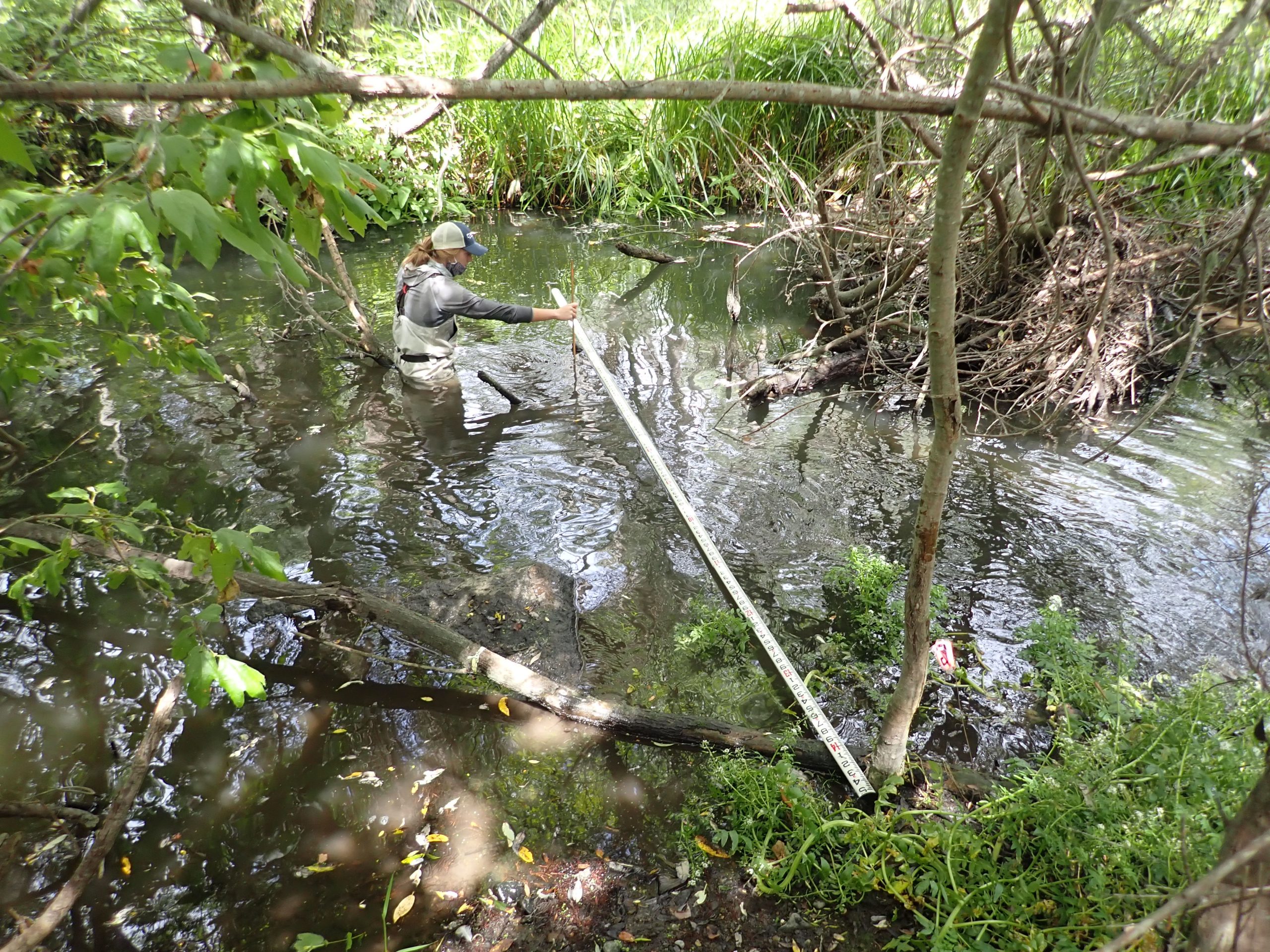
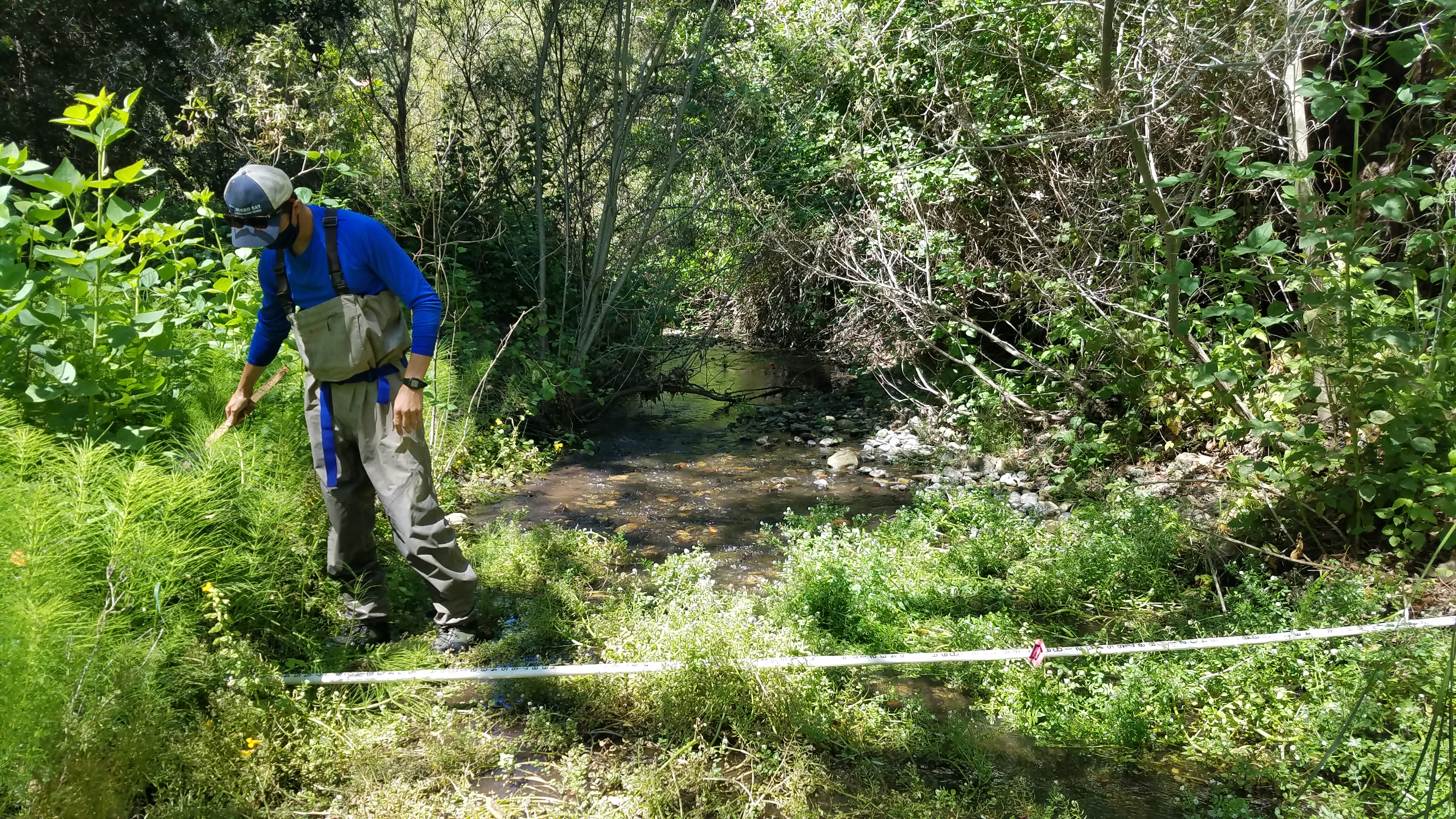
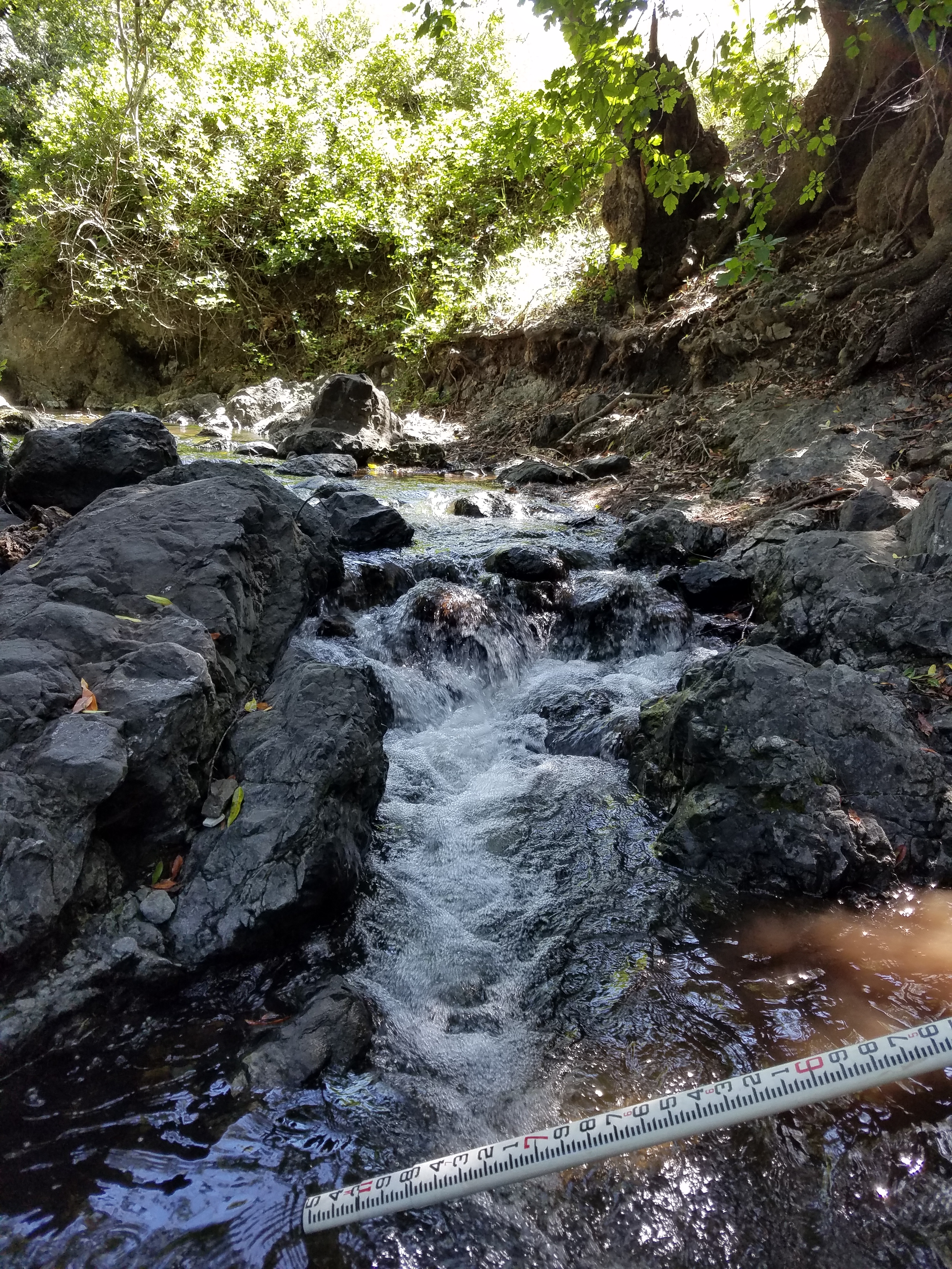
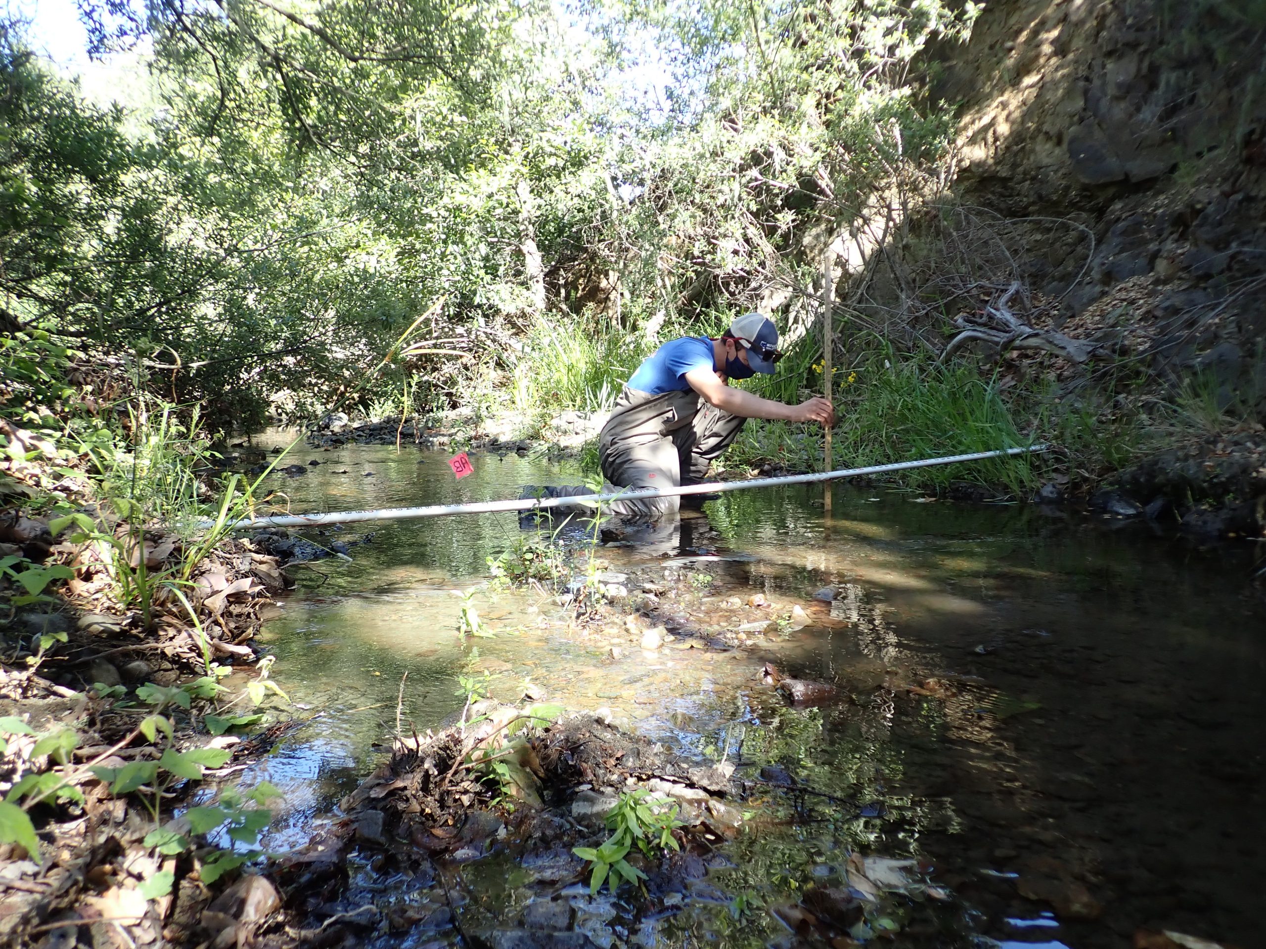
Each spring, staff and volunteers head out to local creeks to collect habitat measurements. These measurements include the depth of the water, the size of the rocks in the stream, and the amount of tree cover shading the creek. This information helps us to better understand available habitat and provide a basis for comparison as the site changes over time.
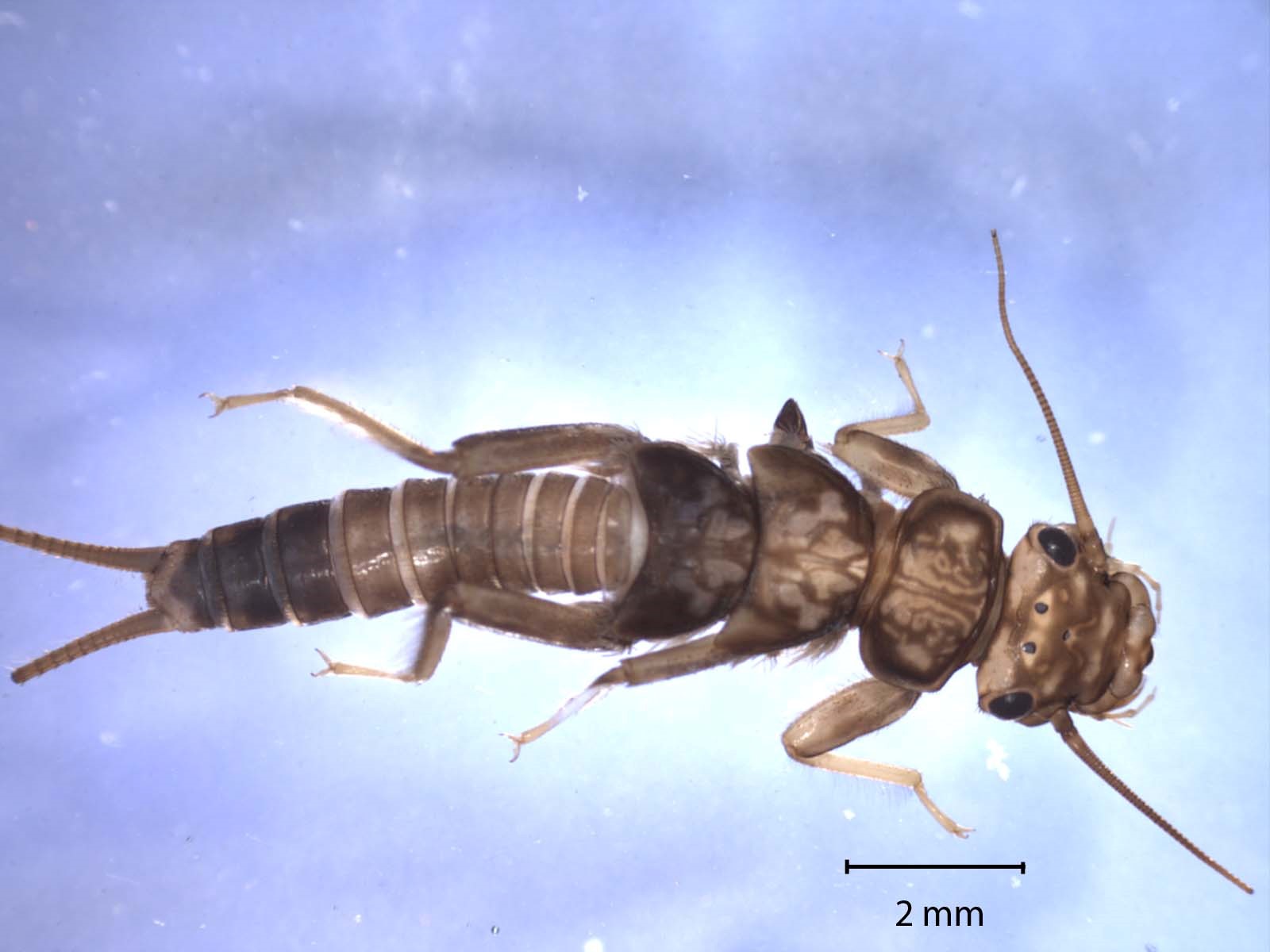
We also sample for benthic macroinvertebrates, or BMIs. The term benthic means bottom-dwelling, macro means that it is visible to the naked eye, and invertebrate simply means that it lacks a backbone. We send these BMI samples to a taxonomy lab where they are sorted, counted, and identified.
2020 bioassessment effort
As many of our readers know, spring bioassessment season is one of the major monitoring efforts of the year. The 2020 bioassessment season was substantially different for a number of reasons.
Typically, the Estuary Program surveys ten sites with the help of nearly twenty volunteers. Last year, due to safety concerns with COVID-19, volunteers were unable to accompany us. This change in volunteer support altered both the structure and the nature of the surveys.
Each year, Estuary Program staff choose survey sites based on the availability of water in the creeks and accessibility of the site. In 2020, site selection had the added challenge of maintaining proper social distance between members of the survey crew within a relatively narrow creek channel. Because of this constraint, not all sites were good candidates for monitoring.
Despite the inherent challenges of conducting a major survey effort amidst a global pandemic, the Estuary Program still completed seven surveys. Three dedicated staff members conducted this considerable effort between May and June of 2020.
You can check out this blog post to read the highlights and challenges of conducting bioassessment surveys in 2020.
2020 survey results
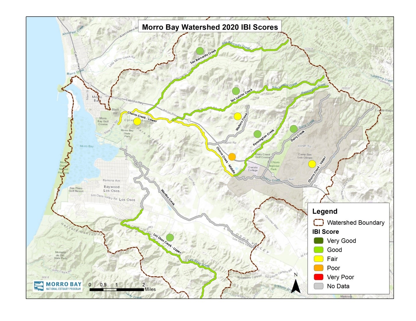
The taxonomy lab processes our samples and sends us a list of what they found in our samples as well as a number of metrics. One metric is called the Index of Biotic Integrity, or IBI. The IBI is calibrated specifically for our part of the state. The map below shows the creek health scores for the Morro Bay watershed in 2020 using the IBI score.
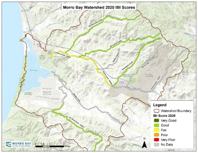
Pennington, San Luisito, and San Bernardo Creeks consistently have some of the best scores in the watershed, which was evident in 2020. These creeks have cold, clear, well-oxygenated water with minimal nutrient and sediment pollution, all of which are conditions that support sensitive BMI and result in good scores.
Los Osos Creek has moderate to good water quality and good habitat, though it did not have enough water to survey during the drought. There has been consistent flow on Los Osos Creek since 2017, and we have been able to sample in one or two locations in the previous four years. The impact of increased stream flow is evident as the 2020 average IBI score is similar to scores prior to the drought.
While Middle and Lower Chorro Creek show the impacts of less-than-ideal water quality (elevated water temperature and nutrients), both sections showed improvement in 2020 compared to previous years.
How do 2020 results compare?
The IBI scores from the 2020 bioassessment survey were compared to historic site averages, some of which date back to the early 1990s. In the following map, the color of the creek segments indicates the 2020 score and the dot next to the creek segment indicates the average of historic scores.
In 2020, scores ranged from average to slightly above average, with the biggest improvements seen on Lower and Middle Chorro Creek. Individual scores from 2011 to 2017 tended to be lower than average, which is thought to be due to California’s persistent drought. 2019 appeared to be one of the first years to show an upward trend in scores, and in 2020, scores are now returning to pre-drought levels. These BMIs are food for fish, so a healthy BMI population means the creek is good habitat for fish, such as the iconic steelhead trout (Oncorhynchus mykiss), a threatened species in our watershed.
Recognizing the contribution of the Miossi Trust
The Harold J. Miossi Charitable Trust has been a long-time partner in this important work. The Miossi Trust has contributed a total of $72,150 to the effort, supporting seven seasons of this work. The resulting data set is invaluable for assessing conditions in the watershed, including how well local creeks support life for sensitive species like steelhead trout.
We are pleased to announce that the Miossi Trust recently awarded us a generous $11,600 grant to support the 2021 monitoring season. We are excited to get out in the field for bioassessment monitoring again, as this is some of our most challenging and rewarding fieldwork of the year.
What you can do in 2021
In a typical year, bioassessment monitoring is not only a favorite with staff, but also with volunteers. It provides an opportunity for students and community members to learn a real-world assessment tool and participate in monitoring that contributes to an ongoing dataset. We, like many, thought that the pandemic would be resolved by 2021 and that we’d be able to welcome volunteers back to our organization. Unfortunately, given the current uncertainty surrounding the situation, we have decided to conduct this year’s bioassessment work as we did in 2020, with only a few staff members who are trained in COVID-safe protocols and without volunteer participation.
Although this volunteer opportunity will not possible for the 2021 season, we urge our readers and potential volunteers to pursue your interest in service and community science in other ways. Socially distanced trash clean-ups are a great way to get some time outdoors while making a real difference for the environment. If you’d like to focus your efforts on scientific observation and data collection, . Following your favorite environmental organizations online, and commenting on and sharing their social media posts helps to spread awareness of science and stewardship practices.
We’re all looking forward to a time when we can safely welcome our volunteers back to the field.
Help protect and restore the Morro Bay estuary
- Donate to the Estuary Program and support our work in the field, the lab, and beyond.
The Estuary Program is a 501(c)3 nonprofit. We depend on funding from grants and generous donors to continue our work. - Support us by purchasing estuary-themed gear from ESTERO. This locally owned and operated company donates 20% of proceeds from its Estuary clothing line and 100% of Estuary decal proceeds to the Estuary Program. Thank you, ESTERO!
- Purchase items from the the Estuary Program’s store on Zazzle. Zazzle prints and ships your items, and the Estuary Program receives 10% of the proceeds. Choose from mugs, hats, t-shirts, and even fanny packs (they’re back!) with our fun Estuary Octopus design, our classic Estuary Program logo, or our Mutts for the Bay logo.
Thank you for your support!