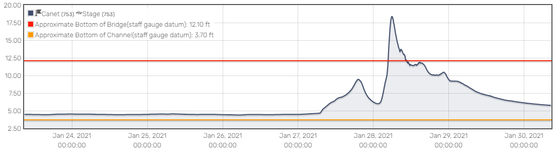
Hydrograph of Chorro Creek monitoring site at Canet Road during storm of January 2021. Shows high water height of mover 18 feet on January 28.
The figure above is referred to as a hydrograph and illustrates the height of water at a particular spot in a creek over time. This hydrograph shows the height of the water in Chorro Creek during the January 2021 storm at a monitoring site near Canet Road, which is close to the restoration project site. Estuary Program staff use the data from this site to estimate when and for how long the floodplain restoration site will activate. This data is available through the San Luis Obispo County website.
Hydrograph of Chorro Creek monitoring site at Canet Road during storm of January 2021. Shows high water height of mover 18 feet on January 28.