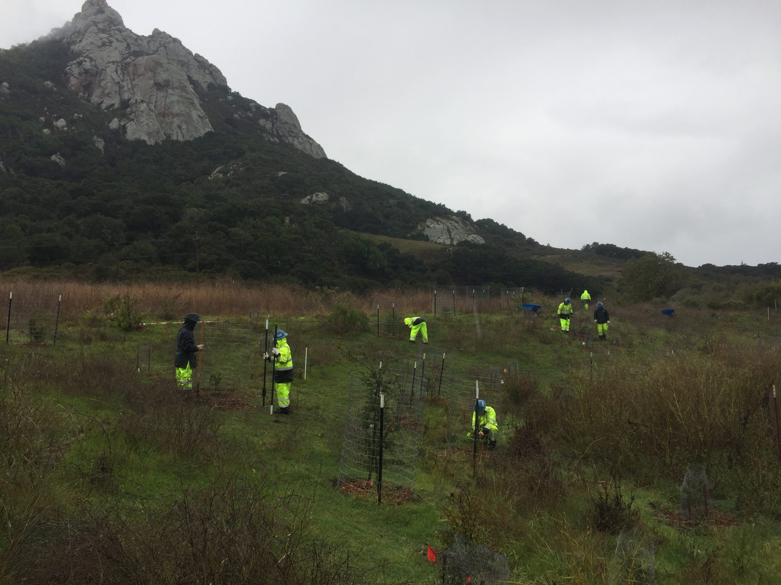
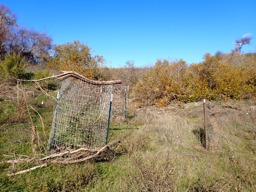
With the help of project partners and funding from the California Department of Fish and Wildlife and the State Coastal Conservancy, the Estuary Program completed a 4.8-acre restoration project at the Chorro Creek Ecological Reserve project in fall of 2019. The project included grading close to a half mile of side channel habitat to widen the floodplain on Chorro Creek, installing large woody debris, and planting diverse native shrubs and trees. To learn more about the implementation of the project and history of the site read this blog or watch a video presentation here.
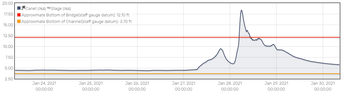
January 2021 storm conditions and hydrograph
During the first rainy season after project completion, there wasn’t enough precipitation to flood Chorro Creek and activate the channels. Then, in January of 2021, a large rainstorm brought almost eight inches of rain to the Morro Bay area over a three-day period. This storm was large enough to be classified as a ten-year-storm, which means that we can expect to get a storm of this size once every ten years. The storm caused Chorro Creek to overflow into the newly restored floodplain, putting the project to the test.
January 2021 floodplain activation videos
Estuary Program staff can’t always be on site to watch the creek rise during storms, so we use technology to help us gather data. Time lapse videos have helped us capture what the project site looks like during peak flows.
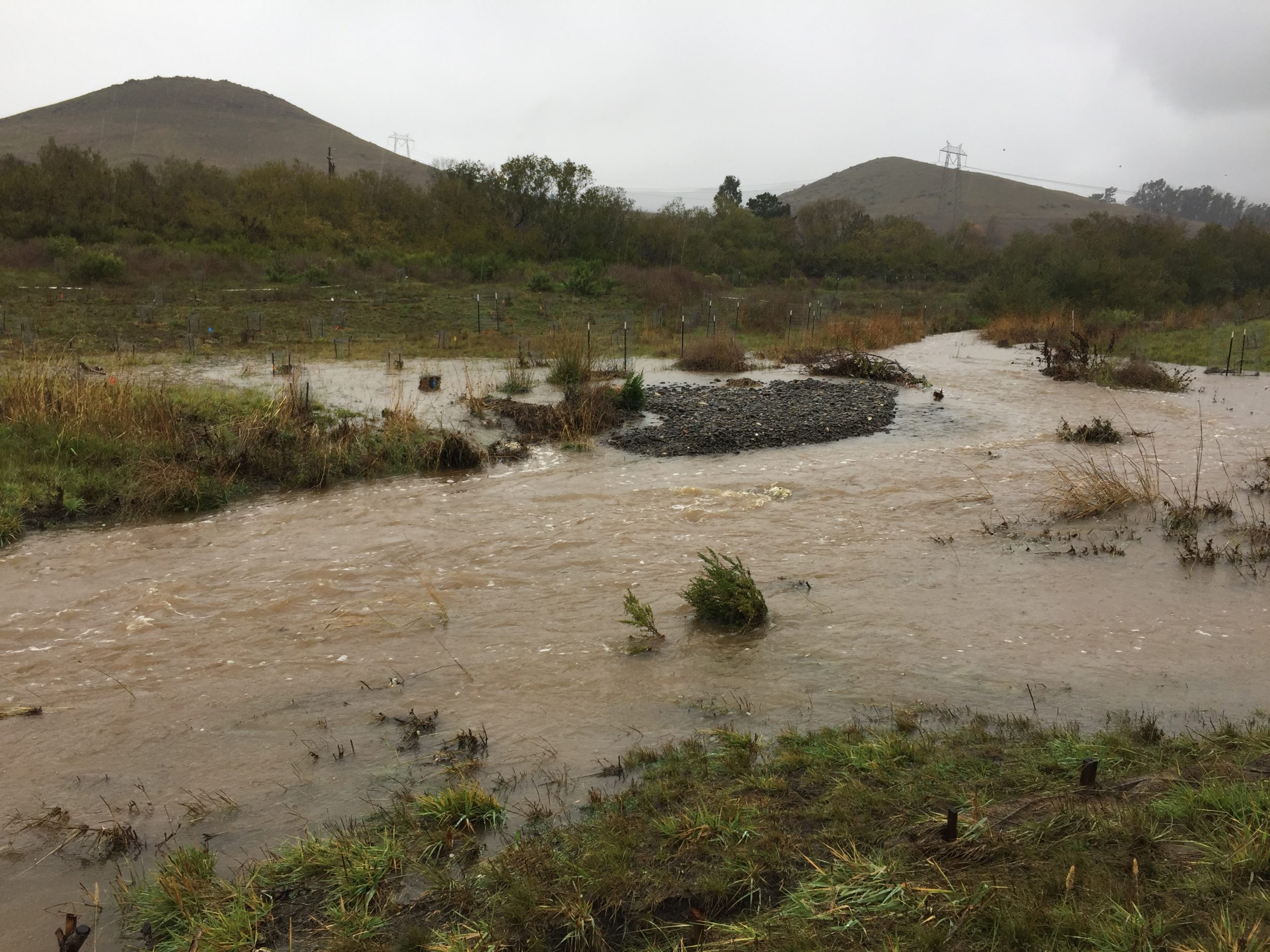
Given that water levels are relatively low during typical weather conditions for much of the year, the amount of water that flows through our watershed during these large storm events looks dramatic.
Watch this timelapse video of the floodplain activating during the ten-year storm event in January 2021. You can see that the full floodplain is activated and, as the flows dissipate, a large gravel bar appears. This gravel bar is made of sediment that was washed into the creek during the storm and deposited here.
This video shows the high flows within the side channel of Chorro Creek from another vantage point, showing side channel changes after the January 2021 storm event.
This video shows high flows along the upper side channel that was constructed as part of the restoration project. Flows had receded from the peak during this video.
How did the site respond to these high flows?
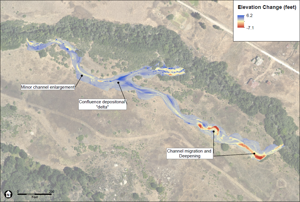
Water is a powerful force, and the storm in January 2021 changed the project site. The high, rushing water carved out new deep pools in some places and deposited excess sediment in others, creating new gravel bars.
Experts at Environmental Sciences Associates (ESA), the firm who designed the restoration project, have conducted repeat geomorphic surveys including a drone flight, cross-sections, and profiles of the side channels. These surveys track changes in the landscape and the ways in which water flows over it.
The data shows that much of the restoration site held up well, given that these high flows came so early in the post-restoration life of the project site. There was some erosion resulting in a net loss of 1,318 cubic yards of sediment. However, if the floodplain hadn’t been excavated during the project implementation period, much more sediment would have eroded and washed downstream from the site with these large stormwater flows.
Eighty-three of the 1,415 new plants added to the site were lost during the storm, and many cages needed to be cleaned from debris. Despite this, the site still meets the project target for plant health with 90% of the plants having survived the storm.
More stormwater flows in December 2021
The floodplain also activated for an extended period of time in December 2021. Flows filled much of the constructed floodplain area. The rushing water deposited additional sediment at the project site and created a low flow channel within the large gravel bar deposited during the January storm, almost a year earlier. Water has also remained in the channel, providing wildlife habitat.
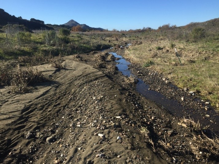
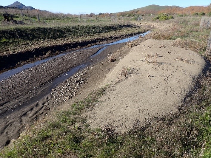
As you can see in the two pictures above, reconnecting the creek to the floodplain has allowed the excess sediment to be deposited at the project site. This has reduced the amount of sediment flowing into the Morro Bay estuary, which has historically filled in at an unnaturally fast rate.
Monitoring continues at the project site
We will continue to track the evolution of the side channels and growth of the native plantings. These types of restoration projects are many years in the making and it is encouraging to see the project site taking form and beginning to show ecological benefits.
Subscribe to our weekly blog to have posts like this delivered to your inbox each week.
Help us protect and restore the Morro Bay estuary!
- Donate to the Estuary Program today and support our work in the field, the lab, and beyond.
The Estuary Program is a 501(c)3 nonprofit. We depend on funding from grants and generous donors to continue our work. - Support us by purchasing estuary-themed gear from ESTERO. This locally owned and operated company donates 20% of proceeds from its Estuary clothing line and 100% of Estuary decal proceeds to the Estuary Program. Thank you, ESTERO!
- Purchase items from the the Estuary Program’s store on Zazzle. Zazzle prints and ships your items, and the Estuary Program receives 10% of the proceeds. Choose from mugs, hats, t-shirts, and even fanny packs (they’re back!) with our fun Estuary Octopus design or our Mutts for the Bay logo.
Thank you for helping our beautiful, bountiful, biodiverse bay!