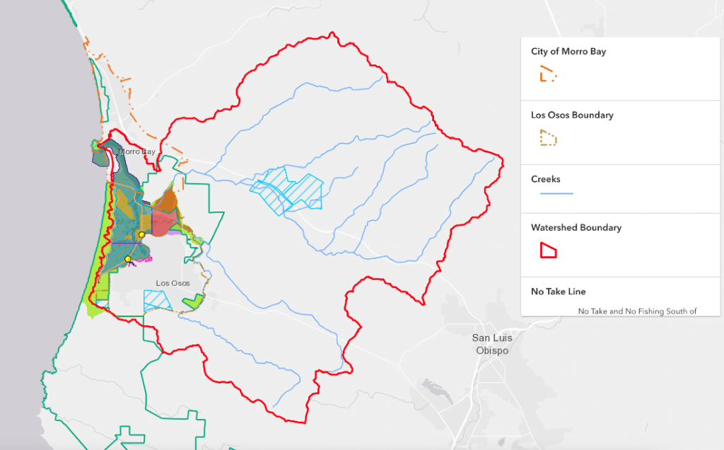
The Morro Bay estuary and the surrounding watershed contain multiple bodies of water, an incorporated city, an unincorporated community, a military base, a community college, acres of protected lands, and vast areas of privately-owned land. The entirety of the watershed spans a large area, so not surprisingly there are numerous entities that have jurisdiction throughout the area. A jurisdiction is the power of a person or group to make decisions for a specific area. For instance, the government of the City of Morro Bay maintains and makes decisions for the area within its city boundaries. These individuals or groups often put regulations in place so that the rules are clear to those who visit, work, play, or live in that particular area.
Making a Jurisdictional Map for Morro Bay
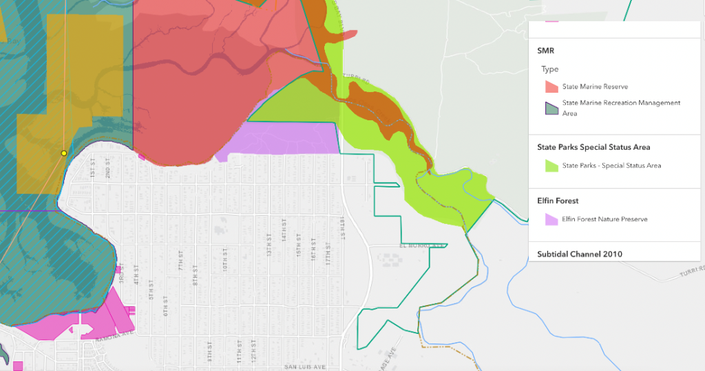
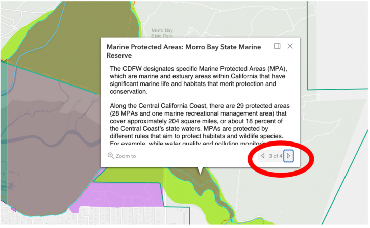
Jurisdictions can often be confusing, with multiple entities having authority over a specific area. The Estuary Program often gets questions related to jurisdictional control, and over the years we’ve found it helpful to have a jurisdictional map that summarizes the different geographical areas around the watershed and the people or groups responsible for them. One of the goals of this map is to help the public determine which organization or entity to contact regarding issues that relate to a specific area.
Indigenous Tribes Acknowledgment (Salinan and Yak Tityu Tityu Northern Chumash)
The Salinan People and the yak tityu tityu yak tiłhini Northern Chumash tribe have lived around Morro Bay and in San Luis Obispo County for thousands and thousands of years.
For the Salinan People, Le’samo (Morro Rock) is a powerful and important place in many stories. They request that others take care of the land and sea as they have traditionally done to respect our part of the world. To learn about the Salinan tribe, please visit SalinanTribe.com.
For the yak tityu tityu yak tiłhini Northern Chumash tribe, the sea, Miti Hali (San Luis Obispo County), and Morro Bay specifically, are very special and important spaces for their stories and culture. They ask that visitors honor and enjoy these lands in respect of those who have protected it then and now. To learn more about the yak tityu tityu yak tiłhini Northern Chumash tribe, please visit yttnorthernchumash.org.
Xayatspanikan & auʔauʔ (Thank You).
How to Use the Jurisdictional Map
An interactive version of the map is available on our website. When using the map, please keep in mind that a jurisdictional map is always a snapshot in time because the area boundaries may be modified or the controlling entity may have changed. The map was created with the data available in March 2022. We are unable to constantly review the various data sources to determine if any jurisdictions have changed. Thus, users should be aware of the March 2022 creation date of this tool.
Also, please keep in mind that the map is meant to be informational and is not intended to be used for navigational, regulatory, legal, or decision-making purposes.
Additional Jurisdictional Resources
A primary goal in creating the map was to help users determine which entity has jurisdiction over a particular area and facilitate the user’s ability to gather more information on that entity or area. It is not possible for us to include and keep up-to-date all information for a particular jurisdiction. By providing links to the resources such as websites for the controlling entities, users can get the most current information and contact information. The contact information, as of March 2022, can be found here.
We hope you find this to be a useful tool. If you have suggestions for when the map is next updated, please reach out and let us know.
Cover photo Copyright aerialarchives.com.
Help us protect and restore the Morro Bay estuary!
- Donate to the Estuary Program today and support our work in the field, the lab, and beyond. The Estuary Program is a 501(c)3 nonprofit. We depend on funding from grants and generous donors to continue our work.
- Support us by purchasing estuary-themed gear from ESTERO. This locally owned and operated company donates 20% of proceeds from its Estuary clothing line and 100% of Estuary decal proceeds to the Estuary Program. Thank you, ESTERO!
- Purchase items from the Estuary Program’s store on Zazzle. Zazzle prints and ships your items, and the Estuary Program receives 10% of the proceeds.
Thank you for helping our beautiful, bountiful, biodiverse bay!