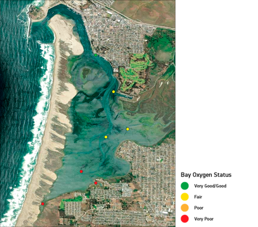
This map shows oxygen levels at seven sites around the estuary. Oxygen levels tend to be higher toward the front bay where the cold well-oxygenated waters of the Pacific Ocean are easily pushed into the bay through the deeper channels. Our data shows lower oxygen levels in the back bay. The shallower depths in this part of the bay prevent those ocean waters from coming in with the tide, leading to stagnant water with less oxygen. These conditions can be harmful to the most sensitive wildlife.