Monitoring from a state-wide perspective
California’s coastline stretches 840 miles and is interspersed with numerous estuaries both large and small. This diversity makes it no small task to track broad-scale trends and assess human influence on our estuaries. Nevertheless, this is the primary goal of the California Estuary Marine Protected Area Monitoring Program (EMPA). This program conducted its first set of pilot surveys in 2021 at 15 estuaries to test out monitoring methods. The project is currently working to expand to nearly 30 estuaries.
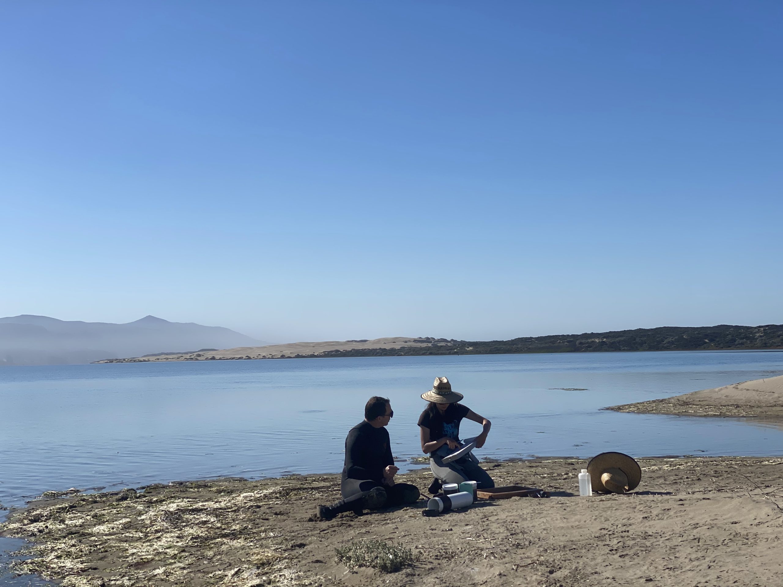
Central Coast Wetlands Group (CCWG), an affiliate research group of Moss Landing Marine Labs, is the project lead and is conducting the EMPA monitoring fieldwork on the Central Coast. This fall, the Estuary Program joined CCWG staff in Arroyo De La Cruz and Morro Bay to lend a hand and learn more about how they assess the health of estuaries.
What does it mean to be a Marine Protected Area?
Along with the overall goal of better understanding estuarine health across California, the EMPA program is also assessing how well the Marine Protected Areas (MPAs) safeguard estuaries. The MPA Network is a California program that protects regions of coastline from certain commercial and recreational uses to help conserve biological diversity. A network of MPAs was established after the passage of the Marine Life Protection Act in 1999. The EMPA monitoring program compares data from estuaries with and without the MPA designation. This determines if the protected status is having a measurable effect.
Within Morro Bay there are two MPAs, both of which are included in EMPA monitoring. They are the Morro Bay State Marine Recreational Management Area and the Morro Bay State Marine Reserve. For more information on the location of MPAs within Morro Bay, take a look at our jurisdictional map which was shared in a previous blog post.
How do you measure the health of an estuary?
An estuary is an area where salty ocean waters meet up with freshwater inflows. Estuaries come in many shapes and sizes and are also subject to vastly different physical and chemical influences. They are each home to a variety of different plants and animals. While the diversity in estuaries is a driver for why we strive to protect them, it also provides a challenge when comparing the health of estuaries in a standardized way across a state as large as California.
EMPA monitoring focuses on tracking ecological functions, which refers to the services that a healthy estuary provides. The ecological functions measured include the quality of habitat available for different groups of organisms and proper cycling of nutrients. It also includes support for sensitive plants and animals, and the ability of an estuary to mitigate the impacts of sea level rise.
A snapshot of the fieldwork in Morro Bay
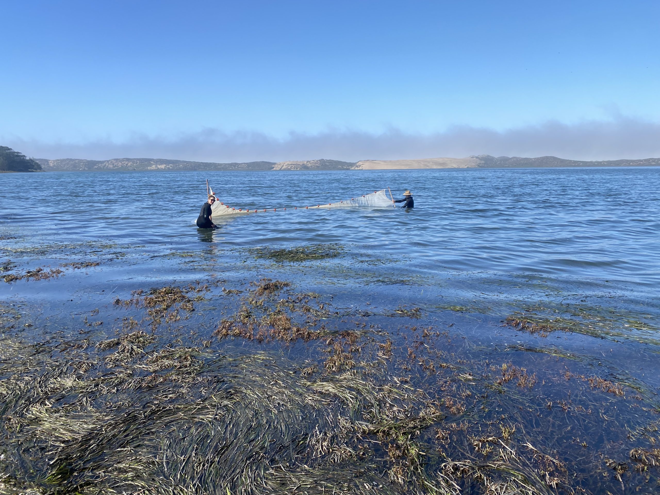
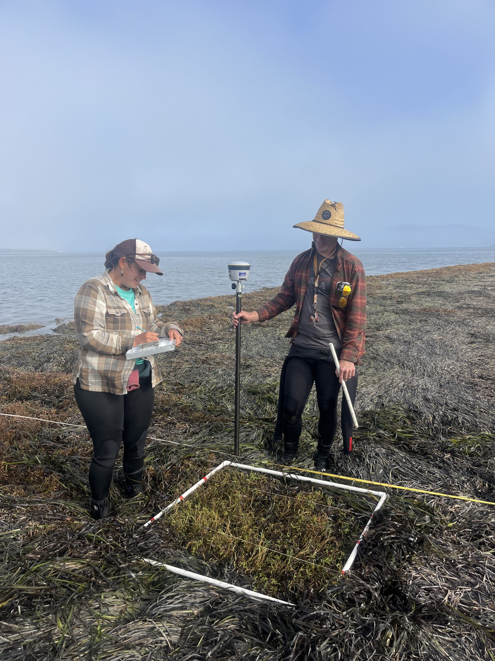
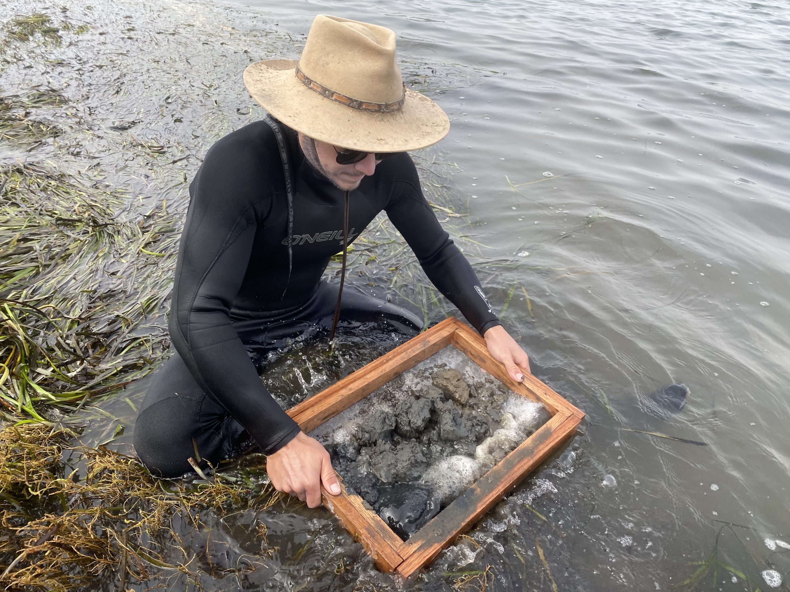
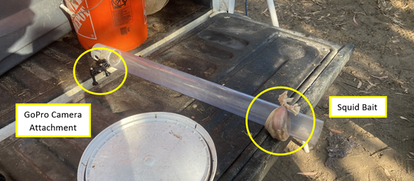
This fall, Estuary Program staff were able to see firsthand how ecological functions are evaluated. Many of the methods are designed to collect a representative sample of the plants or animals present at a particular site. These are excellent indicators of a well-functioning estuary. Fish populations are assessed using beach seine nets as well as a technique called Baited Remote Underwater Video (BRUV). Small invertebrates can be found in the mud along the shoreline using sediment cores. Larger invertebrates along the main channel are collected in crab traps. After measurements and species identification are recorded, all organisms are returned unharmed to the estuary. Staff also assess vegetation. If native plant cover is less dense than expected or if there is a high percentage of invasive species, then the system is likely impaired.
Once data has been collected consistently for several years, baseline conditions can be established showing how estuary health fluctuates over time and between sites. This in turn will help determine the impact of the MPA designation in protecting California’s estuaries.
Help us protect and restore the Morro Bay estuary!
- Donate to the Estuary Program today and support our work in the field, the lab, and beyond.
The Estuary Program is a 501(c)3 nonprofit. We depend on funding from grants and generous donors to continue our work. - Support us by purchasing estuary-themed gear from ESTERO. This locally owned and operated company donates 20% of proceeds from its Estuary clothing line and 100% of Estuary decal proceeds to the Estuary Program. Thank you, ESTERO!
- Purchase items from the Estuary Program’s store on Zazzle. Zazzle prints and ships your items, and the Estuary Program receives 10% of the proceeds.
- Subscribe to our seasonal newsletter: Between the Tides!
- We want to hear from you! Please take a few minutes to fill out this short survey about what type of events you’d like to see from the Estuary Program. We appreciate your input!