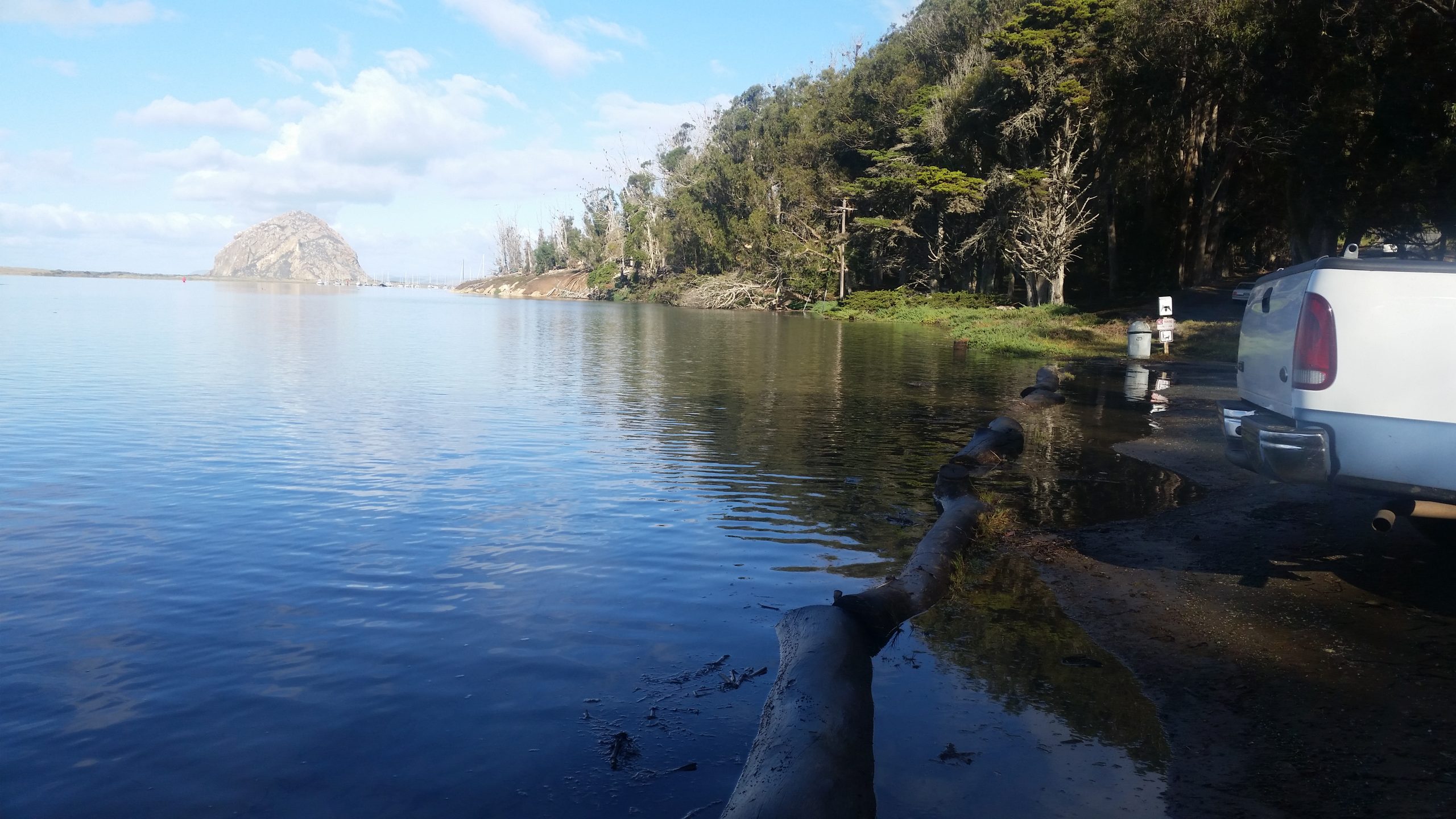
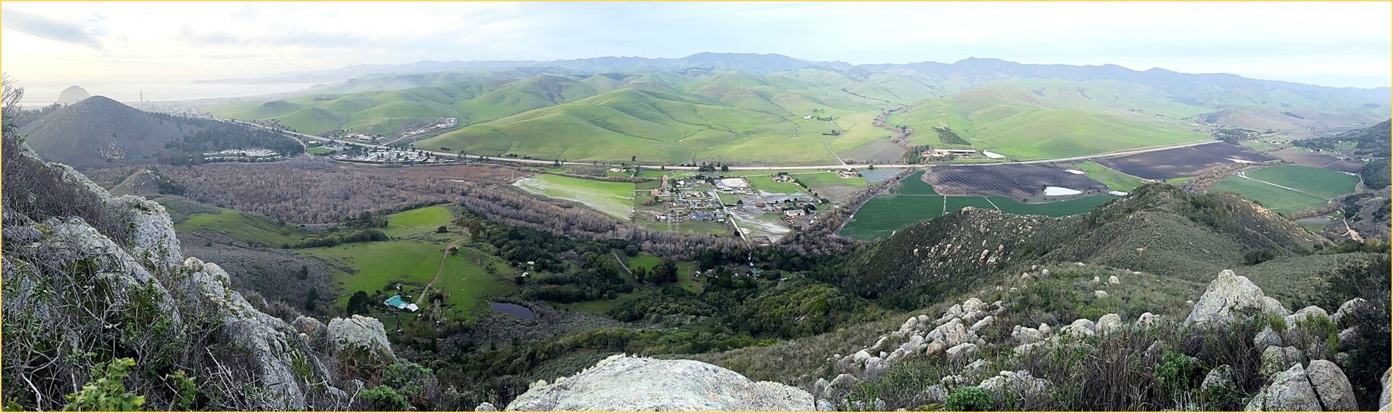
Our coastal communities are still feeling the impacts of the January 2023 storms. During this time, heavy rains and high tides flooded transportation corridors and communities along the bay shoreline and the lower Chorro Creek watershed. Portions of South Bay Boulevard, State Park Road, Highway 1, Quintana Road, and Canet Road experienced flooding. As a result, the community of Los Osos was completely cut off. As sea levels continue to rise and powerful storms become more common, these low-lying areas are expected to face more frequent flooding and long-term damage.
We wanted to share the efforts of two local partners who are working to plan for these impacts. The San Luis Obispo Council of Governments (SLOCOG) and the Coastal San Luis Resource Conservation District (CSLRCD) have both received grant funding to study which areas are most at risk. They also aim to explore solutions that support the community and the environment.
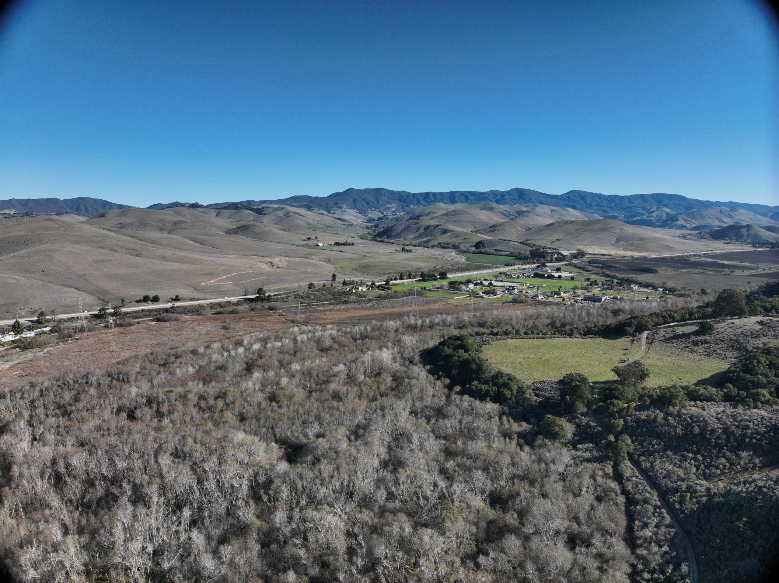
Envisioning a More Resilient Connection Between Morro Bay and Los Osos
SLOCOG launched the Morro Bay Estuary Climate Resilience Transportation Plan in spring 2024 with funding from Caltrans. This project develops solutions to improve car and bicycle transportation and public access between Morro Bay and Los Osos. Another goal of the project is to protect the habitats of the estuary and State Parks.
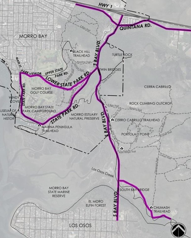
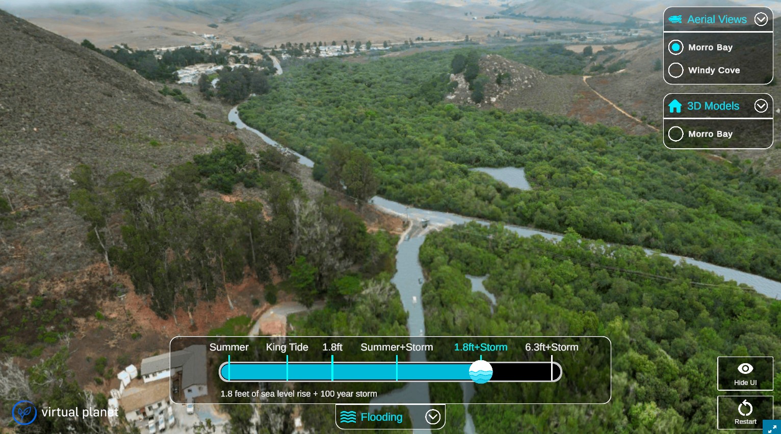
The project began with an inventory of the transportation infrastructure, recreational opportunities, and sensitive habitats at risk from flooding. Next, project managers developed a hydrodynamic model that simulates and predicts water movement and flow patterns in the bay. This model simulated vulnerability for three sea level rise scenarios (0 ft, 1.8 ft, and 6.3 ft) under storm and non-storm conditions. Further analysis of possible road closures will be summarized in a coastal hazards and vulnerability assessment expected in summer 2025. Visit the project’s website for more details.
Community engagement is also central to SLOCOG efforts. The organization hosted a workshop late last year to gather community feedback on existing conditions and possible ideas for adaptation. The project team is using existing coastal hazard maps and community input to identify options to enhance transportation while protecting habitat. The project team will also create a conceptual design for a new protected bike and pedestrian path linking the communities of Los Osos and Morro Bay. Stay tuned for additional community engagement opportunities later this summer.
This project will involve the County, City of Morro Bay, Caltrans, State Parks, the Estuary Program, and other partners. We will be working together to seek funding, implement projects, and provide expertise.
Nature-Based Solutions to Reduce Flood Impacts
The January 2023 storms also heavily impacted homes, agricultural fields, and roads along lower Chorro and San Bernardo Creeks. The CSLRCD owns Chorro Flats, the floodplain adjacent to lower Chorro Creek. This area is right before the creek waters enter the Morro Bay estuary. While Chorro Flats has supported floodplain functions such as sediment capture for over 25 years, it is now at or close to capacity. The CSLRCD received grant funding from the State Coastal Conservancy to better understand current conditions and assess actions to increase floodplain capacity. The main goal is to reduce prolonged flooding and the damage it can cause. Another goal is to protect the habitat within the 950-acre project area.
The CSLRCD is looking at nature-based solutions to increase floodplain capacity. Some of these solutions include land acquisition, floodplain restoration, culvert updates, and land use best management practices. Similar to SLOCOG’s transportation plan, this project is using hydrodynamic modeling to assess current and future flood conditions and potential adaptations.
Several conceptual design alternatives will be developed with landowner and stakeholder input. Then a preferred alternative will be selected with community input. The preferred alternative will identify restoration techniques and specific sites for furthering design plans and for environmental review. The project is expected to finish this winter, and the CSLRCD anticipates seeking funding for project implementation.
The Estuary Program is excited to be a part of both important efforts. We hope these projects protect crucial infrastructure while safeguarding vulnerable habitats throughout the Morro Bay estuary and the lands that surround it.
Help us protect and restore the Morro Bay estuary!
- Donate to the Estuary Program today and support our work in the field, the lab, and beyond.
The Estuary Program is a 501(c)3 nonprofit. As a result, we depend on funding from grants and generous donors to continue our work. - Support us by purchasing estuary-themed gear from ESTERO. This locally owned and operated company donates 20% of proceeds from its Estuary clothing line and 100% of Estuary decal proceeds to the Estuary Program. Thank you, ESTERO!
- Purchase items from the Estuary Program’s store on Zazzle. Zazzle prints and ships your items, and the Estuary Program receives 10% of the proceeds.
- Subscribe to our seasonal newsletter: Between the Tides!
- We want to hear from you! Please take a few minutes to fill out this short survey about what type of events you’d like to see from the Estuary Program. We appreciate your input!