For a few days each winter, the California coast experiences unusually high and low tides known as “king tides.” The California King Tides Project aims to document them to give us a glimpse into the impacts of sea level rise and extreme weather events in areas like Morro bay. Continue reading to learn more about the project and how to participate.
What are Tides?
Tides are long-period waves that travel throughout the ocean. Tides travel across water and end when they hit land, where they become more visible to us. When the highest part of the tidal wave hits land, we see it as high tide. When the lowest part of the wave hits land, we see it as low tide.

There are several factors that impact the creation and movement of tides. The main influence is the gravity of the moon, which pulls water away from the earth and towards the moon. This force creates a “tidal bulge” of water that is higher in elevation than the surrounding water. This is the peak of a high tide. Simultaneously, the pull of water towards the moon creates another tidal bulge on the opposite side of the earth. The bulges also “squeeze” the water between them, which causes a low tide on both sides of the earth between the bulges. This means that there are always two high tides and two low tides happening somewhere on earth.
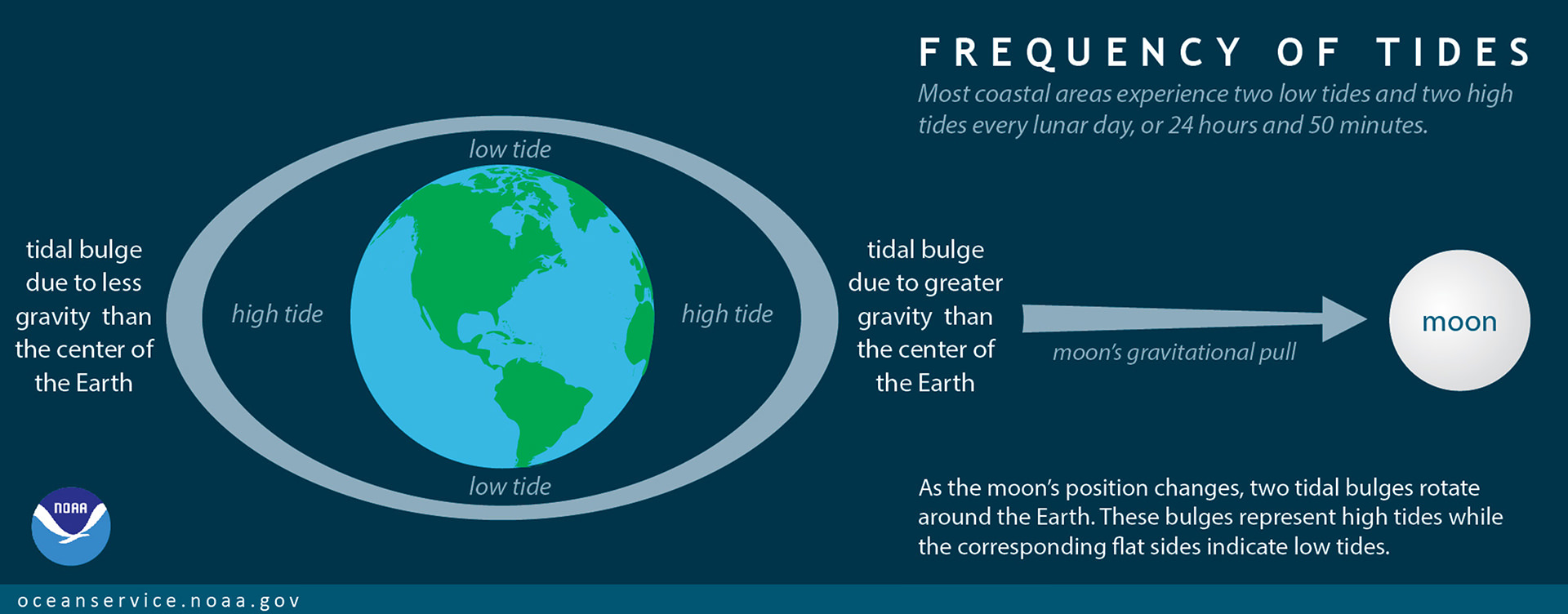
As the moon orbits the earth, it pulls the tidal bulge along with it. The solid mass of the earth actually spins beneath the water, with the bulge rotating around the earth in line with the moon. This webpage from NASA has an excellent series of animations showing the creation and movement of tides.
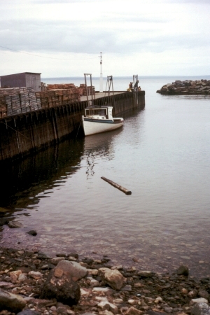
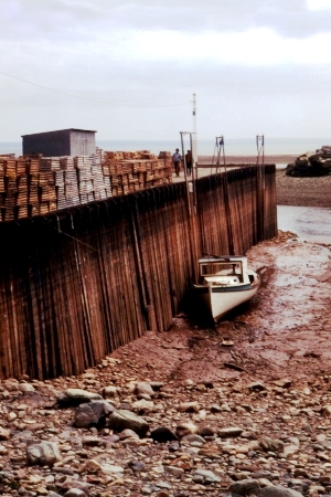
These images show high and low tides near the Bay of Fundy, which experiences one of the largest tidal ranges in the world of about 52 feet. The tidal range in Morro Bay is about seven feet. Photo courtesy of © Samuel Wantman / Wikimedia Commons, CC BY-SA 3.0, https://commons.wikimedia.org/w/index.php?curid=225283
What is a King Tide?
“King tide” is a colloquial term for notably high or low tides. It does not have an exact scientific definition since the tidal range on each shoreline is different. Most coastal areas experience minor king tides about twice a month. This occurs when the sun, moon, and earth all come into alignment. The gravitational pull of the sun combines with the pull from the moon, causing a higher tide than usual. These are called “spring tides” and are the most common type of king tide.
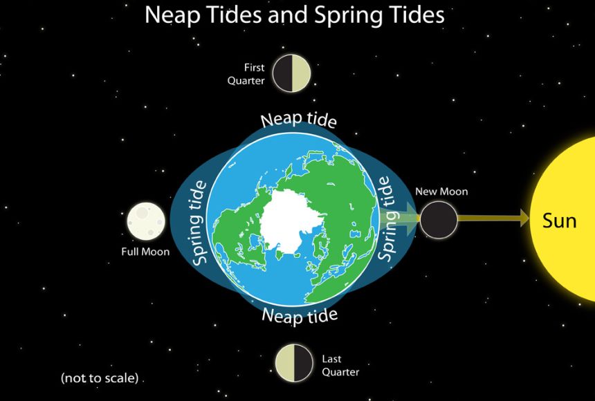
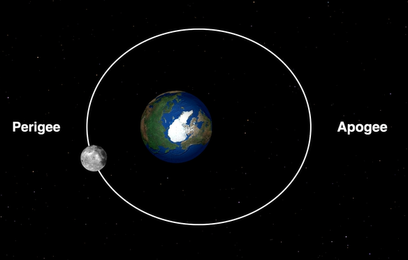
Periodically, the sun, moon, and earth enter a specific alignment that creates the most extreme king tides of the year. This occurs when the moon, traveling in an elliptical pattern, reaches its closest point to the earth. This is called the perigree, and it occurs about once a month. The earth also travels in an elliptical pattern, and once a year it reaches its closest point to the sun. This is called the perihelion.
About once a year, the perihelion, perigree, and spring tides all occur at the same time. This combination of forces causes the highest and lowest tides of the year that are commonly referred to as “king tides.” Here in California, these generally occur in late December or early January.
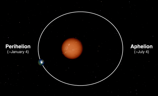
Images from this Exploratorium video show the elliptical patterns of the moon around the earth (top) and the earth around the sun (bottom), as well as the locations of perigree and perihelion. Watch the video for more detailed information about the combination of planetary movements that cause annual king tides.
The King Tides Project
The California Coastal Commission’s California King Tides Project seeks to document the annual winter high king tides throughout California. According to NOAA, sea levels have risen about eight to nine inches globally since 1880. Depending on future greenhouse gas emissions, researchers estimate that sea levels could rise anywhere from two to seven feet by the year 2100. But knowing the average global sea level rise is different than knowing exactly how that rise will impact individual coastlines and nearby communities. Much like with tidal range, the effects of rising sea levels depend on geography, coastline topography, and human development.
High king tides are the perfect opportunity for a glimpse into the potential effects of sea level rise. This information can show researchers, landowners, government officials, and others how their coastlines may be impacted by rising sea levels.
Join the Effort
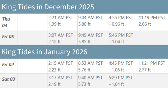
This year’s King Tides Project dates are December 4 and 5, 2025, as well as January 2 and 3, 2026. Use an online tide table such as this one to find the time of high tide for each day you plan to go out. Then, go out to the coast and use your smartphone or digital camera to take photos of the coastline at high tide. You can then upload your photos using a web browser or the free Survey123 app. For more information on how to upload, see here.
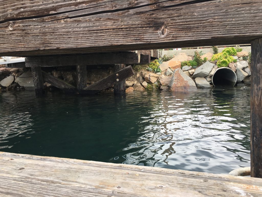
The most effective photos for this project capture the high tide near roads, bridges, or other areas that may be impacted by rising water levels. It can also be helpful to photograph familiar landmarks (such as rocks, staircases, piers, etc.) for an easy visual comparison of high and low tides.
You can still participate even if you live outside of California! Many other states including Oregon, Washington, and Hawai’i have their own King Tides Project. Look online to learn more.
Sources:
https://oceanservice.noaa.gov/facts/tides.html
https://education.nationalgeographic.org/resource/cause-effect-tides/
https://science.nasa.gov/moon/tides/
https://oceanservice.noaa.gov/facts/springtide.html
Help us protect and restore the Morro Bay estuary!
- Donate to the Estuary Program today and support our work in the field, the lab, and beyond.
The Estuary Program is a 501(c)3 nonprofit. We depend on funding from grants and generous donors to continue our work. - Support us by purchasing estuary-themed gear from ESTERO. This locally owned and operated company donates 20% of proceeds from its Estuary clothing line and 100% of Estuary decal proceeds to the Estuary Program. Thank you, ESTERO!
- Purchase items from the Estuary Program’s store on Zazzle. Zazzle prints and ships your items, and the Estuary Program receives 10% of the proceeds.
- Subscribe to our seasonal newsletter: Between the Tides!
- We want to hear from you! Please take a few minutes to fill out this short survey about what type of events you’d like to see from the Estuary Program. We appreciate your input!