Eelgrass fieldwork depends on tides
Fall is a busy eelgrass season for field staff at the Estuary Program. The exact timing of our field work depends on when the good low-tides occur, which varies slightly from year to year. This year, October had a few days that had tides low enough to expose the eelgrass during daylight hours. This doesn’t always happen—sometimes the low tides we need happen after sundown and before sunrise. We were glad to see good tides in combination with good timing because we have a few different projects going on.
Monitoring permanent eelgrass plots
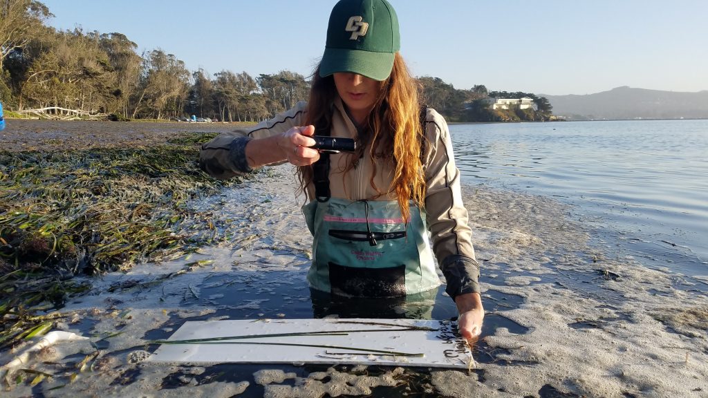
First up was monitoring permanent eelgrass plots with our partners at Cal Poly. We have been going out to the same exact locations each season to track how eelgrass changes from location to location across the year.
Mapping eelgrass
Multispectral imaging
We were able to work on a second project simultaneously. The Estuary Program has been mapping submerged aquatic vegetation, such as eelgrass, since 2004. To do this, an airplane flies over the bay and collects a multispectral image of the bay. Multispectral imagery is produced by sensors that measure reflected energy within several bands of the electromagnetic spectrum. Different vegetation and algae has a different electromagnetic signature. You can classify the photos based on the signature of the vegetation in the image. This allows us to then produce a map that shows the distribution of eelgrass and algae in the bay.
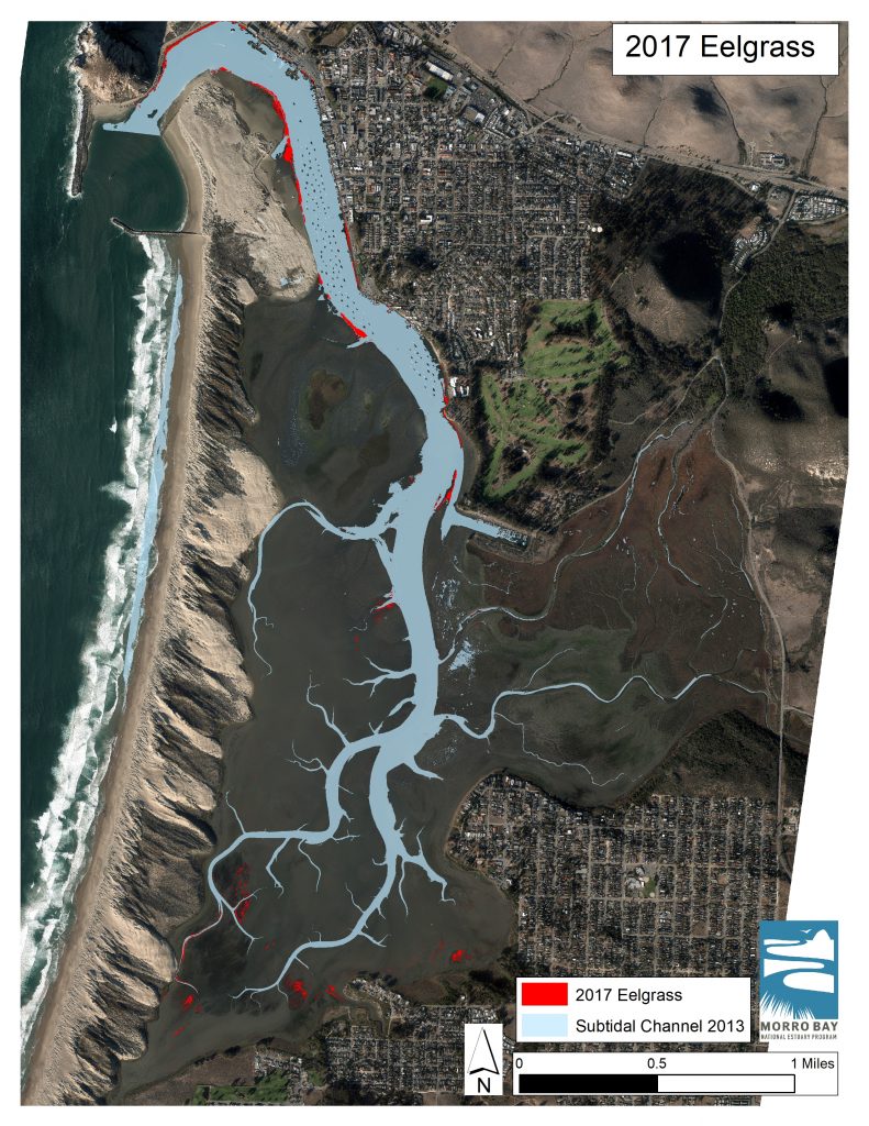
We try to repeat this survey every two years, to help better track the status of eelgrass in Morro Bay.
Ground-truthing eelgrass mapping results
An important step in verifying the data collected through the aerial flight is to collect field validation points. To do this, we put on waders, go out in the bay with a GPS unit, and collect information at different locations and at a variety of points where the flight has noted eelgrass, macroalgae, or bare mudflat. This process, which we call ground-truthing, helps validate the data collected during the aerial imaging process to ensure we are getting accurate results.
Working in partnership with Cal Poly
This year, Cal Poly Anthropology student, Sequoia, joined us to conduct these surveys. She has helped us set up mapping programs and troubleshoot software, which—to clue in anyone not familiar with mapping programs—is a very huge and helpful feat.

Monitoring eelgrass restoration plots
We were also out monitoring some of our eelgrass restoration plots. We have two locations in the back bay off Mitchell Drive. For new readers, you can read about some of our past restoration efforts and watch videos of the transplant process here and here.
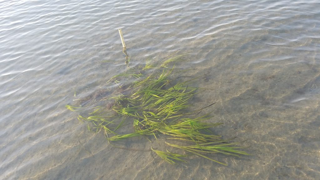
Eelgrass patches in the back bay
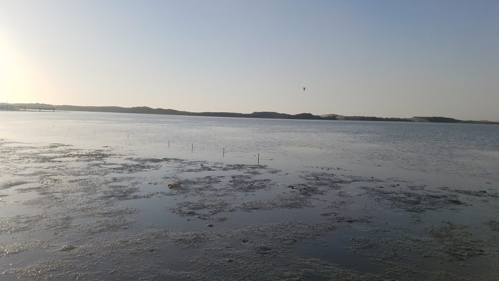
The area near Mitchell Drive fascinates us. Though very muddy and difficult to access, the mudflat is now dotted with patches of eelgrass. Eelgrass did not grow in this location for a number of years, but we have noticed these patches popping up for the past few years. Though they are not forming the large beds we see in the front of the bay, their presence is promising and they still provide valuable habitat.
Volunteer and attend our Science Explorations focus on eelgrass
If you would like to get involved with eelgrass work in the bay, fill out our volunteer interest form. We will need volunteers for our 2020 eelgrass restoration effort, most likely between February and March.
To learn more about the status of eelgrass in the bay as well as some of the findings from our work with Cal Poly, join us for our next Science Explorations Talk on Thursday, January 23rd. Keep an eye on our Events Page for more information.
Help us protect and restore the Morro Bay estuary!
- Donate to the Estuary Program today and support our work in the field, the lab, and beyond.
The Estuary Program is a 501(c)3 nonprofit. We depend on funding from grants and generous donors to continue our work. - Support us by purchasing estuary-themed gear from ESTERO. This locally owned and operated company donates 20% of proceeds from its Estuary clothing line and 100% of Estuary decal proceeds to the Estuary Program. Thank you, ESTERO!
- Purchase items from the the Estuary Program’s store on Zazzle. Zazzle prints and ships your items, and the Estuary Program receives 10% of the proceeds. Choose from mugs, hats, t-shirts, and even fanny packs (they’re back!) with our fun Estuary Octopus design, our classic Estuary Program logo, or our Mutts for the Bay logo.