Too much sediment harms the bay
The Estuary Program protects and enhances Morro Bay and its watershed through projects that support important natural areas and restore degraded habitats. One of the ways we do this is by reducing the amount of sediment that flows into the creeks that feed the bay. This helps to keep the bay from filling in at an unnatural rate and protects steelhead spawning habitat.
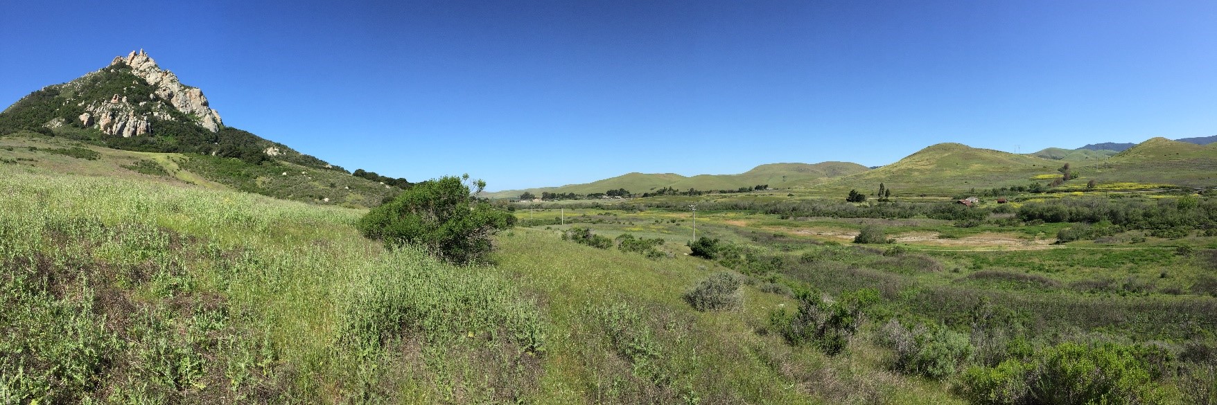
Over the years, an excess of sediment has flowed into Chorro Creek, making it harder for it to support wildlife. Along with many partners, the Estuary Program set out to improve conditions on this creek through a floodplain restoration project in an area now called the Chorro Creek Ecological Reserve.
How floodplain restoration helps
Enhancing and expanding floodplains is one tool in the toolbox to help capture sediment from creek systems and provide a range of other benefits for wildlife and people. For example, with less sediment entering the creek, spawning gravels for steelhead in the stream are less silted in, which allows more oxygen to get to their eggs. The slower moving water within the floodplain channels can also support refuge areas for fish during high water flows. Spreading water onto a floodplain also allows groundwater reservoirs to refill, and established plants can take in nutrients like nitrogen, which helps to improve water quality.
Chorro Creek Ecological Reserve Floodplain Restoration project history and goals
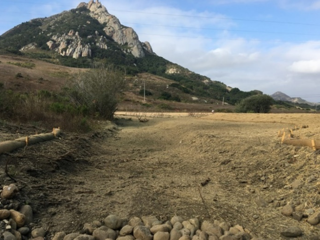
In 2003, the Estuary Program helped to secure a 320-acre piece of property located at the base of Hollister Peak along Chorro Creek with the support of the State Coastal Conservancy and California Department of Fish and Wildlife (CDFW) among others (CDFW now manages the site). This part of Chorro Creek had been leveed and the historic floodplain was largely disconnected, meaning that the creek had limited natural area to overflow into during storms. The main objectives of this project were to reconnect the floodplain and reintroduce vegetation along the creek banks to provide better, more functioning habitat for steelhead and other sensitive aquatic species.
Floodplain restoration project preparation and designs
This multiphase project was years in the making. The planning process alone took nearly four years. This time was spent obtaining permits and funding and refining the project design. Environmental Science Associates (ESA) was the lead engineering firm for the project and helped to complete the hydrological studies that would support the final design. Experts also conducted studies pertaining to sensitive plant species and archeology to make sure that the project would not interfere with sensitive species or historical and cultural artifacts.
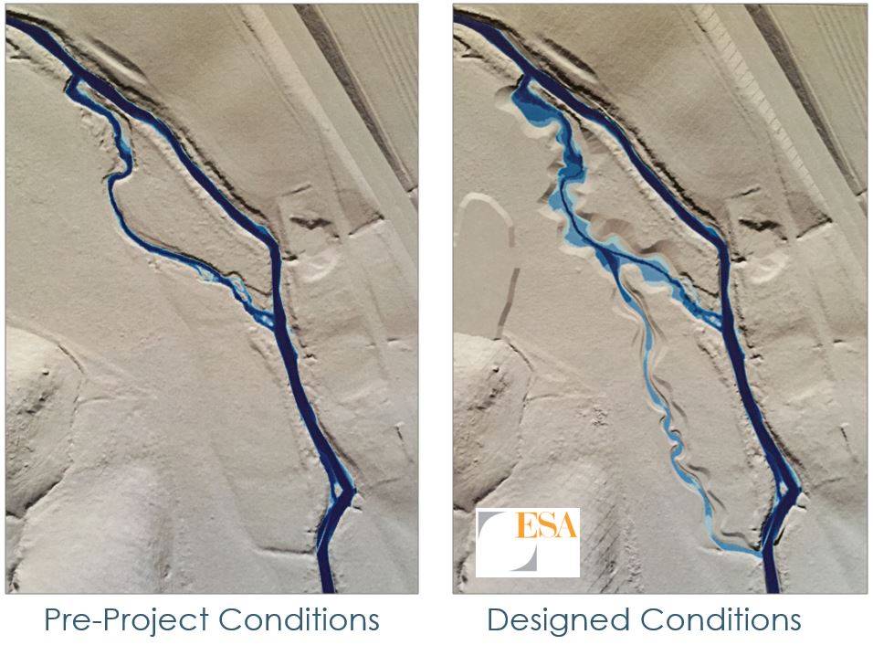
Both images above show how water would flow through the creek during a five-year storm event. (A five-year storm is a storm that happens on average once in five years, measured according to rainfall.) As you can see, the project design pictured on the right allows water to overflow its banks, slowing the floodwater to benefit water infiltration and sediment deposition.
Project implementation
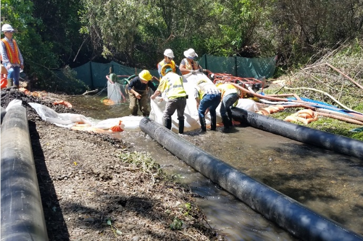
Dewatering the creek to bring in large equipment
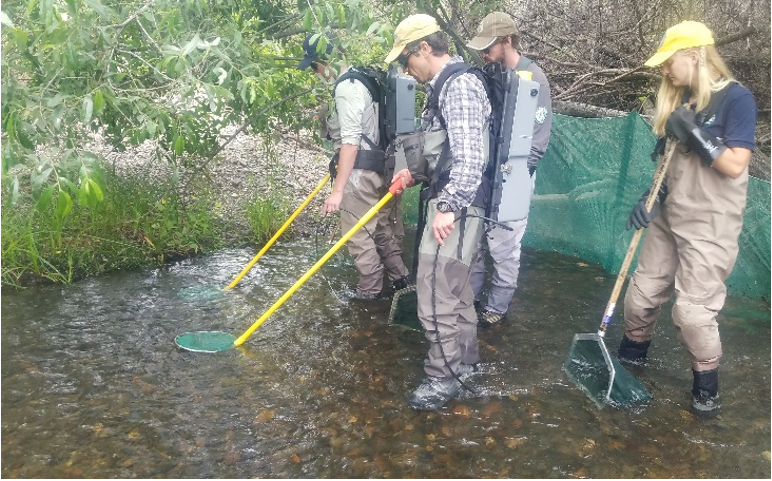
The first step to this large-scale restoration project was to excavate a new channel and create additional floodplain space along two side channels. In order to bring in heavy equipment for the regrading process, a small crossing in Chorro Creek first needed to be dewatered. Stillwater Sciences conducted fish salvage, moving any aquatic species present in the creek to outside of the project boundary to make sure they would not be harmed.
Next, workers used heavy machinery to help regrade or excavate a new channel on the upstream end and expand the floodplain area. This area was likely the historical path of Chorro Creek before changes were made with prior land use. They transferred the sediment they removed from the area around the creek to a three-acre fill site at the base of Hollister Peak. Concrete riprap was also removed from the site and recycled.
Both photos above show the construction of the upper side channels along the floodplain of Chorro Creek. Two channels totaling 1,200 feet were constructed and/or expanded in size during the project.
Creating habitat and slowing the flow of the creek
To create more suitable habitat for fish and aquatic species, pieces of large wood were then anchored through the channel. Large wood in creeks provides refuge for fish during high flow conditions, as well as adds complexity to the stream.
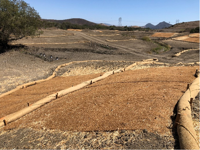
Additionally, willow baffles were placed along the creek corridor for channel stabilization and to slow down flowing water for sediment to settle out. For sediment stabilization and control erosion, coir fabric and straw wattles were secured upslope of the channel. Native seed was then scattered using a hydro-seeder and drill-seeder throughout the project area to establish native grasses.
The photographs below show coir fabric and straw wattles used for erosion control on the site. All disturbed areas were also seeded with native plant species.
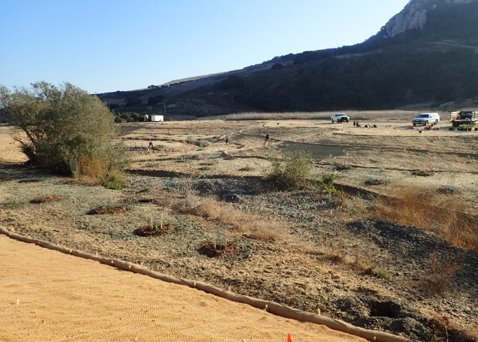
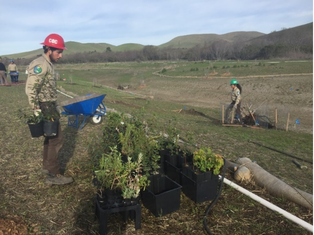
Bringing native plants back to Chorro Creek’s floodplain
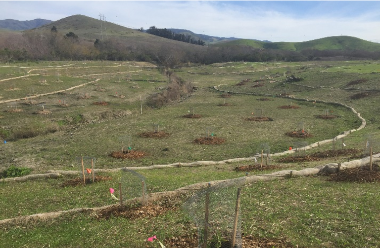
The final effort to complete this large-scale restoration project was establishing nearly 1,500 native plants throughout the site. These plants were grown locally by the California Conservation Corps, and the planting effort was largely possible through their support. Species included coastal live oak, coyote brush, box elder, California sycamore, black sage, blue elderberry, mugwort, coffeeberry, California sagebrush, and California rose. (Stay tuned for a future blog post focused on this planting effort.)
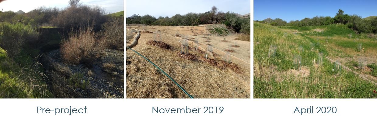
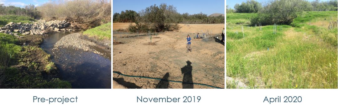
One Year Post Project
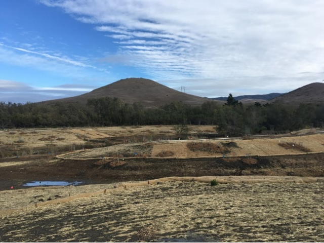
The Estuary Program is completing a range of monitoring on site to track project goals. We monitor plant survival, floodplain activation, photo-monitoring, geomorphic monitoring of erosion and sedimentation, and overall stream health.
Project impacts
As we look back on this project, we approximate about 24,000 cubic yards of sediment has been removed from the initial floodplain. A large portion of that sediment would have entered Chorro Creek and ultimately Morro Bay Estuary.
This site is also now reconnected to nearly five acres of floodplain habitat, allowing for better groundwater recharge and overall improved water quality. We also hope that steelhead trout will access the floodplain side channels and seek refuge there when waters rise due to storms. The riparian vegetation established during the project will also provide vital habitat for wildlife.
Thank you, project partners!
This project would not have been possible without the continued support of our many partners. Partners for this project included the California Conservation Corps, California Department of Fish and Wildlife, State Coastal Conservancy and those that supported the implementation including Environmental Science Associates, Stillwater Sciences, Four M Contracting, and Precision Construction Services.
Stay tuned for our next blog post highlighting the side channel activation and changes to the site that occurred during winter storms.
Subscribe to our weekly blog to have posts like this delivered to your inbox each week.
Help us protect and restore the Morro Bay estuary!
-
- Donate to the Estuary Program today and support our work in the field, the lab, and beyond.
The Estuary Program is a 501(c)3 nonprofit. We depend on funding from grants and generous donors to continue our work. - Support us by purchasing estuary-themed gear from ESTERO. This locally owned and operated company donates 20% of proceeds from its Estuary clothing line and 100% of Estuary decal proceeds to the Estuary Program. Thank you, ESTERO!
- Purchase items from the the Estuary Program’s store on Zazzle. Zazzle prints and ships your items, and the Estuary Program receives 10% of the proceeds. Choose from mugs, hats, t-shirts, and even fanny packs (they’re back!) with our fun Estuary Octopus design, our classic Estuary Program logo, or our Mutts for the Bay logo.
- Donate to the Estuary Program today and support our work in the field, the lab, and beyond.