Anyone who has lived in the West is familiar with the ever-present threat of drought and the need for reliable sources of clean water for people and for wildlife. If there is not enough water flowing in our creeks, especially during the dry season, it can affect the health of the plants and animals that live there. The Estuary Program tracks surface flows to determine whether there is enough water present to support sensitive aquatic species year-round. We are expanding our network of sensors to increase our streamflow monitoring capacity.
How We Measure Streamflow
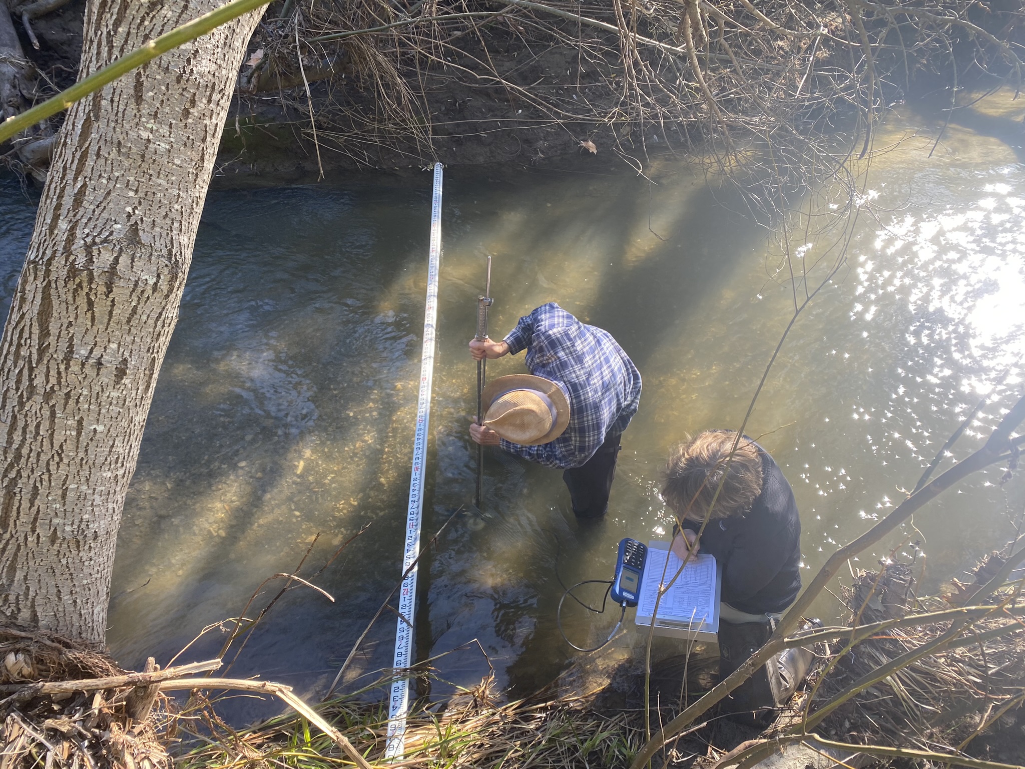
There are two primary ways that we can monitor streamflow in our creeks. The first is by taking manual measurements. Staff and volunteers the width of the channel and the depth of the water. Next, we collect the water velocity at different locations across the creek. We can then calculate how much water moves downstream every second, which equates to the flow rate in cubic feet per second (cfs).
Continuous Streamflow Monitoring
While manual streamflow measurements provide important information about flow conditions, they only capture a specific moment in time. To see how streamflow changes over time, the Estuary Program uses continuous monitoring equipment. This specialized equipment allows us to collect data every 15 minutes, year-round.
For more information about continuous water quality and streamflow monitoring, you can check out this blog post.
New Monitoring Sites
This spring, the Estuary Program is partnering with Creek Lands Conservation to install five new streamflow gauges in the Morro Bay watershed. When the project is complete, the Estuary Program will have six continuous streamflow monitoring stations.
How We Install Streamflow Gauges
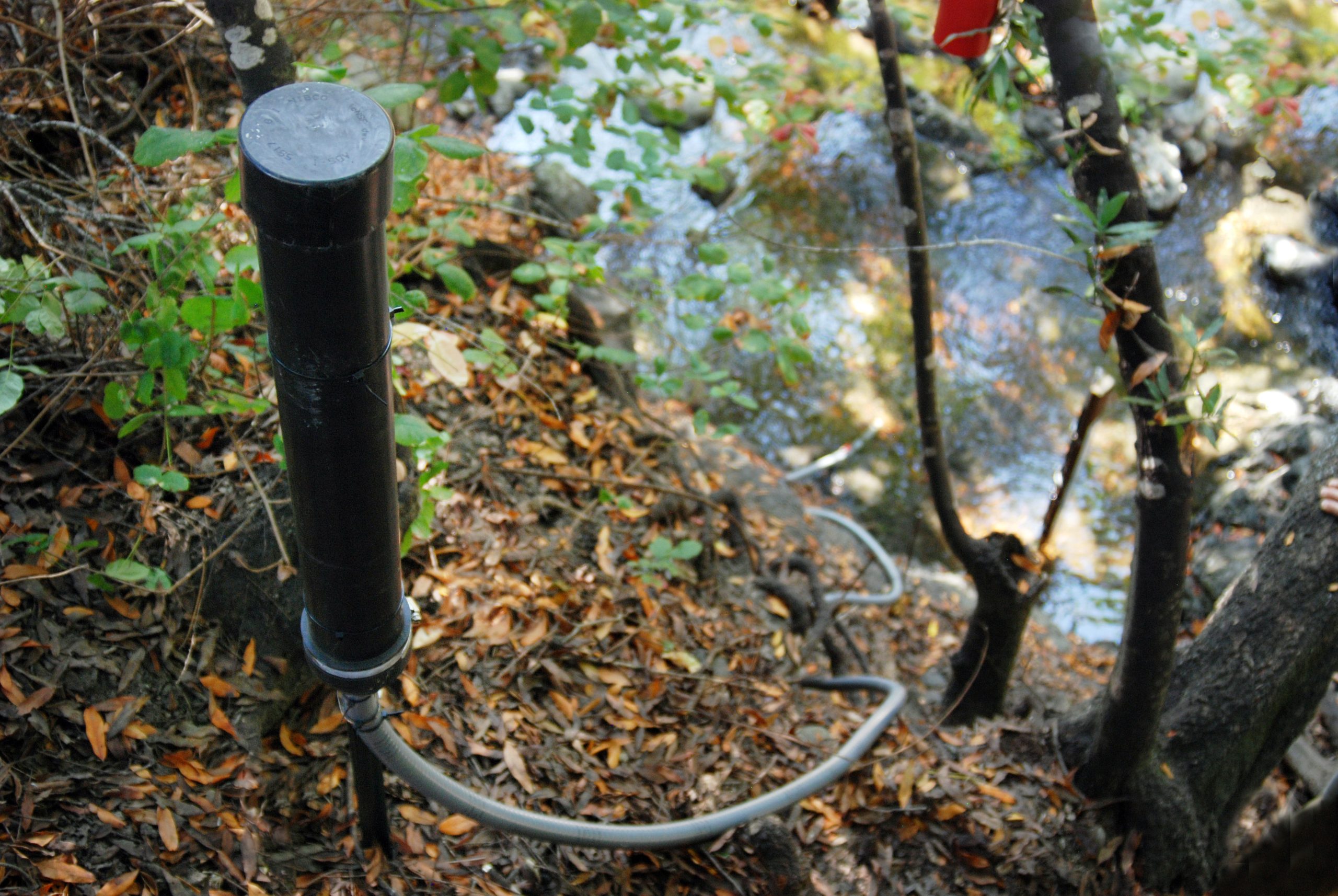
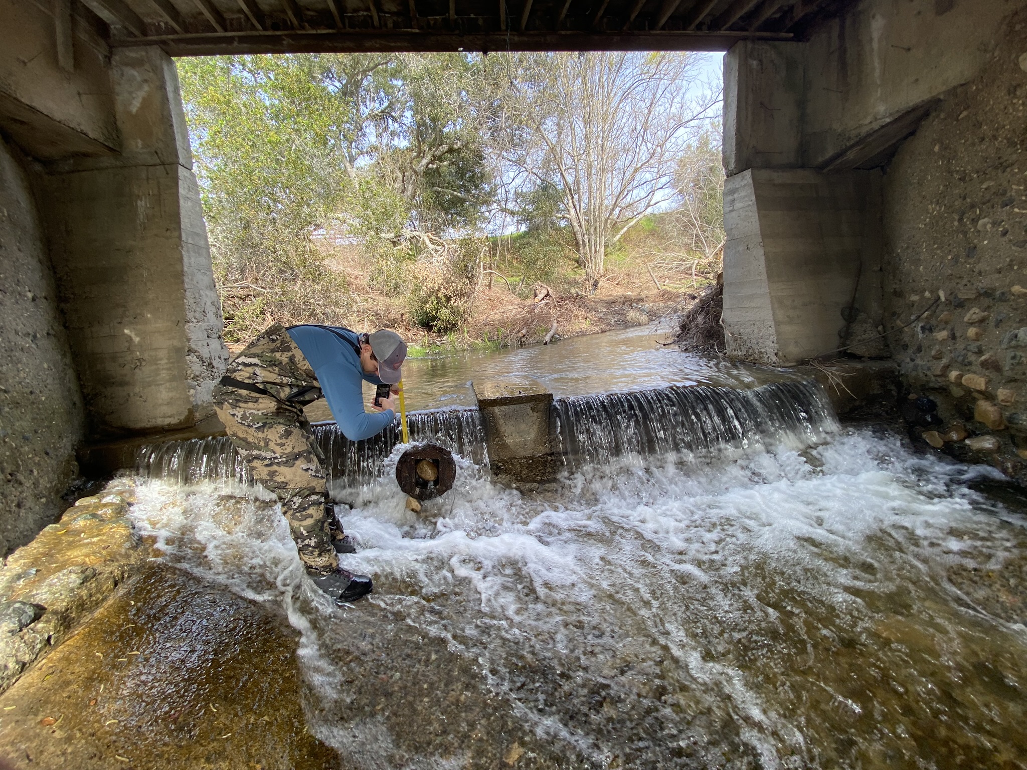
Prior to deploying each sensor, we scout the creeks for optimal conditions. Sites with bedrock are ideal since they provide a sturdy anchoring location that will not change too much over time. Once we identify an ideal location, we conduct a survey to develop a site-specific plan and elevation profile.
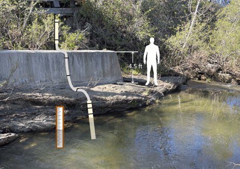
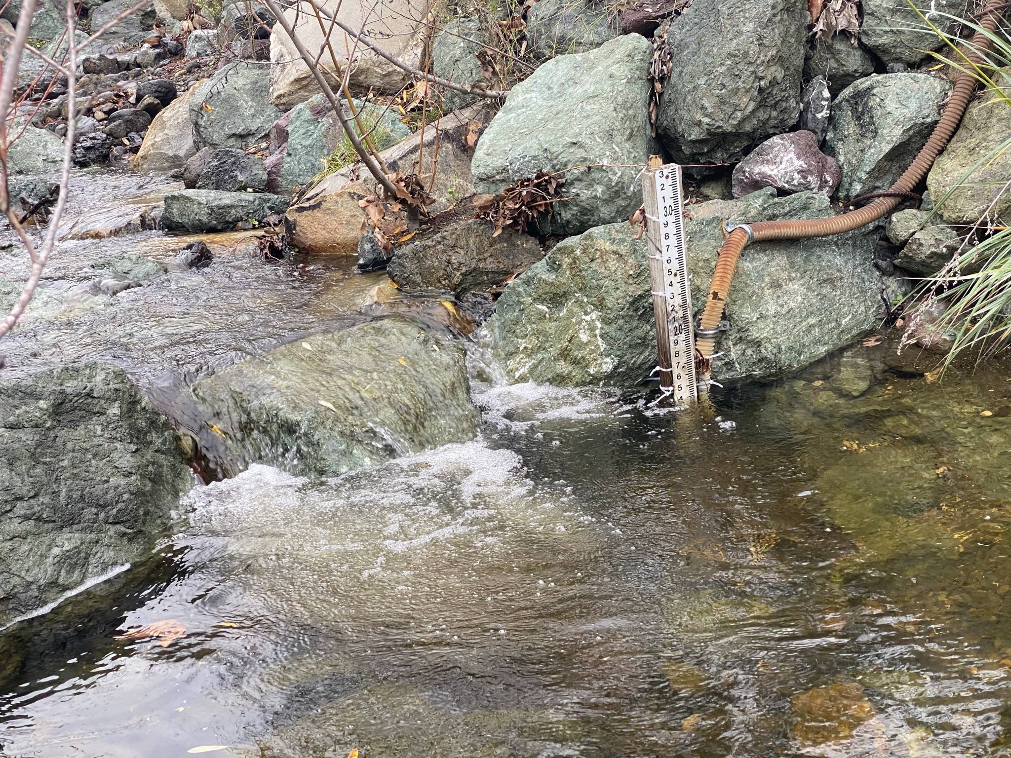
Alongside the continuous streamflow monitoring equipment, we install a large stationary ruler called a “staff plate.” During site visits, surveyors use this ruler to take visual depth measurements. We then compare these readings to the sensor readings to check accuracy.
It’s important that each sensor is installed at a known elevation. As the water levels change over time, this sensor will pick up changes in pressure and depth. The Estuary Program will use this information along with manual streamflow measurements to establish a depth-streamflow relationship.
Working with Creek Lands Conservation
Creek Lands Conservation is a local partner who provided crucial technical expertise and sensor installation support for this project. Like the Estuary Program, Creek Lands is a nonprofit organization who works to conserve and restore freshwater and near shore marine ecosystems. Creek Lands is based in Arroyo Grande but is involved in projects throughout California’s Central Coast, ranging from Monterey to Ventura County.
To learn more about Creek Lands Conservation, you can visit their website at www.creeklands.org.
Help us protect and restore the Morro Bay estuary!
- Donate to the Estuary Program today and support our work in the field, the lab, and beyond.
The Estuary Program is a 501(c)3 nonprofit. We depend on funding from grants and generous donors to continue our work. - Support us by purchasing estuary-themed gear from ESTERO. This locally owned and operated company donates 20% of proceeds from its Estuary clothing line and 100% of Estuary decal proceeds to the Estuary Program. Thank you, ESTERO!
- Purchase items from the Estuary Program’s store on Zazzle. Zazzle prints and ships your items, and the Estuary Program receives 10% of the proceeds. Choose from mugs, hats, t-shirts, and even fanny packs (they’re back!) with our fun Estuary Octopus design, our classic Estuary Program logo, or our Mutts for the Bay logo.
Thank you for helping our beautiful, bountiful, biodiverse bay!