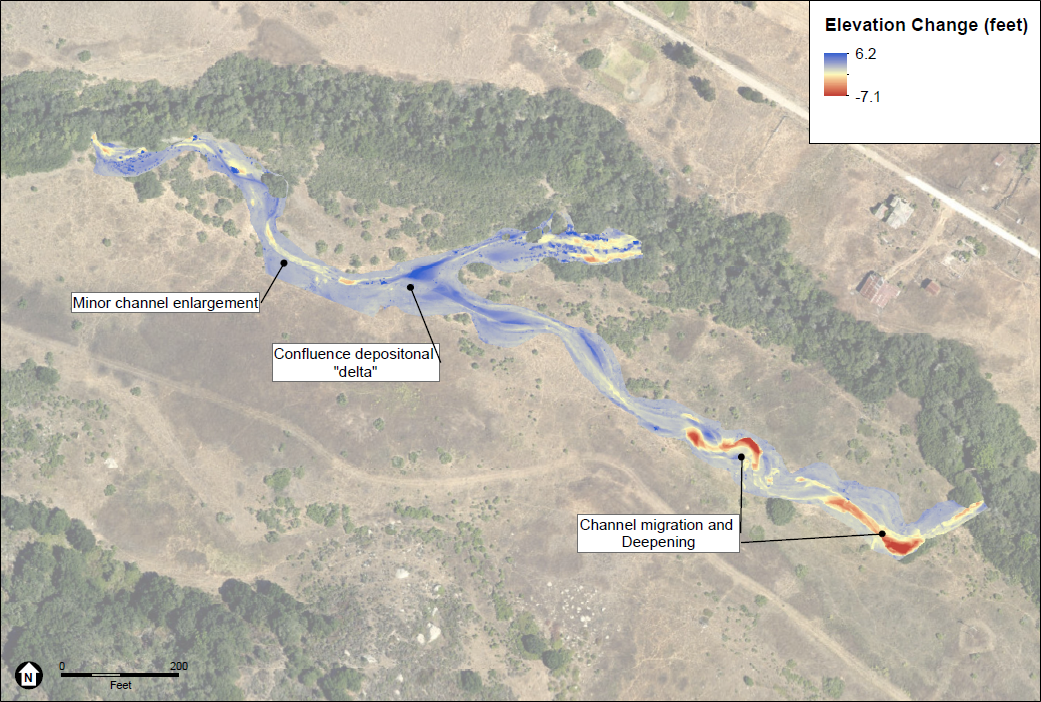
Map of elevation changes on CCER project site after January 2021 Storm
Change in elevation along the two side channels (1,200 ft.) adjacent to Chorro Creek using drones. Data provided by Environmental Science Associates.
Map of elevation changes on CCER project site after January 2021 Storm