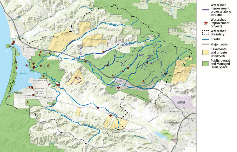
This map shows the lands that are conserved and protected through public ownership, easements, and private preserves. The map also illustrates the locations of projects such as floodplain restoration, invasive plant removal, and stormwater management infrastructure.