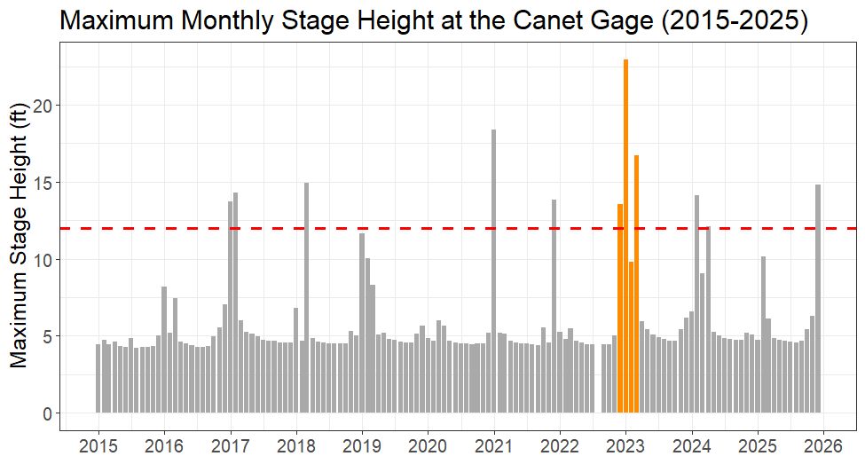
Stage height is the depth of water in a creek. The graph shows maximum monthly stage height (ft) recorded by the gage at Canet Road, located at a bridge that crosses Chorro Creek. During the series of storms from December 2022 to March 2023 (orange bars), stage height reached its highest point of the decade. The dashed red line represents the height of the bridge along Canet Road. Frequent heavy rainfall coupled with groundwater saturation kept Chorro Creek significantly fuller than average for four consecutive months, contributing to persistent flood conditions.