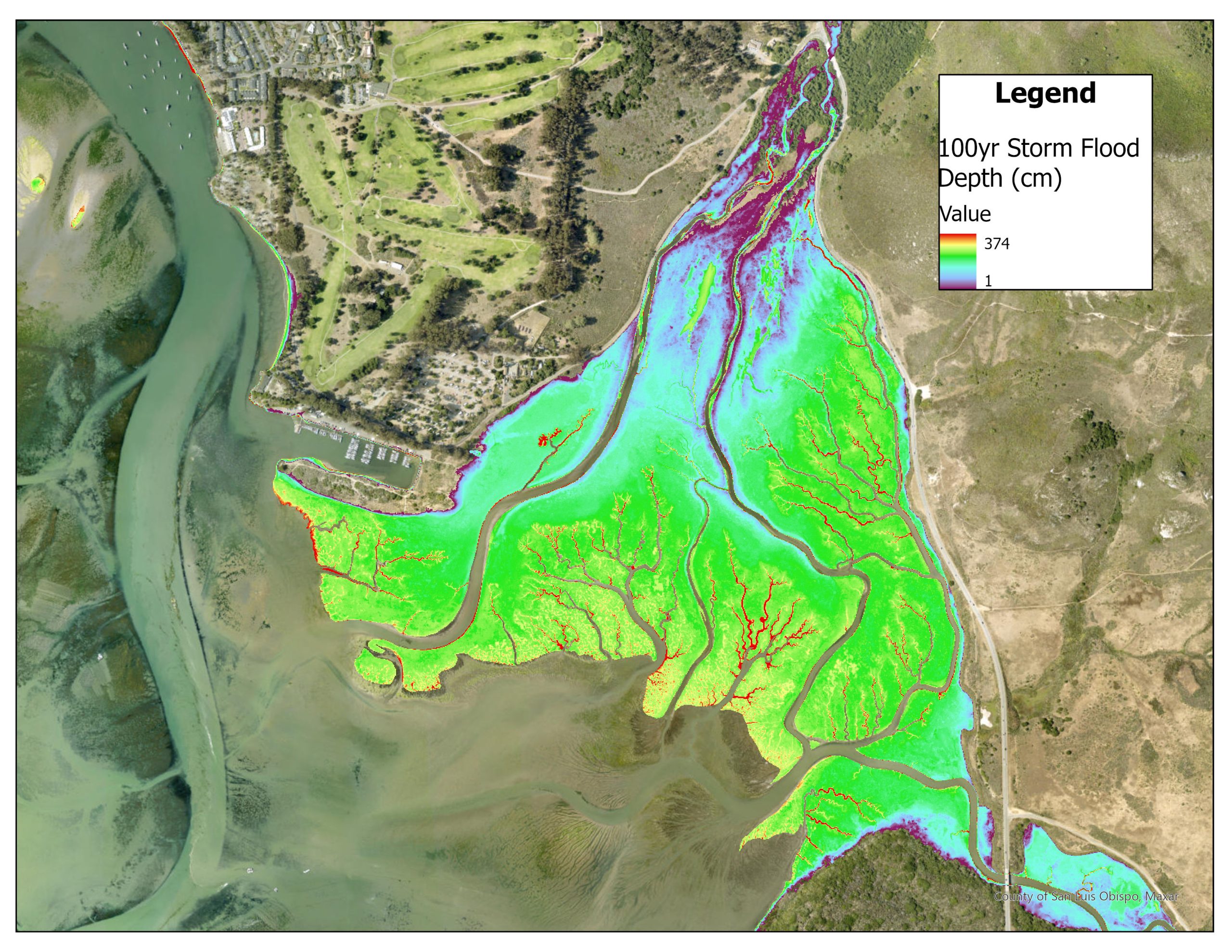
USGS developed the Coastal Storm Monitoring System (CoSMoS) to make predictions of coastal flooding so communities can be better prepared. The map above uses CoSMoS data to display the depth of water along the salt marsh during a rare, 100-year storm event. A flood like this would overtop the bridge spanning Chorro Creek along South Bay Blvd, known locally as Twin Bridges.