Ever wonder what Morro Bay was like before modern development (such as roads, houses, and ranches) and how those changes still shape the watershed and inform restoration efforts today? This blog shares an in-depth look at how the Morro Bay Estuary and surrounding valleys existed under full Indigenous stewardship prior to major Euro-American modification to the landscape.
What is Historical Ecology?
Historical ecology is a field of research that seeks to understand the natural processes and landscapes that were found in an area during a specific time period. With funding from the Estuary Program, the San Francisco Estuary Institute synthesized a wide range of documents including hundreds of archival maps, photos, and writings to document and map historical landscape conditions in the mid-19th century. Research focused on mapping the historical configuration of habitat types and channels within the study area, which encompassed approximately 23 square miles of the Morro Bay watershed (excluding surrounding hillslopes outside of the valley floor areas).
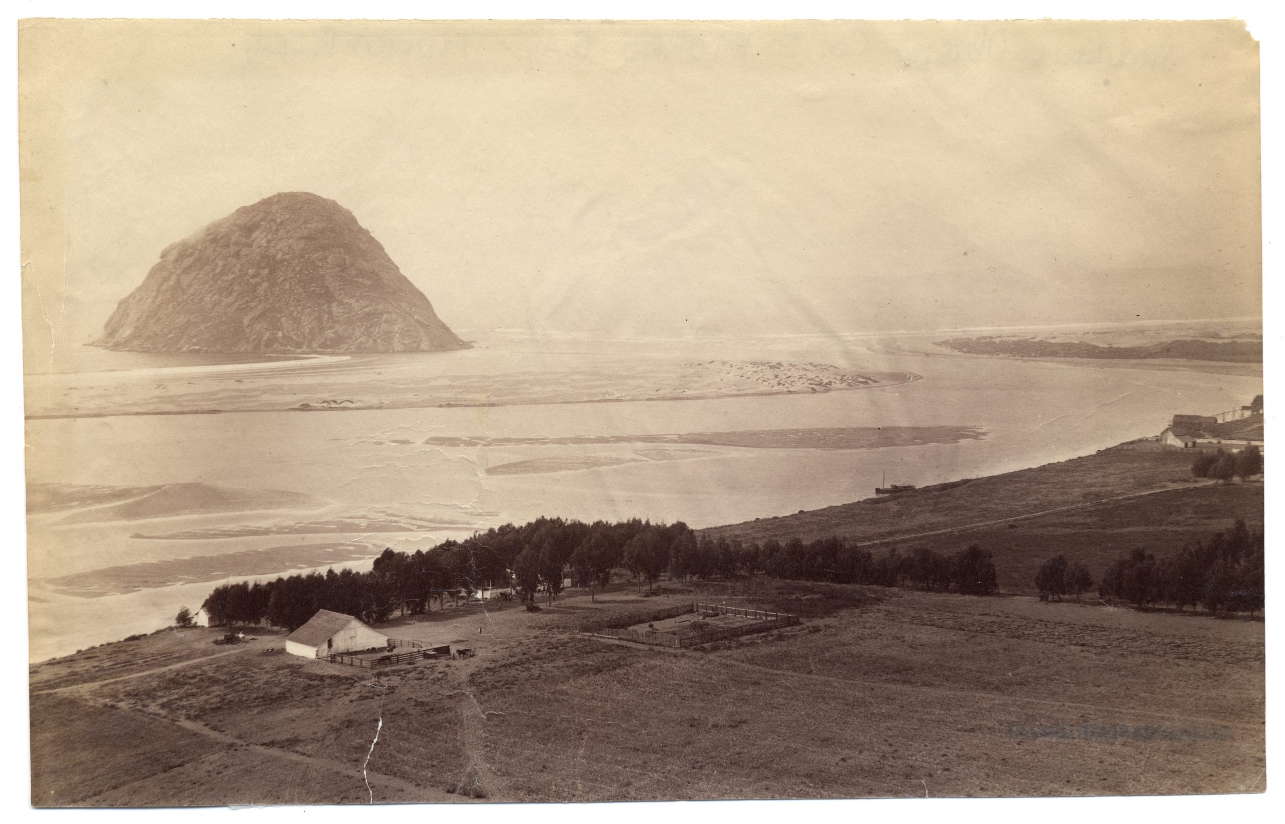
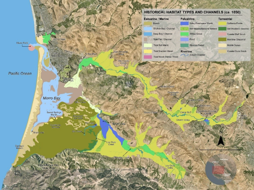
How was Morro Bay and its watershed different in 1850?
Some findings from the report which may surprise people today include:
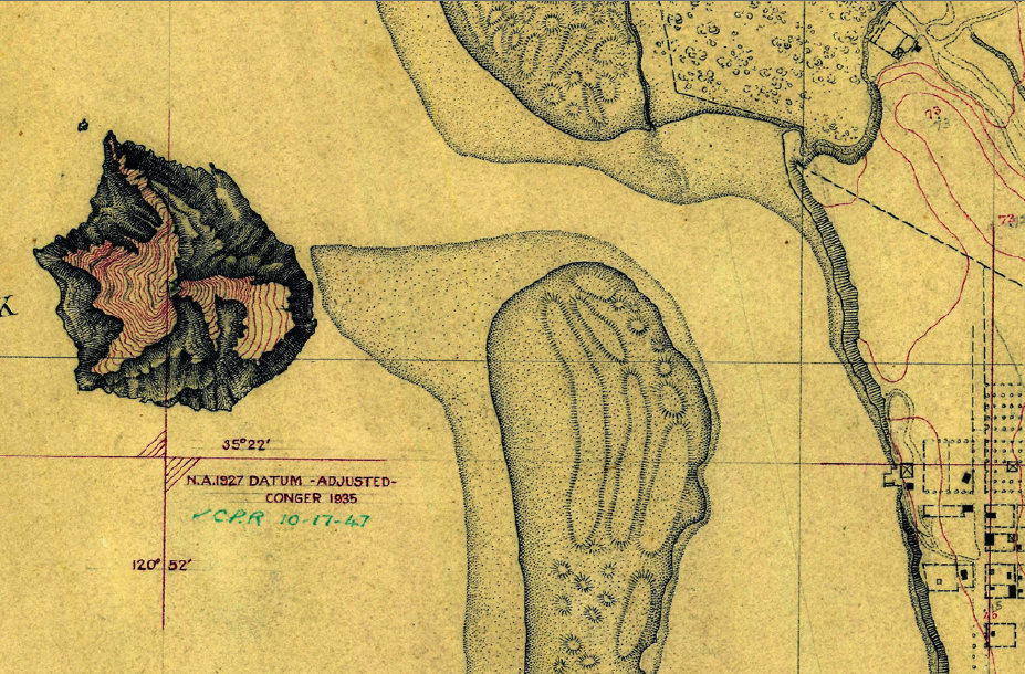
– Morro Rock used to be an island! Before the modern breakwater and causeway connected it to the mainland, Morro Rock was an island with an entrance to the bay on either side.
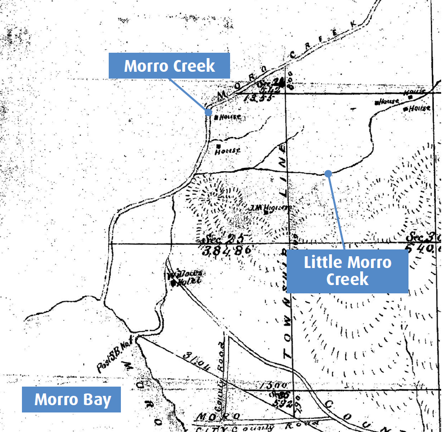
– Morro Creek, which now enters the ocean at Morro Strand north of the causeway, historically drained into the bay just east of where the power plant is today. This area and the areas upstream along Highway 41 were characterized by a dense willow forest (upwards of 2,000ft in length) which provide important resources for Indigenous people.
– Much of Chorro Valley and Los Osos Valley were covered with open prairies of native perennial grasses and wildflowers. Indigenous people maintain these prairies for game and other species by using fire to control the encroachment of brush. yak titʸu titʸu yak tiłhini (ytt) Northern Chumash tribal members are actively returning intentional low intensity burns to their ancestral homelands for the restoration and cultivation of seeds and grasslands (R. Lucas pers. comm.). Many of the invasive annual grasses that dominate today were introduced with ranching. –Aerial photography from 1937 shows that Chorro Creek and Los Osos Creek were lined with riparian forests of willow, sycamore, and live oak which are now much reduced. These riparian forests are poorly documented in older sources but were likely even more extensive before the introduction of ranching. Over half of the mapped riparian forest occurred along Chorro Creek and its tributaries, where it reached widths of nearly 1,000 ft.
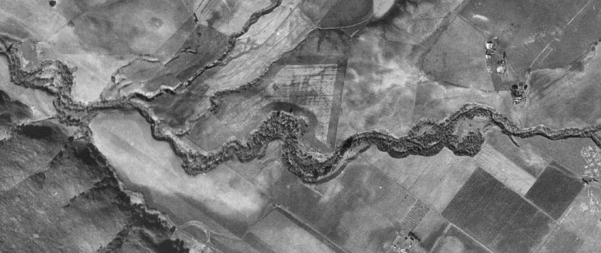
– Chorro Creek and likely Los Osos Creek maintained perennial (year-round) flow and hosted massive runs of steelhead trout seasonally. Los Osos Creek’s flow was supported in part by perennial freshwater springs that disappeared in the early 20th century with the introduction of groundwater pumping.
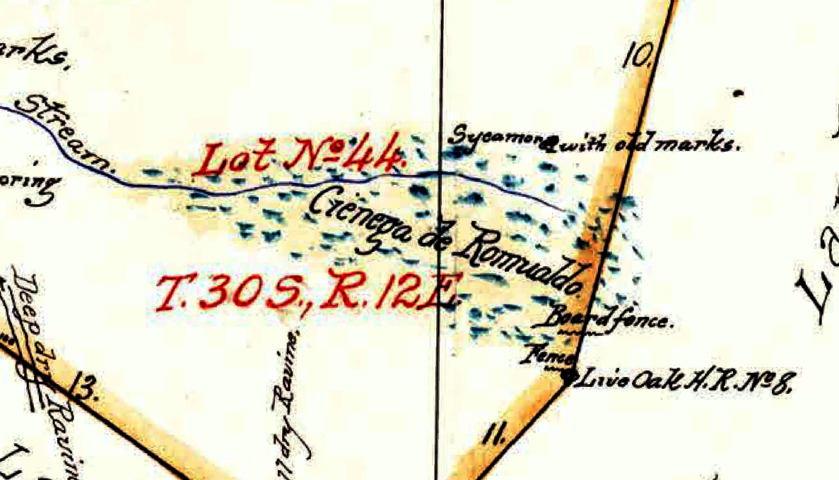
– The lower reaches of Los Osos Creek around the confluence with Warden Creek featured a large freshwater marsh known as Warden Lake. A smaller marsh known as Cienega de Romualdo was situated on Chorro Creek at the present location of the County Juvenile Services Center.
– Salt marshes and mudflats present today in the bay at the outlet of the creeks existed in the 19th century but have since grown with the deposit of sediments carried by the creeks from erosion in the upper watershed. Soil samples taken from these outflow marshes suggest a dramatic increase in erosion beginning with the first introduction of ranching during the mission era.
– Historically, as today, Morro Bay supported an extraordinary diversity of aquatic and avian wildlife.
How should this information inform future restoration and conservation?
The Historical Ecology study gives us a picture of the ways that the landscape around us has changed—sometimes dramatically—from the conditions that prevailed under full Indigenous stewardship, due to land use changes that came with colonization. Can we restore conditions to what they were? In many cases, probably not. But understanding the past and how the landscape functioned can help us consider the future and inform what possibilities we want to work towards.
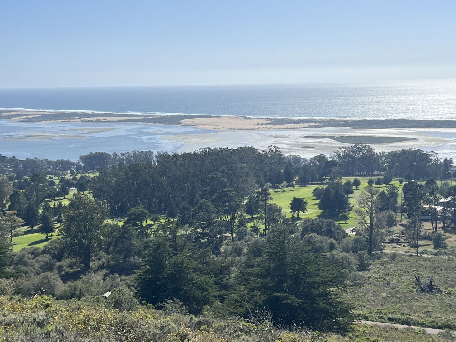
Many of the land uses that have brought about these changes are ongoing, as are the threats that they create. Other threats, such a warming climate and accelerated sea level rise, are new. Some ecosystems, if they are to survive, will have to be given room to move further inland as the water rises. Understanding how Morro Bay estuary’s diverse ecosystems have thrived and also declined in the past can help us prepare for these threats and preserve these landscapes for the wildlife that depend on them and we humans who live here and enjoy them.
Explore the Historical Ecology Study Further
We’ve barely scratched the surface here, and this project deserves a much closer look! Click below to learn more such as where Eto Lake was located, what species grew on Morro Rock, and how Indigenous people steward the land supporting their lifeways and traditional practices.
- Download the full report with graphics (70 pages)
- Download GIS map files of the reconstructed habitats and channels here!
- Save the Date! SFEI will present on the Historical Ecology Study the evening of November 12, 2026 at the Morro Bay Natural History Museum. Details will be available at https://www.mbnep.org/events/
Help us protect and restore the Morro Bay estuary!
- Donate to the Estuary Program today and support our work in the field, the lab, and beyond. The Estuary Program is a 501(c)3 nonprofit. We depend on funding from grants and generous donors to continue our work.
- Support us by purchasing estuary-themed gear from ESTERO. This locally owned and operated company proudly donates a portion of apparel, decal, and hat sales to the Estuary Program. Thank you, ESTERO!
- Subscribe to our seasonal newsletter: Between the Tides!
- We want to hear from you! Please take a few minutes to fill out this short survey about what type of events you’d like to see from the Estuary Program. We appreciate your input!