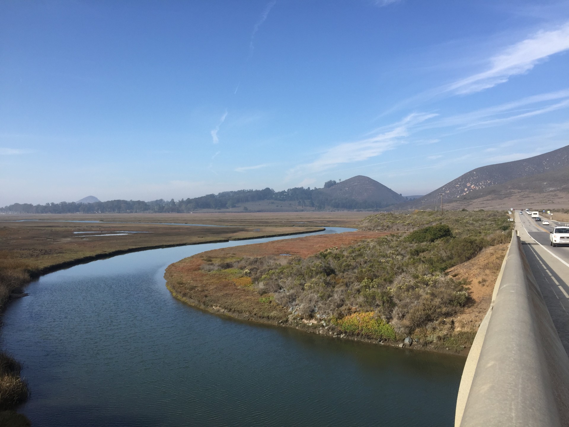
The Morro Bay estuary supports a rich network of marshes, eelgrass beds, mudflats, and dunes that provide essential habitat while also supporting fisheries, recreation, and protection of coastal communities. Rising seas pose a growing threat to the estuary with projections of more than three feet of sea level rise (SLR) by 2100. To better understand the risk of SLR, the Estuary Program partnered with the U.S. Geological Survey (USGS) on a two-year habitat vulnerability study.
Visit Our StoryMap Here!
About the Study
The Estuary Program and USGS collected robust field data and developed a hydrodynamic model, WARMER-Coast, to assess how marshes and adjacent habitats may respond to various sea level rise rates and sediment scenarios. The study aimed to estimate future SLR rates, identify areas and timing of predicted habitat change, and evaluate potential management actions to support habitat resilience.
In addition to a formal report, Estuary Program and project partners created an interactive StoryMap communication tool in both English and Spanish to summarize the results.
Modeling Sea Level Rise
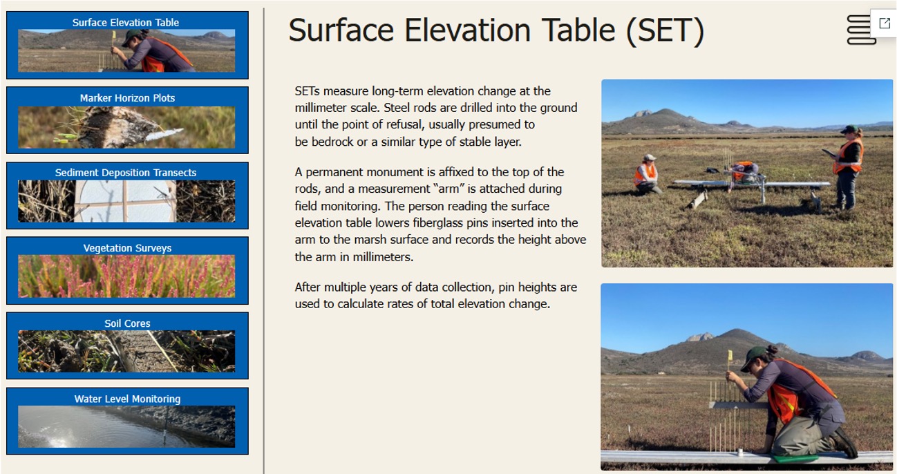
Staff collected field data to calibrate an innovative WARMER-Coast Model used to identify areas of the estuary that are vulnerable to SLR.
Data collection focused on how quickly sediment is accumulating in the estuary to help determine how long habitats can naturally keep pace with sea level rise before management action is needed to minimize habitat change.
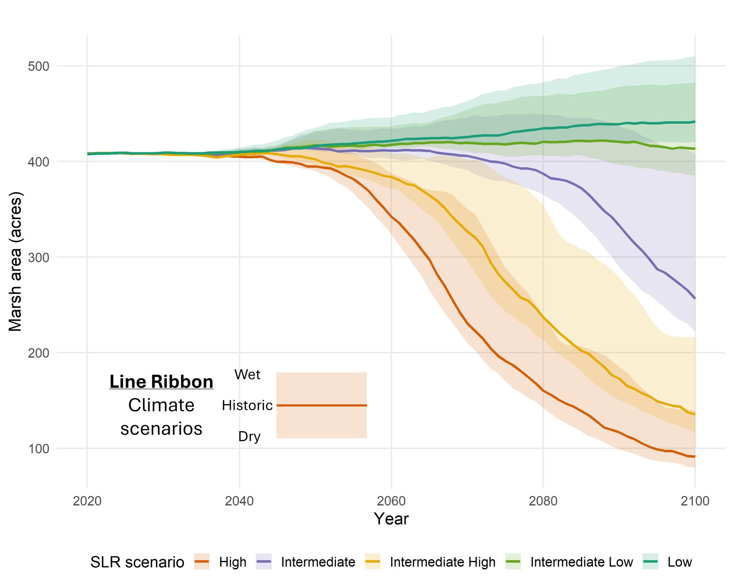
USGS used the model to evaluate five sea level scenarios: low (0.6 ft), intermediate low (1.2 ft), intermediate (2.8 ft), intermediate high (4.5 ft), and high (6.3 ft) projections.
The model also looked at varying levels of sediment delivery to the marsh: similar to recent sediment loading within the last two decades (historic), lower than present day with sediment loads representing a drier climate and lower peak river flows (dry), and higher than present day with sediment loads representing a wetter climate and higher peak river flows (wet).
Key Takeaways from Vulnerability Modeling
According to the model, Morro Bay’s marsh is more resilient in the near term than many other estuary systems in California, given projected sediment inputs to the marsh. The majority of Morro Bay’s current marsh would be resilient under low, intermediate-low, and intermediate sea level rise scenarios through 2070.
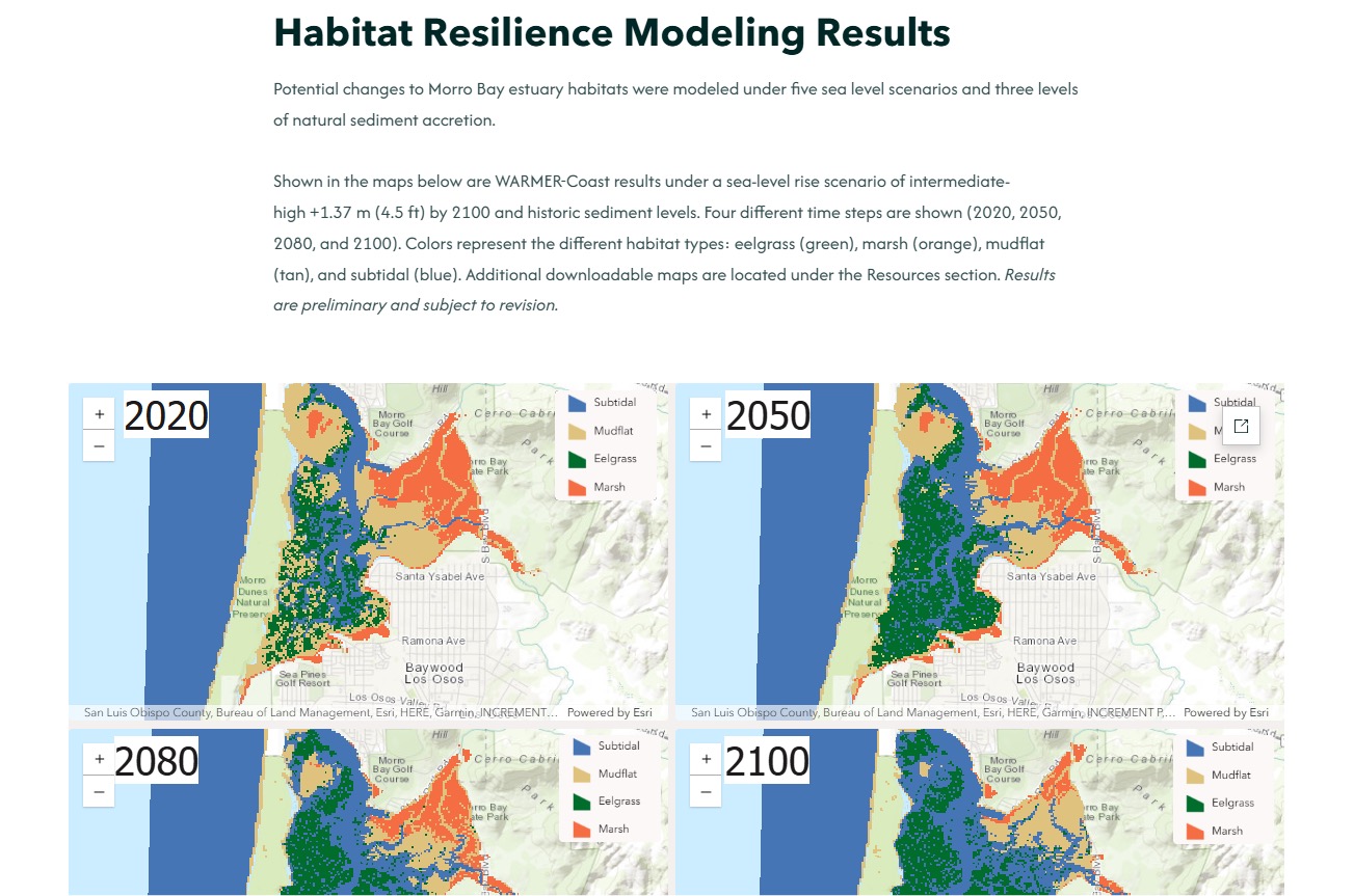
The year 2080 is a turning point for the resiliency of Morro Bay estuary habitats, when marsh habitats begin to convert to mudflat habitat under intermediate sea level rise scenarios. This is when the sea level rise rate exceeds 12 millimeters per year, which is a key threshold for the marsh to keep pace with sea level rise. Under the low, intermediate-low, and intermediate sea level rise scenarios, the marsh is relatively resilient through 2100.
By 2100, the model shows that 100 to 300 acres of current marsh habitat would convert to mudflat or open water under the intermediate to high sea level rise scenarios if no action is taken. The future of the marsh is highly dependent on what sea level rise trajectory we experience.
Exploring the Communication Tool
The StoryMap allows you to take a deeper dive into some of the data and map products of the project. Below are some sections of the StoryMap you can explore.
Impact to Morro Bay Coastal Communities
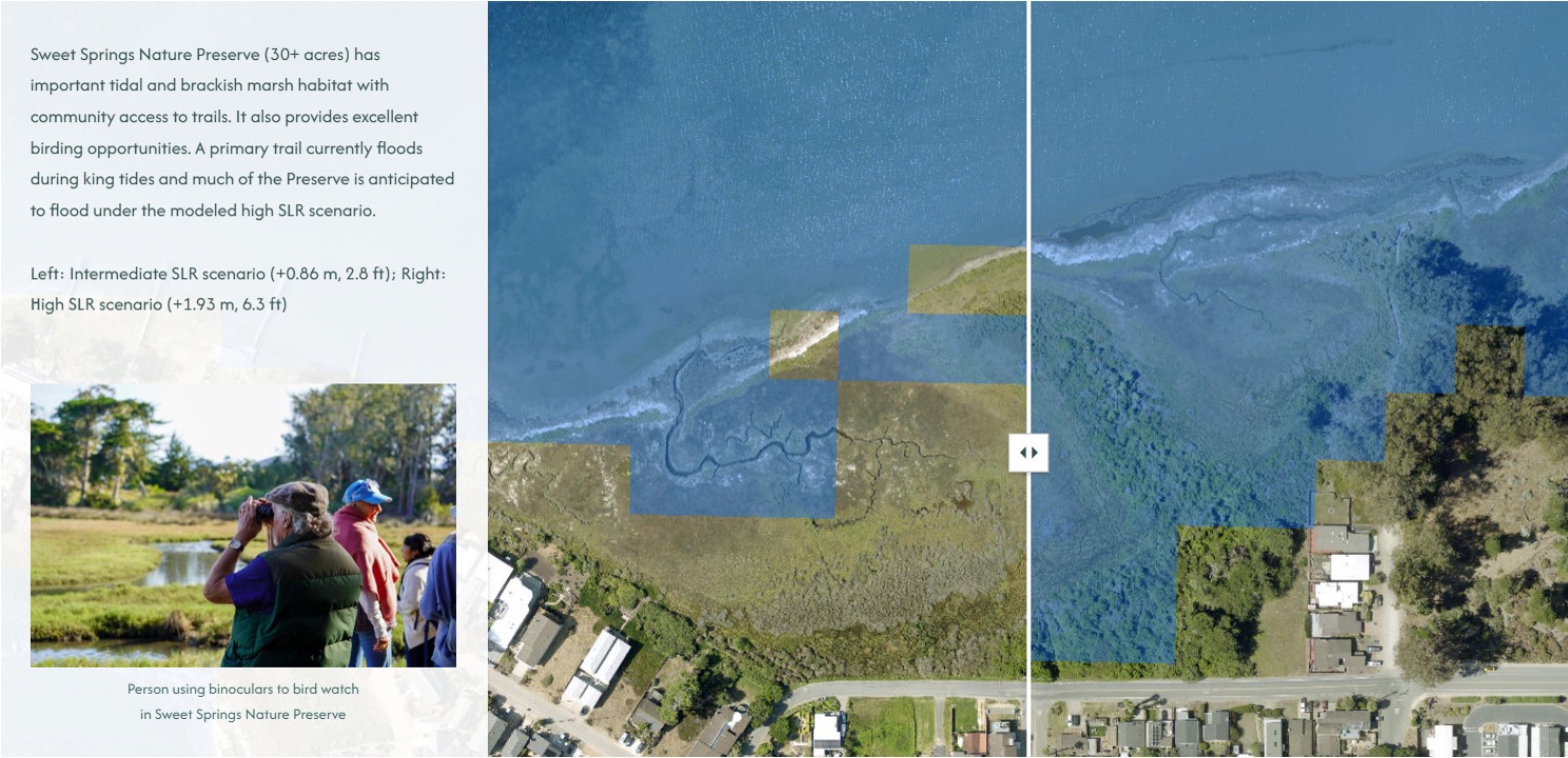
Coastal flooding extent from SLR will affect multiple locations that people love and frequent around the estuary. This section allows you to toggle between maps to compare sea level rise flooding extent during spring high tide conditions under intermediate (2.8 ft) and high (6.3 ft.) sea level rise scenarios by 2100 with historic sediment conditions.
Data Collection
This section allows you to learn more about the field data that informed and calibrated the SLR vulnerability model.
Habitat Resilience Modeling Results
This section allows you to explore a map of potential changes to Morro Bay estuary habitats under one SLR and sediment scenario under various time horizons.
The future of the Morro Bay estuary habitat is still uncertain and highly dependent on what SLR trajectory we experience. The Estuary Program will work with partners to provide additional research and engagement needed with community members, regulators, and Tribes to inform climate adaptation actions as sea levels continue to rise.