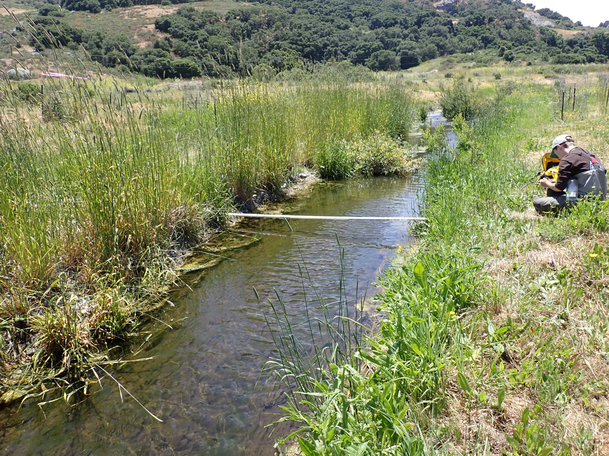
One of the primary goals of the Estuary Program is to protect and restore habitats in Morro Bay and its watershed. This includes reducing accelerated erosion in the creeks that can transport sediment into the bay. In the fall of 2019, the Estuary Program completed a 4.8-acre floodplain restoration project along Chorro Creek at the base of Hollister Peak, an effort made possible by the support of partners including California Conservation Corps (CCC), California Department of Fish and Wildlife (CDFW), and State Coastal Conservancy.
Although the Chorro Creek Ecological Reserve (CCER) project was completed, that doesn’t mean that’s the end of the story. When put to the test by storms in 2021 and 2022, CCER operated as designed, but did have some unexpected outcomes. The constructed floodplain trapped sediment during high flows. The floodplain also slowed down the flow of water to reduce flooding, recharge groundwater, and increase wildlife habitat. You can read more about the past storm impacts in this blog post.
Impacts of the big storm events of 2023
As with many areas in California, the Morro Bay watershed experienced intense rainfalls and flooding with the 2023 storms. As water levels rose in Chorro Creek, the CCER project was inundated with its highest flows to date.
This video shows CCER during the January 9, 2023 storm. This is the largest flow event since the project was completed in 2019.
The large storms of 2023 were estimated to be 50-year (2% chance of occurring in any given year) to 100-year (1% chance of occurring) storm events that caused many changes to CCER, including loss of plants, damage to a road crossing that provided site access, and a widening and straightening of the floodplain channels.
Plants lost in 2023 storms
During construction, the CCER site was graded to shape the creek channels. Upon completion, the bare dirt that remained was vulnerable to erosion during storms. The last phase of the project involved the CCC installing over 1,400 native plants to help stabilize the site. Unlike the 2021 storm where over 90% of the plants survived, the extremely high flows in early 2023 heavily impacted native plantings. Especially impacted were plants on the lower floodplain where the most sediment was captured.
Following the 2023 storms, the California Conservation Corps conducted extensive plant rescue and survival monitoring efforts. About 75% of the plants survived the storms. The most impacted plants were coast live oak and elderberry that were buried by sediment.
Change in floodplain channels
In May 2023, drone imagery of CCER was collected. A comparison to previous drone images illustrate the changes wrought by the storms. The following are aerial images of the site from 2019 to 2023.
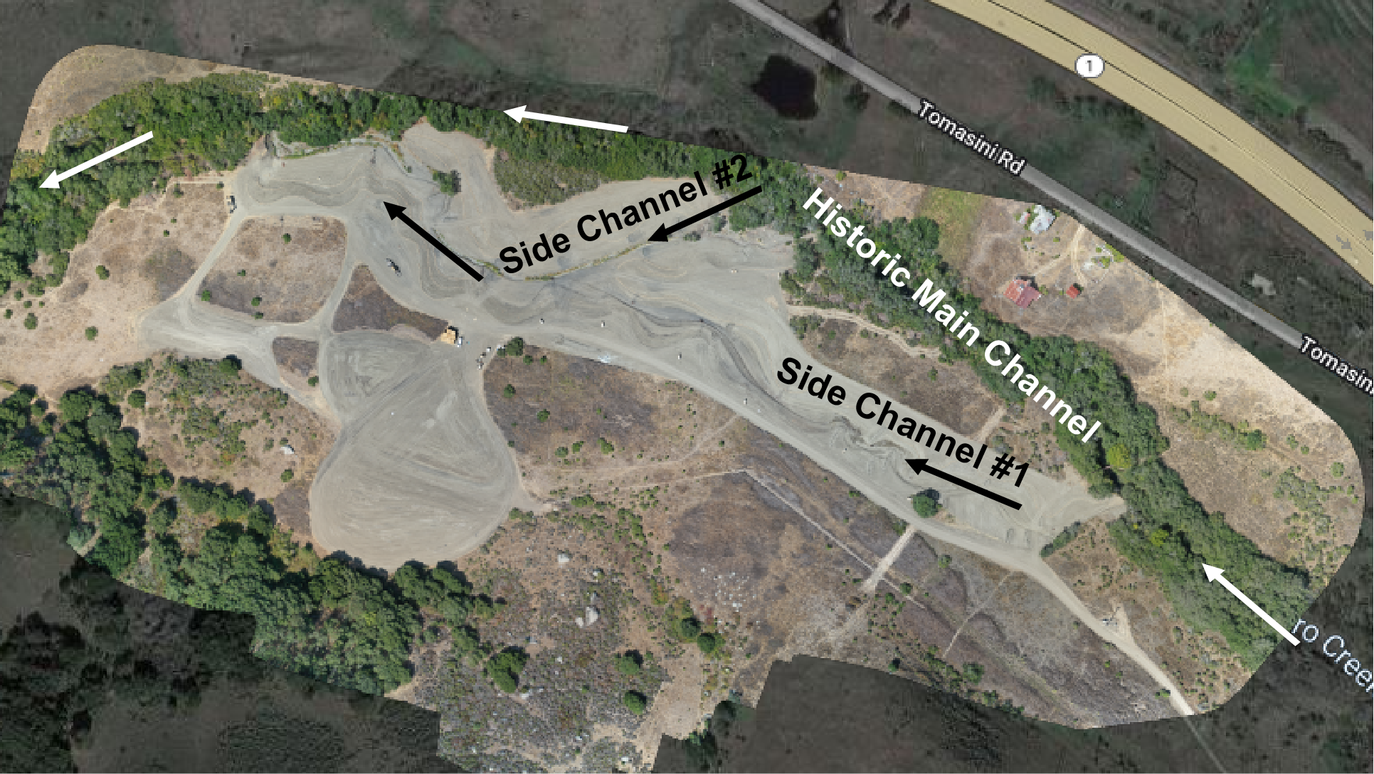
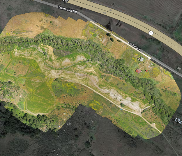
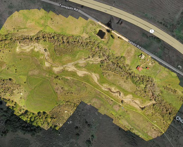
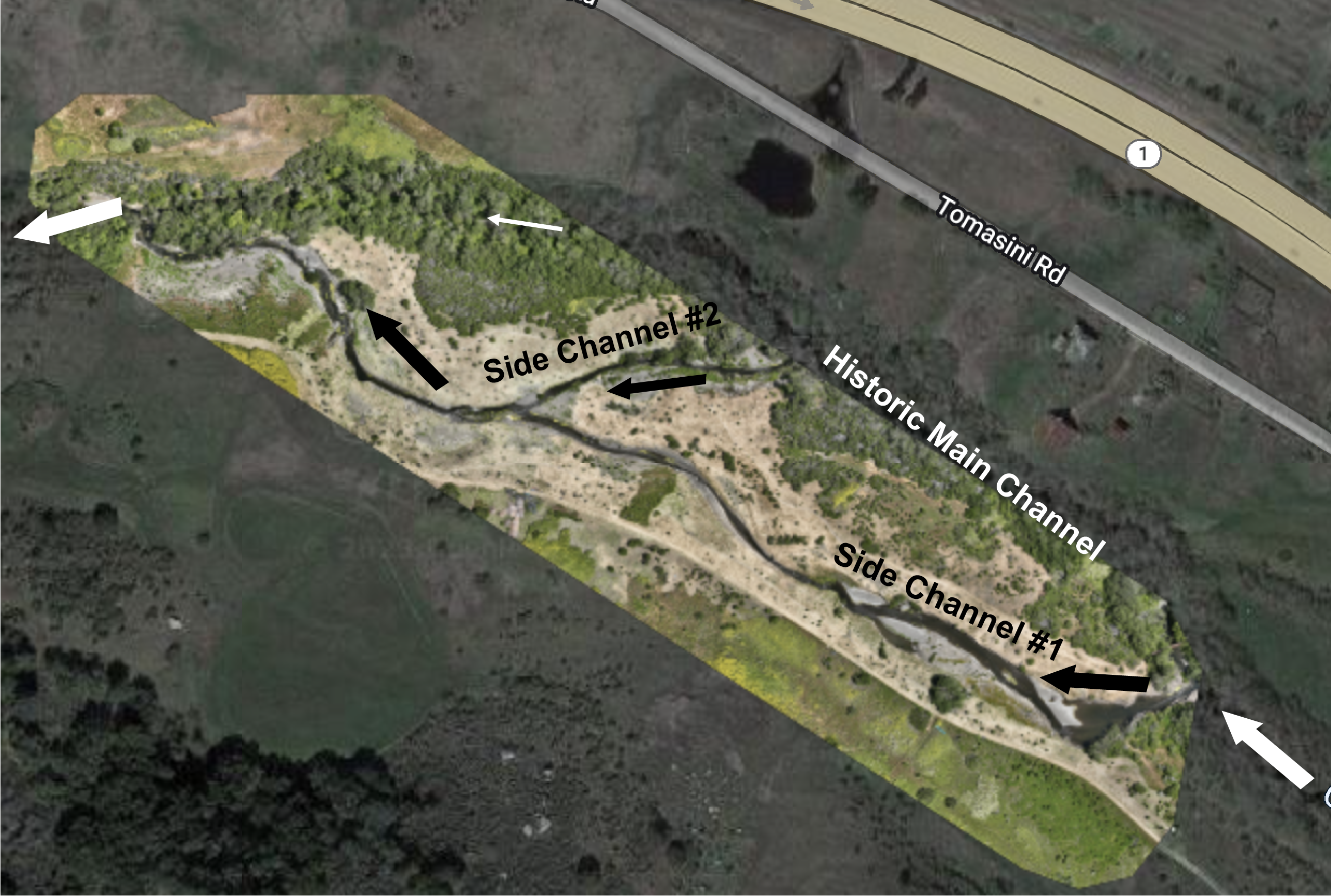
You can see all of the above photos overlaid here. Click on the layer icon at the top right corner of the screen to toggle the different images on and off for comparison.
Adaptive management in the face of climate change
With climate change, we will likely see an increased frequency of this ‘whiplash’ effect where we experience the extremes of intense rainfall and heat/drought. Unfortunately, the seesaw of climate extremes does not necessarily balance each other out. Restoration sites will likely need a more hands-on, adaptive approach to maintain habitat ecosystem functions and the benefits they provide as climate extremes increase.
Adaptive management involves continuing to monitor a project site and making adjustments so that the original project goals can continue to be met. At CCER, we are currently monitoring streamflows and in-stream water temperatures to compare conditions in the historic main channel of Chorro Creek to conditions in the constructed side channels that now have limited vegetation cover. We are also seeking funding to reassess the project for fish passage and floodplain functionality. Stay tuned for future updates!
Help us protect and restore the Morro Bay estuary!
- Donate to the Estuary Program today and support our work in the field, the lab, and beyond.
The Estuary Program is a 501(c)3 nonprofit. We depend on funding from grants and generous donors to continue our work. - Support us by purchasing estuary-themed gear from ESTERO. This locally owned and operated company donates 20% of proceeds from its Estuary clothing line and 100% of Estuary decal proceeds to the Estuary Program. Thank you, ESTERO!
- Purchase items from the Estuary Program’s store on Zazzle. Zazzle prints and ships your items, and the Estuary Program receives 10% of the proceeds. Choose from mugs, hats, t-shirts, and even fanny packs (they’re back!) with our fun Estuary Octopus design, our classic Estuary Program logo, or our Mutts for the Bay logo.
- We want to hear from you! Please take a few minutes to fill out this short survey about what type of events you’d like to see from the Estuary Program. We appreciate your input!